Using NUCAPS to nowcast convective development
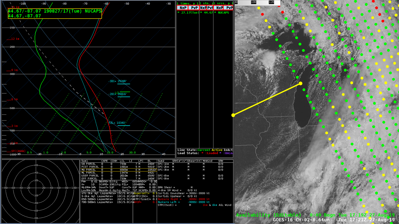
The animation above shows the 1721 UTC GOES-16 Visible (0.64 µm) image along with NUCAPS profile locations from a NOAA-20 overpass. Convection is approaching from the west, from central Wisconsin. NUCAPS soundings can give a good estimate for how far south that convective line might develop, and a north-south series... Read More

