GOES-14 SRSOR: Thunderstorm development over Kentucky
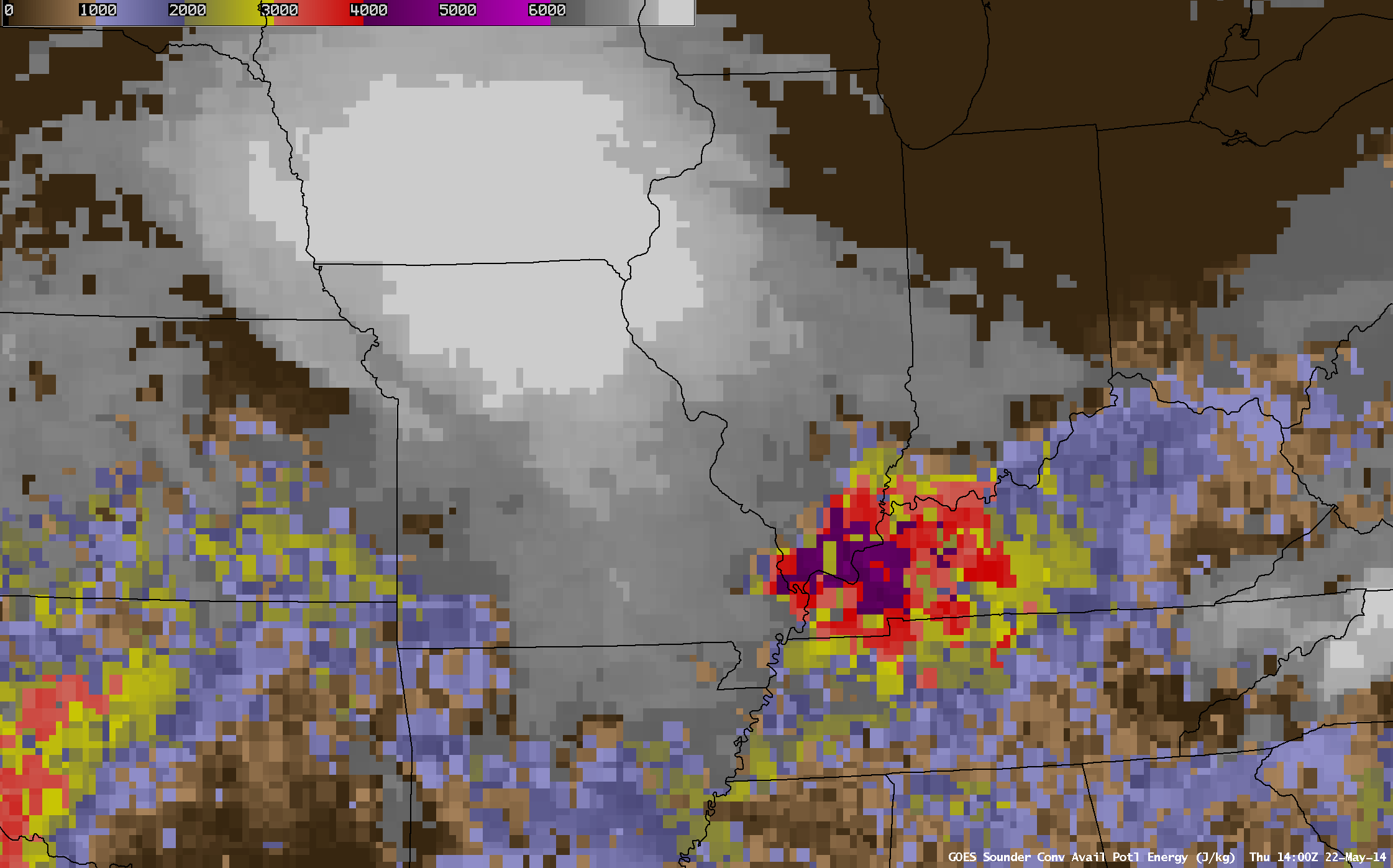
GOES-13 DPI Convective Available Potential Energy (CAPE) on May 22, times as indicated (click to play animation)
GOES-14 operations in SRSOR mode deliver the ability to monitor convective development at very short time-scales. A good example of this occurred over the lower Ohio Valley/western Kentucky on May 22nd. The animation of GOES-13 Sounder Derived Product Imagery of CAPE (above) and of Lifted Index (1300 and 1700 UTC) showed considerable instability waiting to be released.
GOES-14 SRSOR animations can be used to monitor the evolving cumulus field in the search for the tower that will break the cap (Nashville, TN/Lincoln IL Soundings from 1200 UTC). The animation below shows visible imagery from 1800 UTC through 2011 UTC, at which time the convection has developed. Initial convection dissipates, but eventually develops along the Ohio River in western Kentucky (cumulus clouds continue to grow/dissipate over the Mississippi River valley throughout the animation).
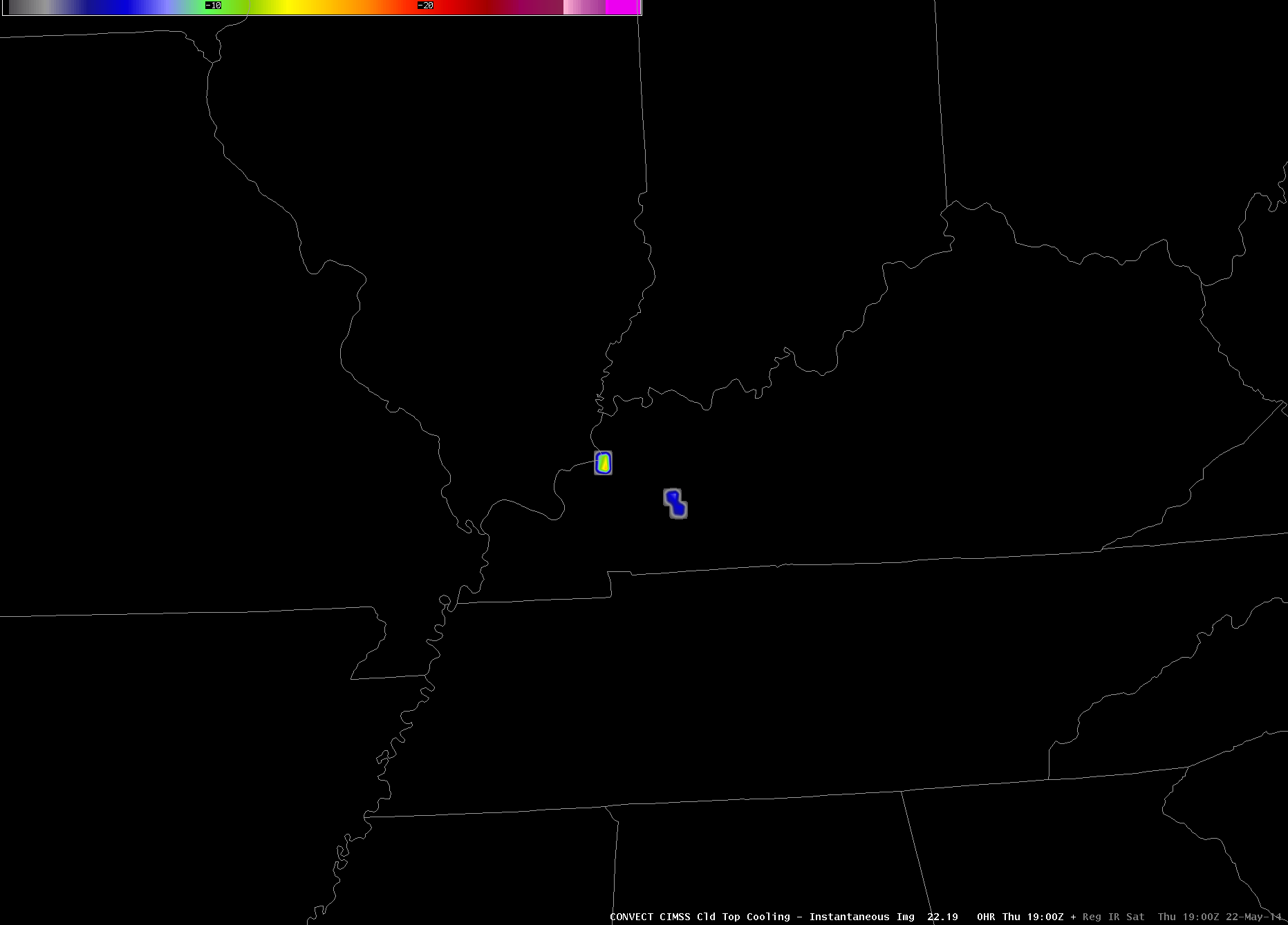
By 1900 UTC, convective development over the lower Ohio Valley is vigorous enough that Cloud-Top Cooling algorithm from CIMSS (below) has flagged growing clouds, with values exceeding 20º C/15 minutes.
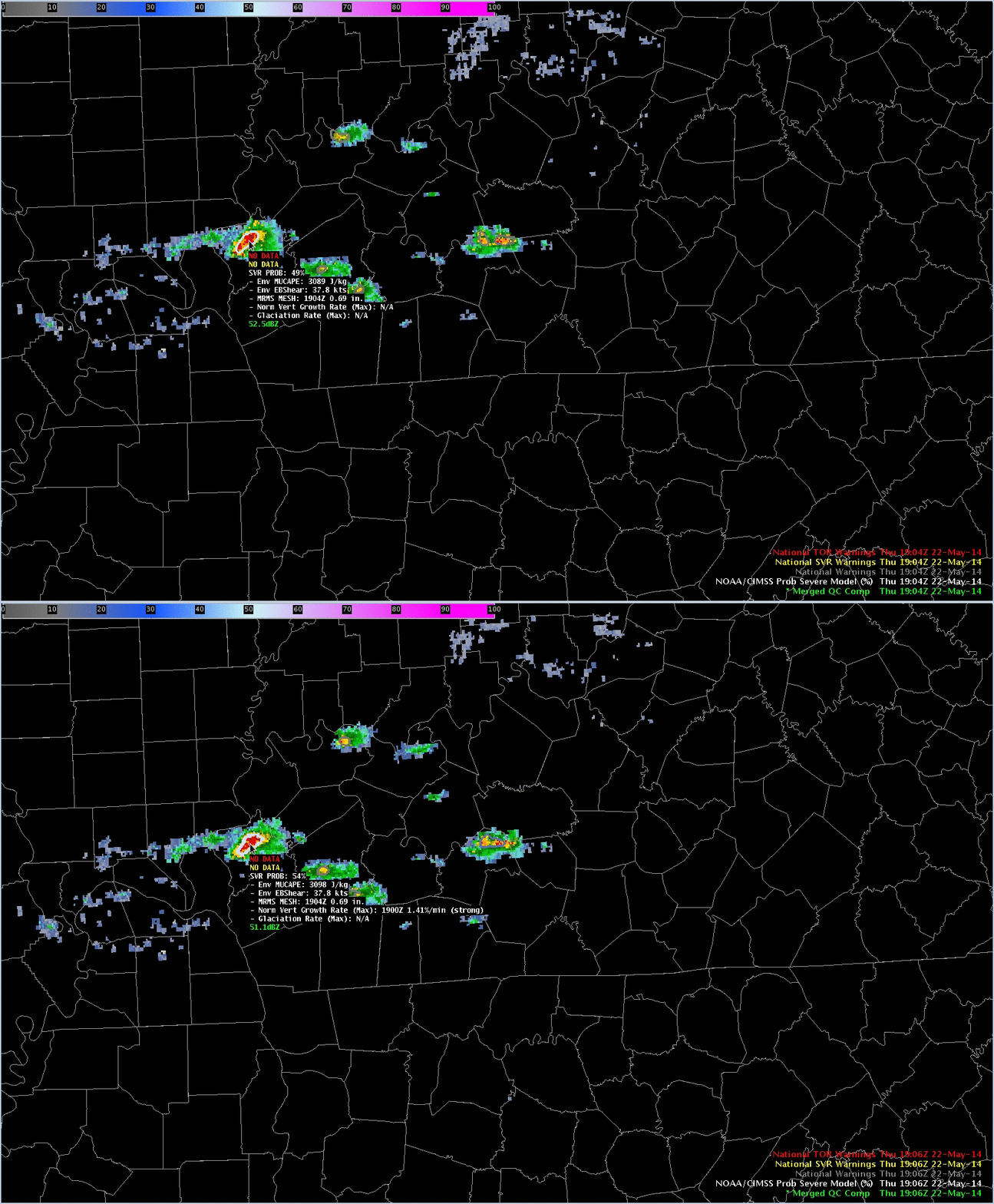
How does the NOAA/CIMSS ProbSevere model then change with time as the convection intensifies? The 1904 and 1906 UTC ProbSevere products, toggled below, shows values increasing from 49% to 54% as Satellite Growth rates at 1900 UTC are incorporated at 1906 UTC. ProbSevere values then dropped (1912 UTC, 1922 UTC) as MRMS MESH decreased.
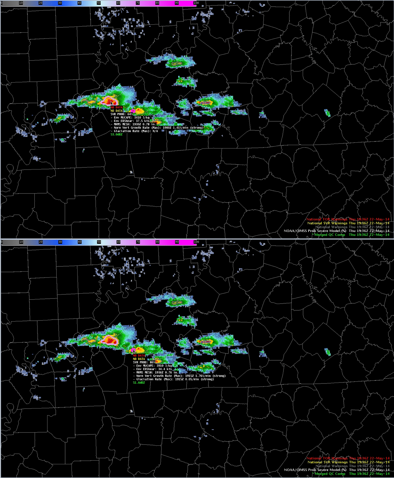
By 1936 UTC, ProbSevere has again increased above 50%, in two regions where MRMS has MESH sizes over 0.50″. MESH values are equivalent in the two regions, as are environmental values, but higher satellite predictors associated with the smaller eastern radar object drive higher ProbSevere values there.
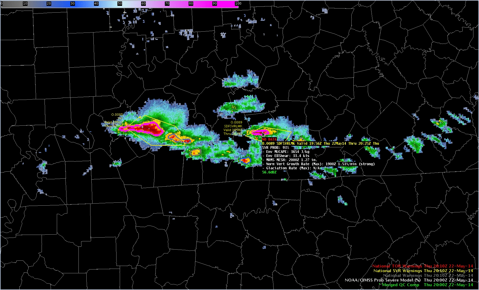
The animation below shows the evolution of NOAA/CIMSS ProbSevere from 1948 UTC through 2000 UTC, with focus on a second cell that was warned. NOAA/CIMSS ProbSevere is designed to give an estimate of when severe weather might initially occur. Severe weather was not reported in Kentucky with these storms (link); however, observations of severe weather did occur as the storms moved near Nashville.
Related Hazardous Weather Testbed blog posts on this event can be found here, here, and here.


