Shotwave Infrared Imagery can Identify Power Plant Plumes
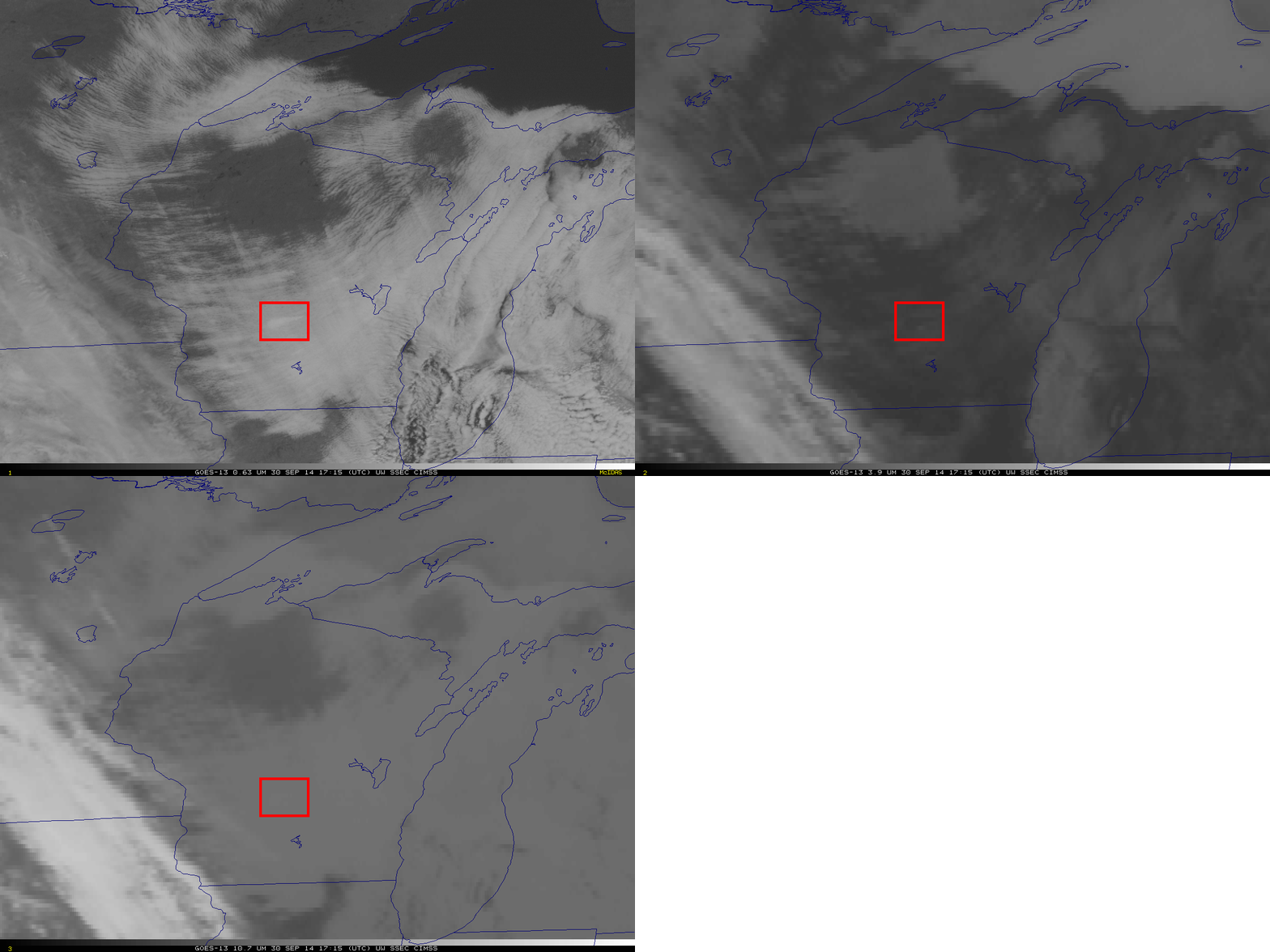
The visible imagery animation above shows stratocumulus over Wisconsin behind a strong early-season cold front. Careful examination of the animation will reveal the presence of at least three exhaust plumes from power plants over Wisconsin. Imagery from 1715 UTC, below, shows visible (0.63 µm) and infrared (3.9 µm and 10.7 µm) data (Click here for an image toggle without the Big Red Box). The plume is warmer in the 3.9 µm imagery, relative to its surroundings; the plume is cooler in the 10.7 µm imagery, relative to its surroundings (an enhanced version of the loop makes this even more evident). Why does the temperature difference exist?
Plumes appear darker — warmer — in the 3.9 µm imagery because of increased reflectivity in the plume: cloud droplets in the power plant plume are smaller and more reflective of 3.9 µm radiation than the cloud droplets in the surrounding stratocumulus field. The plume is cooler in the 10.7 µm imagery because the plume is higher in the atmosphere than the surrounding stratocumulus deck.

GOES-13 Visible Imagery and Infrared Imagery (0.63 µm, 3.9 µm and 10.7 µm), at 1715 30 September 2014. The Red box surrounds a Power Plant Plume (click to enlarge)
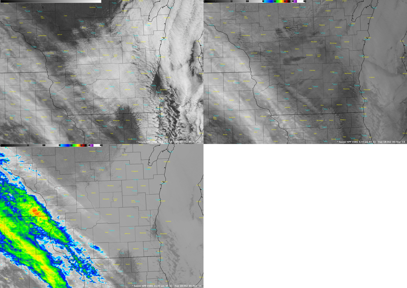
Suomi NPP overflew the area at 1836 UTC, and that imagery is shown below. The higher resolution data allows a better discrimination of the small plumes over the state. As with GOES data, the shortwave infrared (3.74 µm for VIIRS) data also shows warmer conditions over the plume compared to the surrounding stratocumulus deck.


