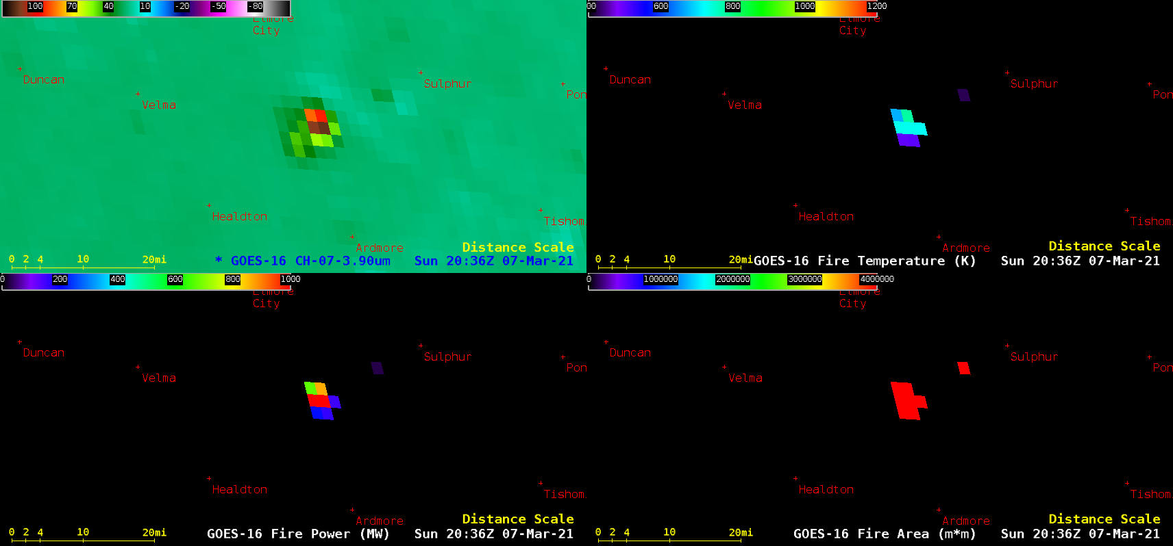
Wildfires in South Dakota
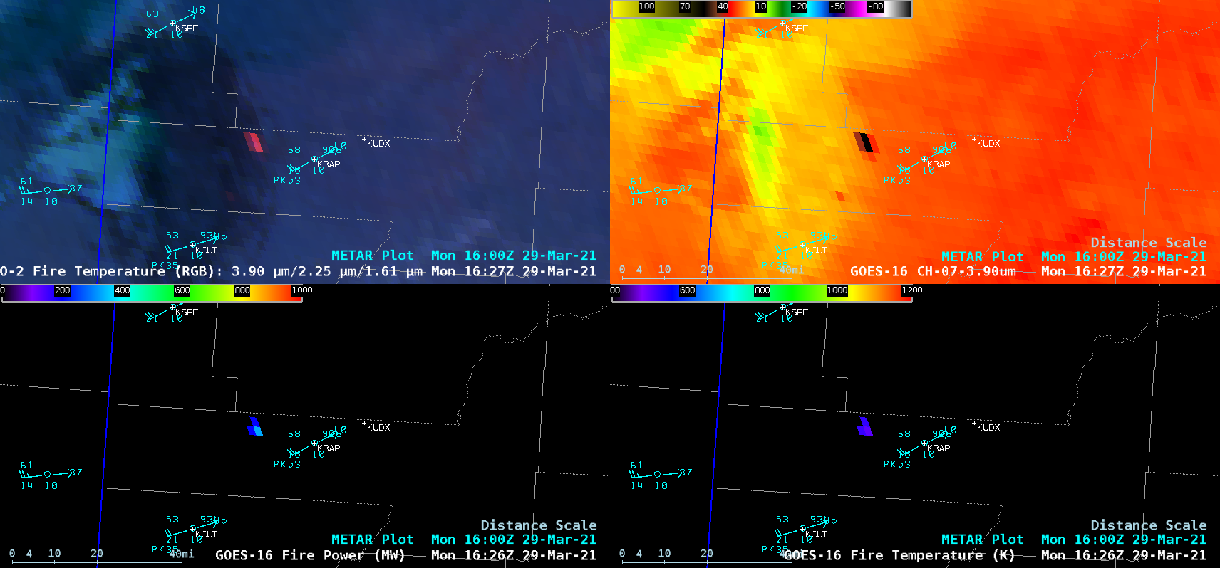
1-minute Mesoscale Domain Sector GOES-16 (GOES-East) Shortwave Infrared (3.9 µm) images (above) displayed the thermal anomalies (clusters of hot pixels) associated with 2 wildfires burning in western South Dakota on 29 March 2021. One fire began just west of Rapid City around 1530 UTC — which forced some evacuations. A second fire began just north of... Read More