Marshall Fire near Boulder, Colorado
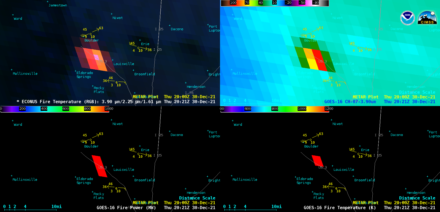
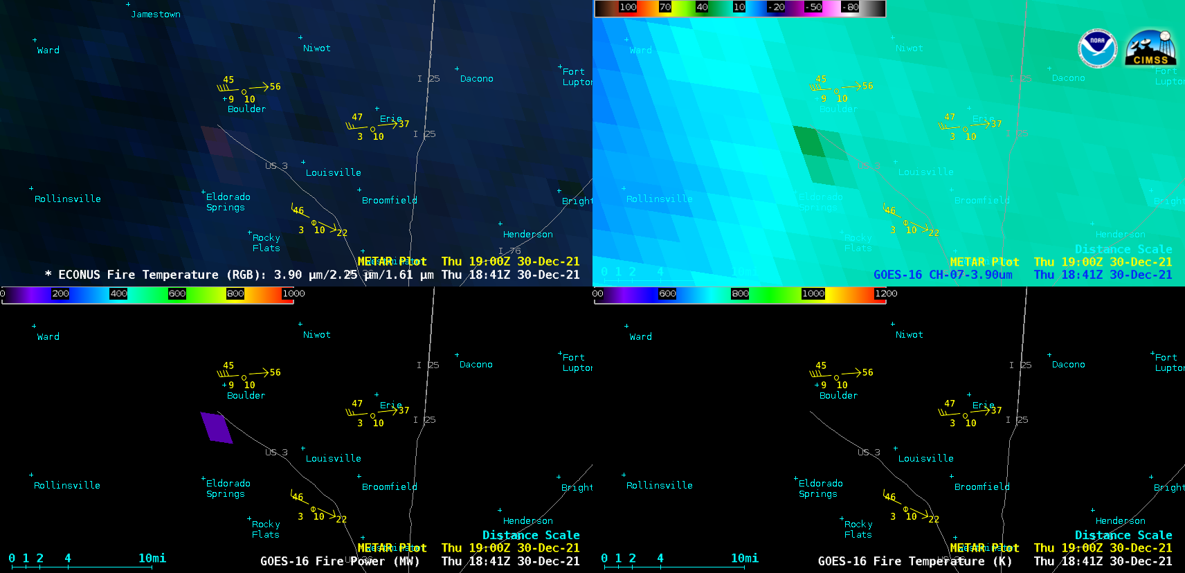
GOES-16 Fire Temperature RGB, Shortwave Infrared (3.9 µm) Fire Power and Fire Temperature derived products (above) showed rapid expansion of the Marshall Fire’s thermal signature in Boulder County, Colorado on 30 December 2021. The earliest unambiguous fire signature appeared on the 1841 UTC image (11:41 am MST); the maximum 3.9 µm infrared brightness temperature was 110.96ºC (at 2021... Read More
