NUCAPS Sounding profiles surrounding Colorado’s East Troublesome Fire

NOAA-20 NUCAPS Profiles over Colorado, at locations indicated, at ca. 1900 UTC on 21 October 2020 (click to enlarge)
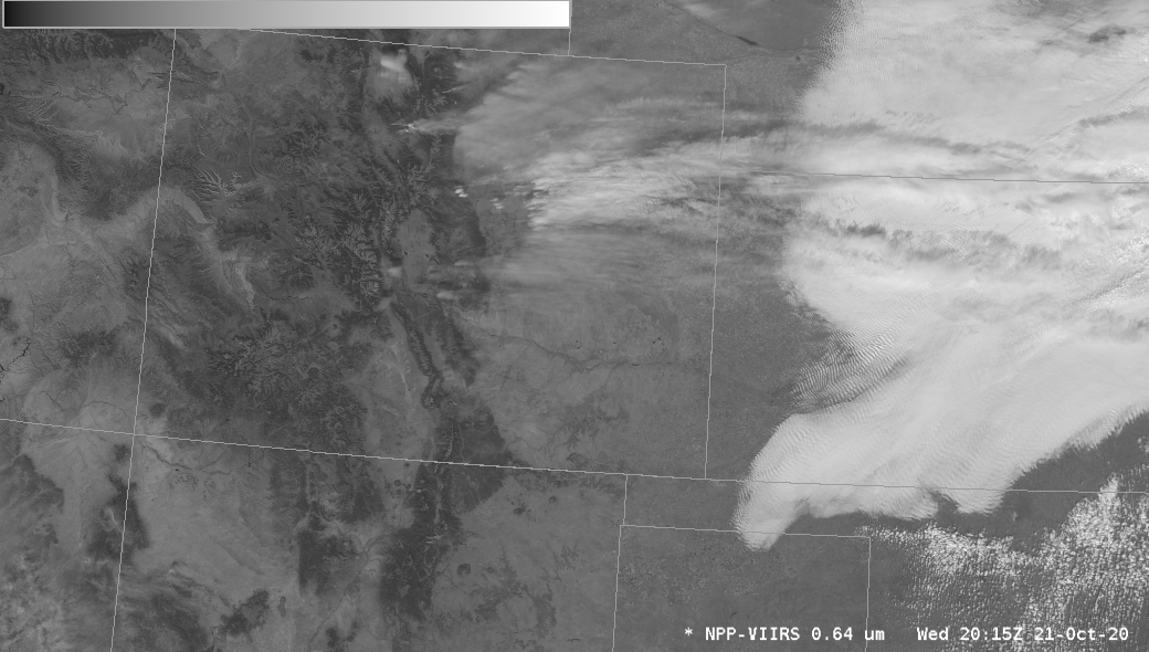
The East Troublesome Fire in Colorado expanded greatly on 21 October (click here for more information), and produced pyrocumulus clouds. NOAA-20 overflew the fire at around 1930 UTC (linked-to overpass map from this site) on 21 October, and NUCAPS profiles, shown above, diagnosed the stability of the mid- and upper-troposphere. The toggle below between the NOAA-20 VIIRS Visible (0.64 µm) and Infrared (11.45 µm) imagery and NUCAPS Sounding availability points show the relationships between cloudiness and point color.

Suomi NPP Visible (0.64 µm) and Infrared (11.45 µm) imagery at 2015 UTC on 21 October 2020, as well as (NOAA-20) NUCAPS Sounding availability points at ~1900 UTC on 21 October (Click to enlarge)
Gridded NUCAPS fields, below, of 500-300 mb lapse rates show very weak stability in and around the fire location. A fire-driven updrafts in the region would not find much in the way to impede its vertical development.

NUCAPS estimates of upper-tropospheric (500-300 mb) lapse rates at ca. 1900 UTC on 21 October 2020 (Click to enlarge)