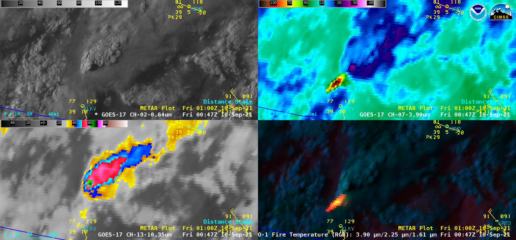
Alisal Fire in Southern California
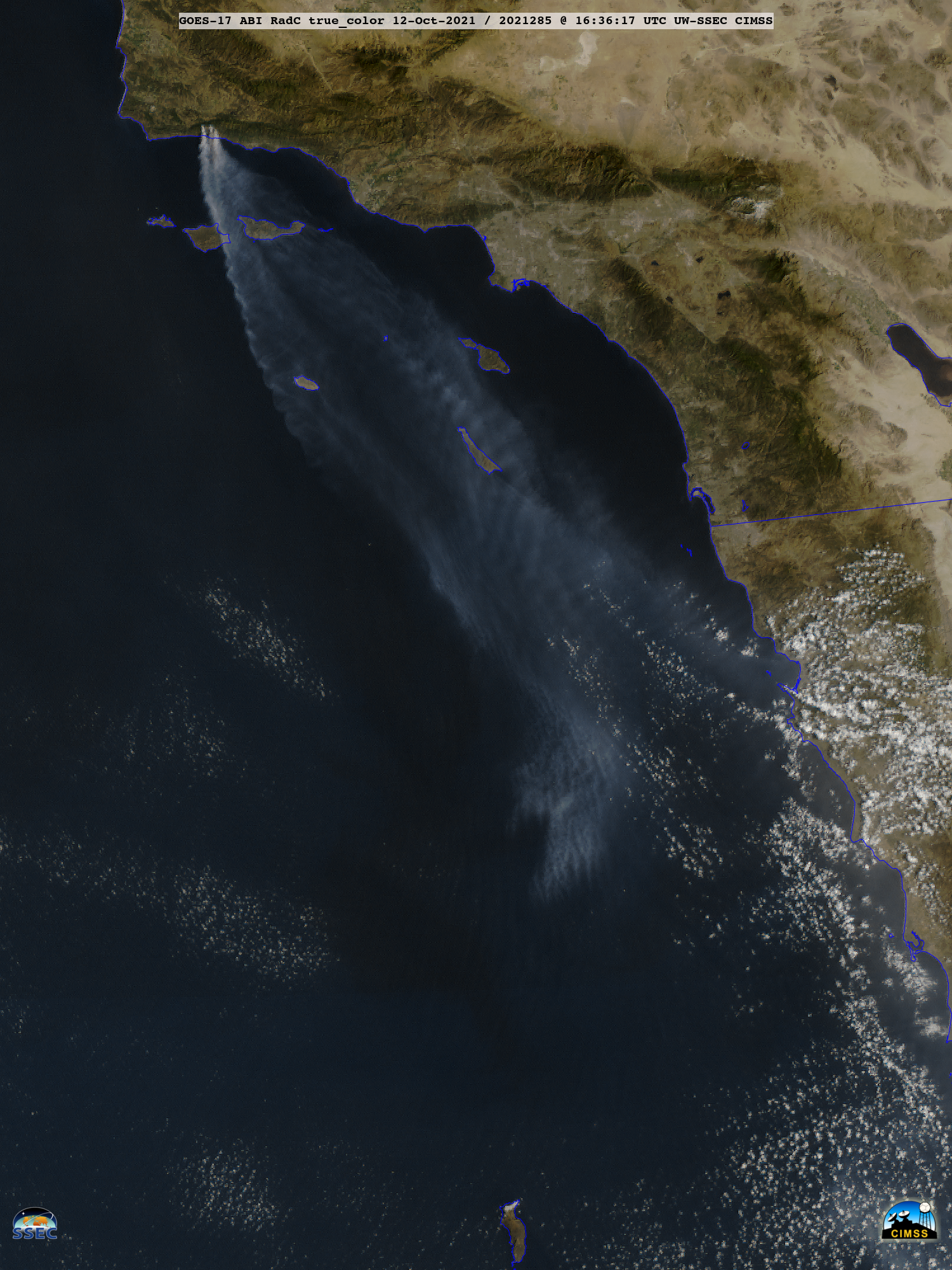
GOES-17 (GOES-West) True Color RGB images created using Geo2Grid (above) showed the transport of smoke from the Alisal Fire in Southern California on 12 October 2021. The dashed line in the images is Highway 101 — a portion of which was closed, as the wind-driven fire raced toward the coast. Late in the day some... Read More
