Parallax with GOES-R and VIIRS Fire Detection
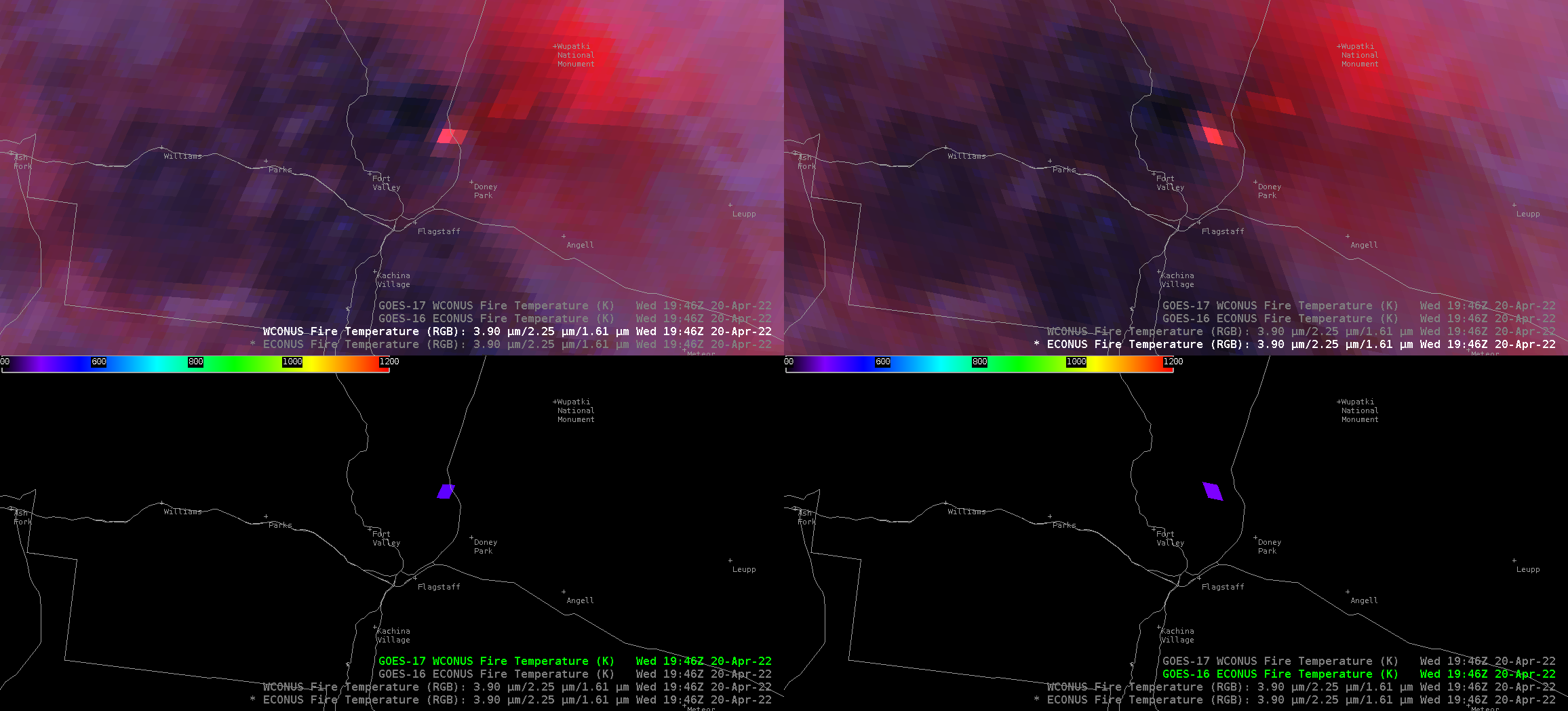
The Tunnel Fire north of Flagstaff offers an excellent example of why knowledge of Parallax with satellite features is important. In the animations above, note how the location of the warmest pixels are shifted: GOES-17 has the warmest pixels very close to US Highway 89 leading northeast away from Flagstaff; GOES-16 has... Read More
