This website works best with a newer web browser such as Chrome, Firefox, Safari or Microsoft Edge. Internet Explorer is not supported by this website.

Category: DMSP

Tropical Storm Michael

1-minute Mesoscale Domain Sector 
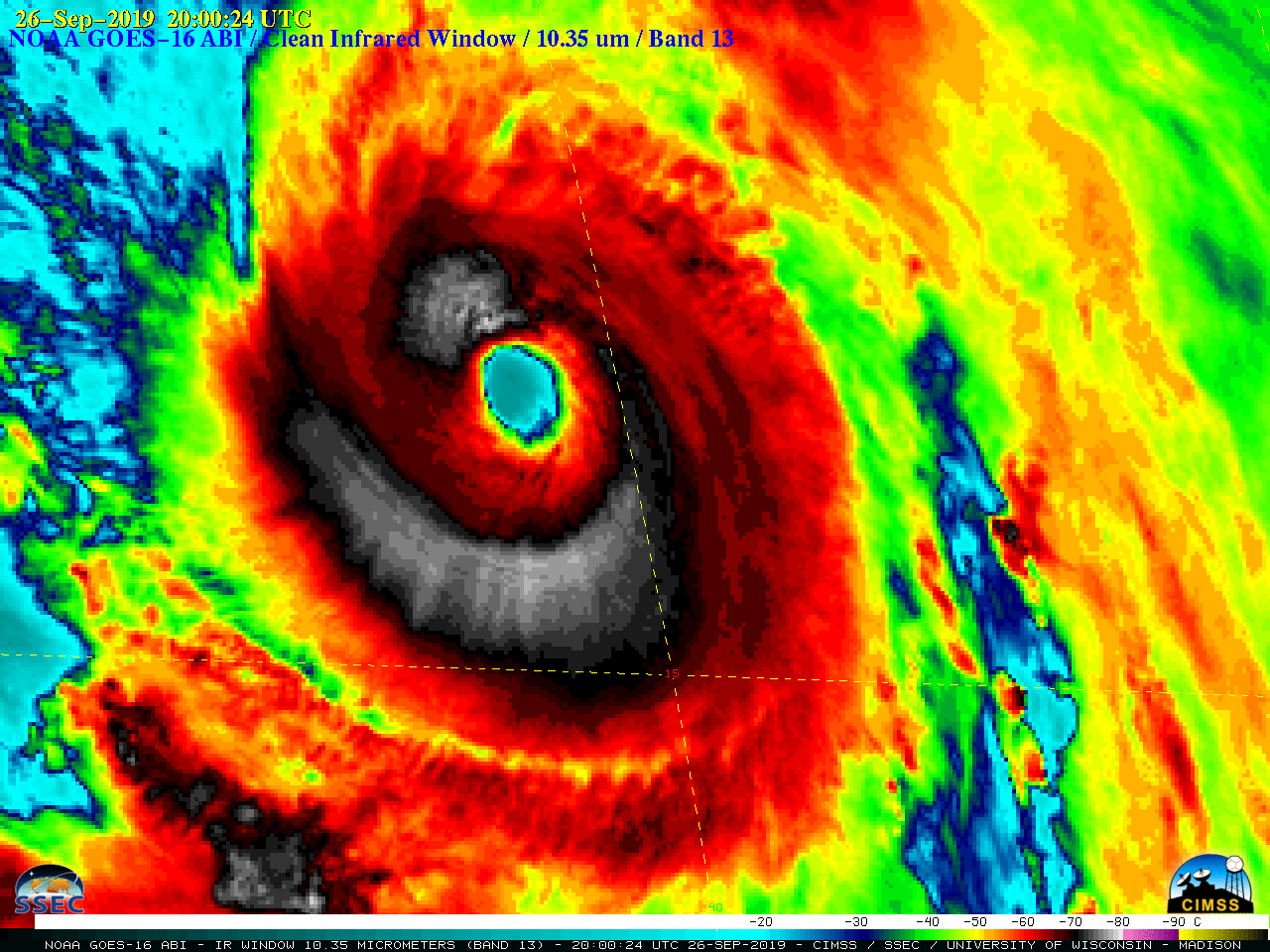
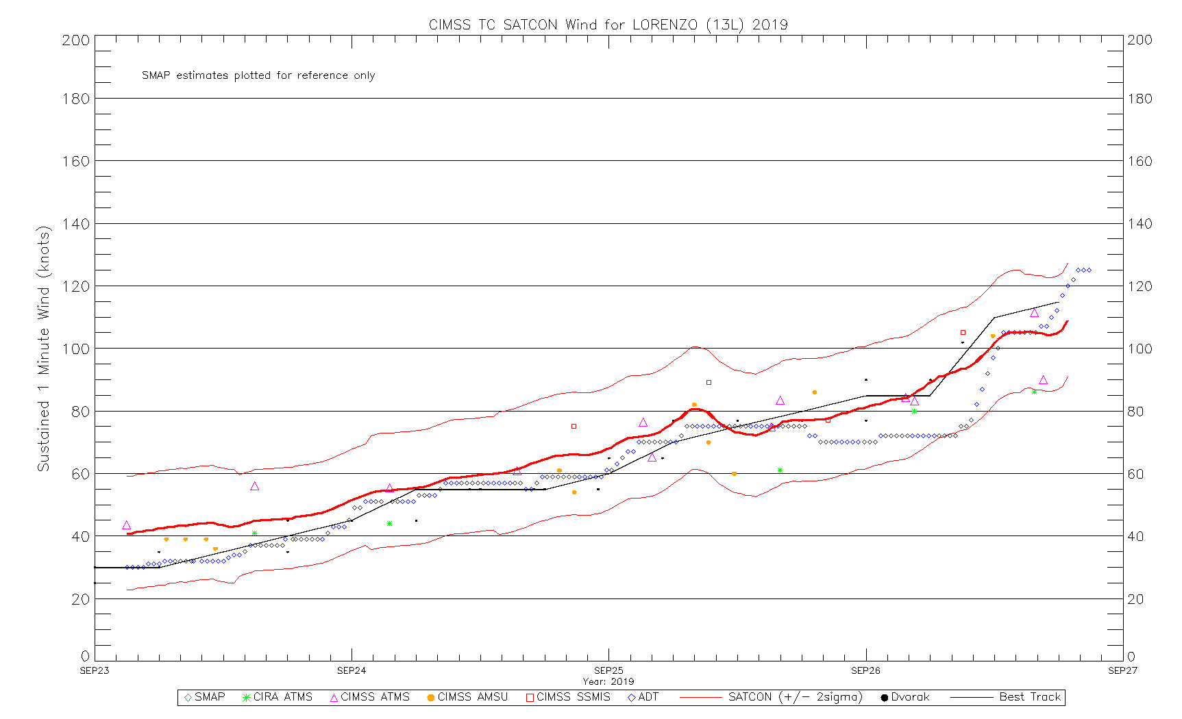
GOES-16 (GOES-East) “Clean” Infrared Window (10.3 µm) images (above) showed deep convection associated with Tropical Depression 14 east of Belize and the Yucatan Peninsula of Mexico early in the day on 07 October 2018. There was a large area of cloud-top infrared brightness temperatures in the -80ºC to -89ºC... Read More

Hurricane Walaka

GOES-15 (GOES-West) Infrared Window (10.7 µm) images (above) showed the formation of a well-defined eye of Hurricane Walaka during a period of rapid intensification (ADT | SATCON) from 0000-2330 UTC on 01 October 2018; Walaka was classified a Category 5 hurricane as of the 02 October 00 UTC advisory. Walaka was moving... Read More

Hurricane Rosa

* GOES-17 images shown here are preliminary and non-operational *GOES-15 (GOES-West) Infrared Window (10.7 µm) and GOES-17 “Clean” Infrared Window (10.3 µm) images (above) showed Hurricane Rosa on the morning of 28 September 2018, after it had rapidly intensified to Category 4 intensity overnight (ADT | SATCON). Since GOES-17 was operating in... Read More