Cyclone Fani makes landfall in India
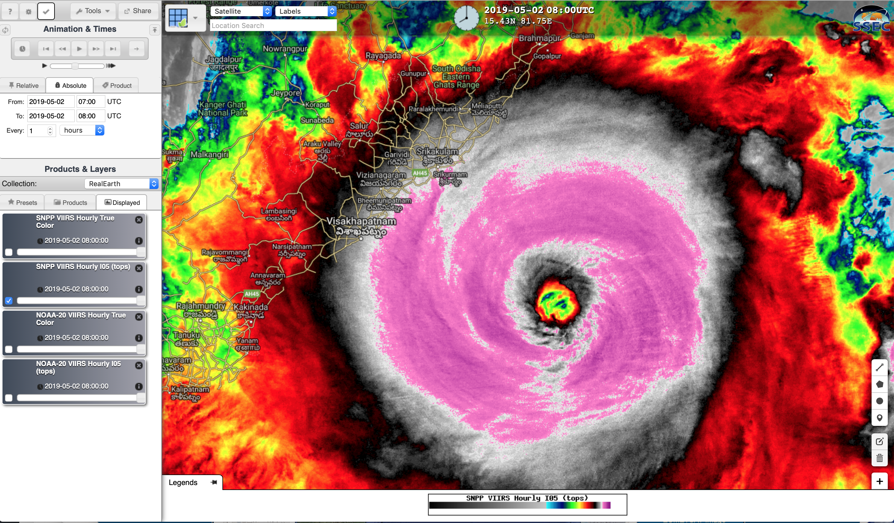
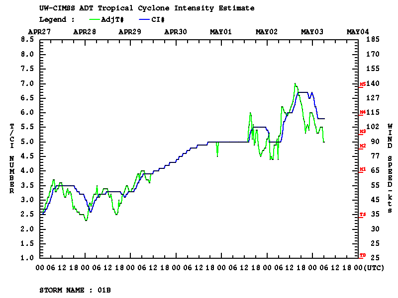
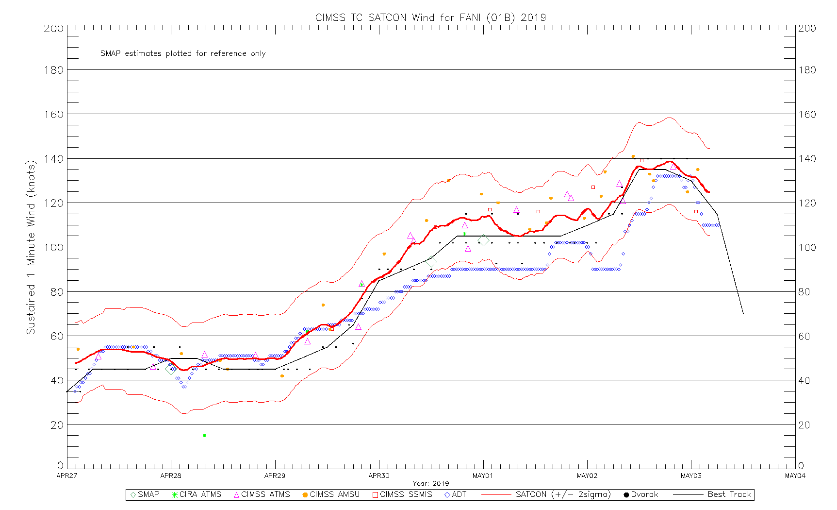
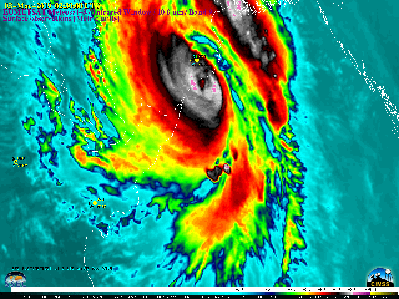
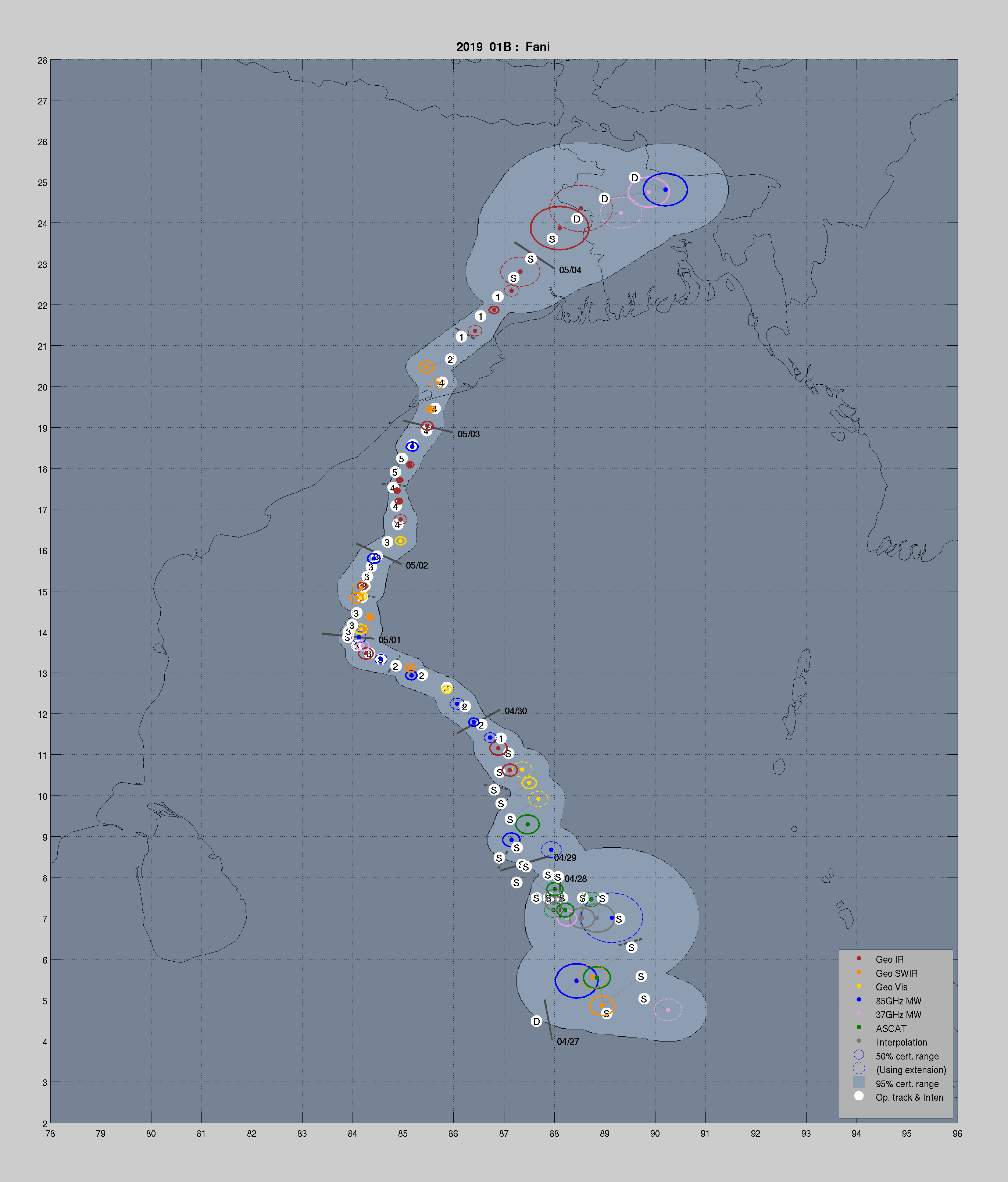
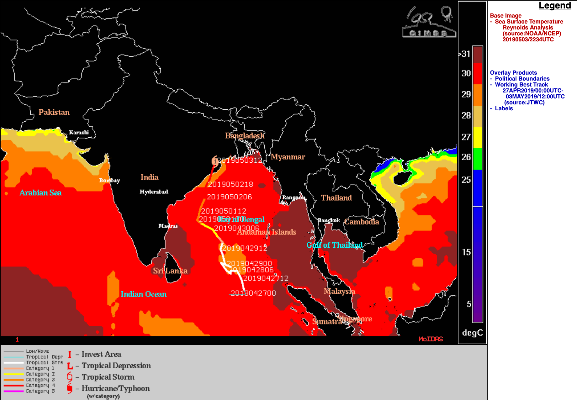
EUMETSAT Meteosat-8 Infrared Window (10.8 µm) images (above) showed the intensification of Cyclone Fani to a high-end Category 4 storm on 02 May 2019 (ADT | SATCON | PGTW advisory), before eventually making landfall in northeastern India at 0230 UTC on 03 May. During its life cycle, Fani moved over warm sea surface temperature values of... Read More
