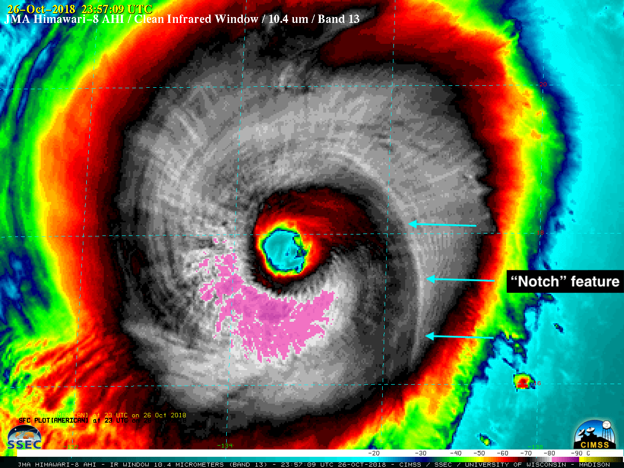
Super Typhoon Yutu re-intensifies to Category 5
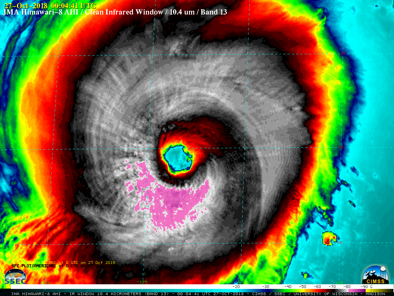
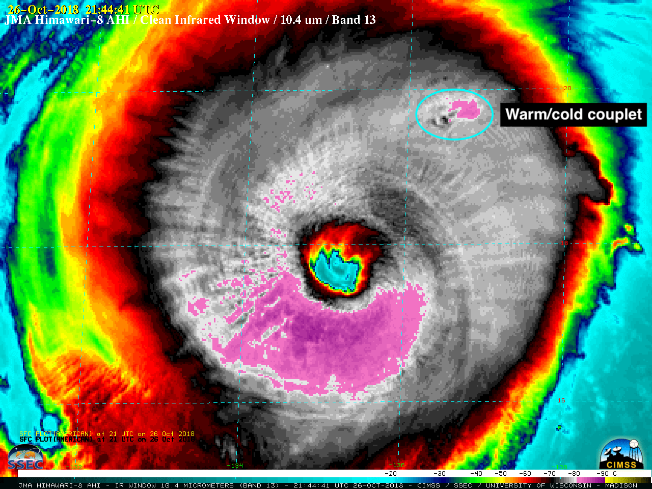
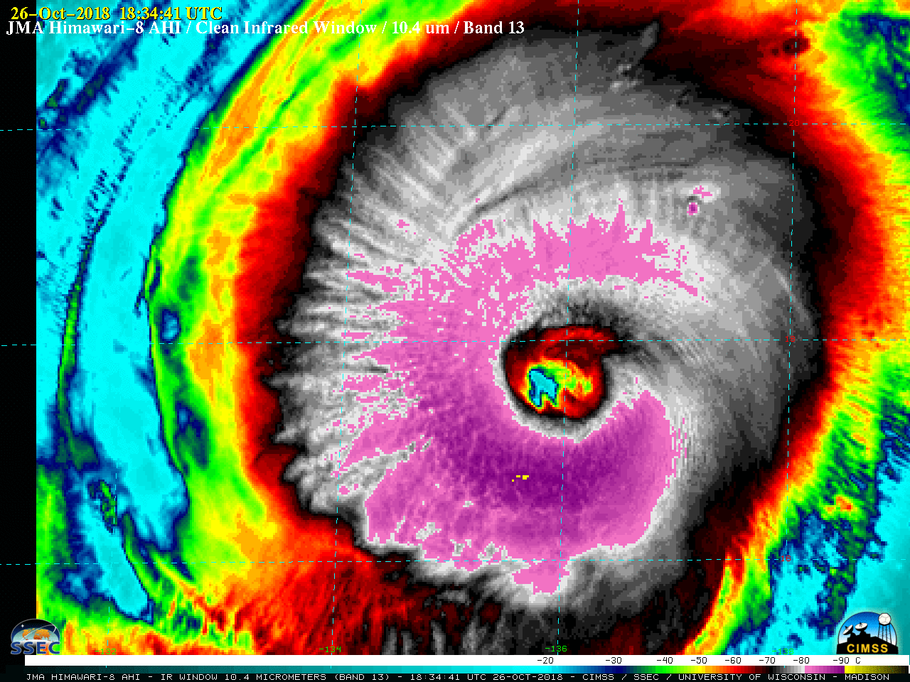
Himawari-8 “Clean” Infrared Window (10.4 µm) images [click to play MP4 animation]
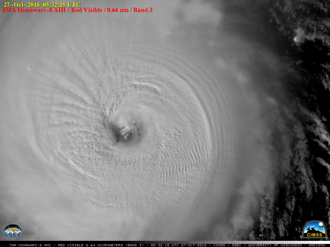
A comparison of Himawari-8 “Red” Visible (0.64 µm) and Infrared Window images during the few hours after sunrise (below) showed an eye that was partially cloud-filled with low-level mesovortices.
![Himawari-8 "Red" Visible (0.64 µm, left) and "Clean" Infrared Window (10.4 µm, right) images [click to play MP4 animation]](https://cimss.ssec.wisc.edu/satellite-blog/wp-content/uploads/sites/5/2018/10/HIM08_VIS_IR_YUTU_26OCT2018_2018300_002944_HIMAWARI-8_0002PANELS.GIF)
Himawari-8 “Red” Visible (0.64 µm, left) and “Clean” Infrared Window (10.4 µm, right) images [click to play MP4 animation]
Himawari-8 “Red” Visible (0.64 µm) images [click to play MP4 animation]
![DMSP-17 SSMIS Microwave (85 GHz) and Himawari-8 Infrared Window (10.4 µm) images [click to enlarge]](https://cimss.ssec.wisc.edu/satellite-blog/wp-content/uploads/sites/5/2018/10/181026__2123utc_dmsp17_microwave_2130utc_himawari8_infrared_Yutu_anim.gif)
DMSP-17 SSMIS Microwave (85 GHz) and Himawari-8 Infrared Window (10.4 µm) images [click to enlarge]