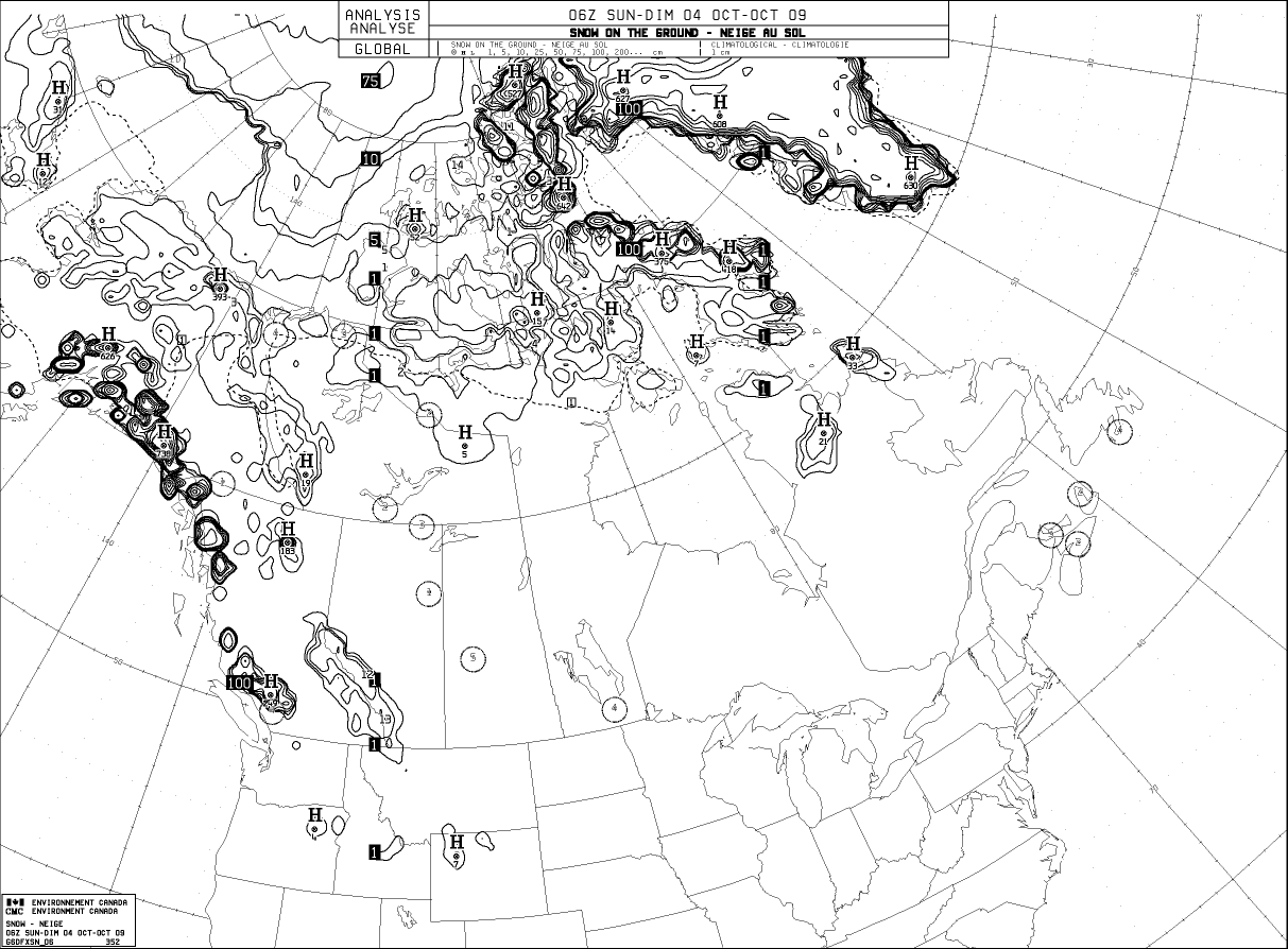
This website works best with a newer web browser such as Chrome, Firefox, Safari or Microsoft Edge. Internet Explorer is not supported by this website.

Category: Arctic

Flooding across interior Alaska

Parts of interior Alaska experienced heavy rainfall and significant river flooding during the last week of July 2008; AWIPS  composite images of the GOES-11 and GOES-12 water vapor channels (above) showed a rather unusual moisture plume — one having a long northwesterly fetch — stretching from the Russian arctic coast... Read More

Using GOES imagery over northern Alaska

Given the rather large satellite viewing angle (or “zenith angle”) of geostationary satellites positioned over the Equator, one would think that the imagery would not be of much value over places such as far northern Alaska. However, a forecast discussion issued by Fairbanks, Alaska mentioned the utility of GOES visible... Read More

Bennett Island plume

[Hat-tip to Gregg Gallina (NOAA/NESDIS Satellite Analysis Branch) for bringing this interesting case to our attention…] A false-color RGB image derived from 1-km resolution NOAA-18 AVHRR data (above) showed a long, narrow cloud plume streaming northwestward from Bennett Island (or “Ostrov Bennetta”, a tiny island... Read More