Wildfires in Alaska
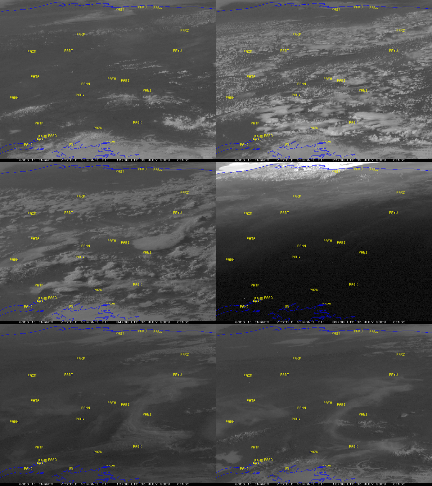
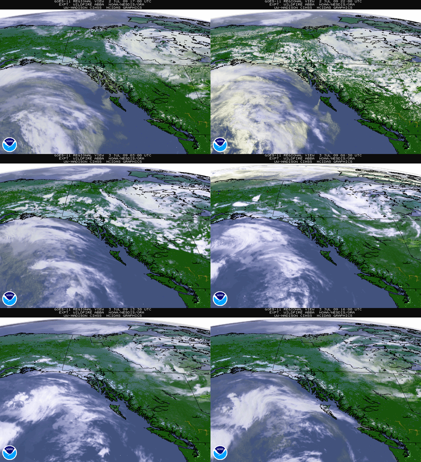
The 2009 wildfire season roared to life in Alaska on 02 July – 03 July 2009, with a number of very large and very intense fires breaking out across interior portions of the state. A ridge of high pressure was in place over the region, allowing Fairbanks to experience a high temperature above 80º F (27º C) on both days. GOES-11 visible images (above) showed some impressive smoke plumes developing on 02 July, especially from the fire located to the east-southeast of Fort Yukon (station identifier PFYU) — note the pulses of “pyrocumulus” that emanated from this >19,000 acre “Little Black One” fire complex:
PUBLIC INFORMATION STATEMENT
NATIONAL WEATHER SERVICE FAIRBANKS AK
1033 AM AKDT FRI JUL 3 2009…WILDFIRES BRING SMOKE TO INTERIOR…
THE MAJORITY OF THE SMOKE IS COMING FROM A WILDFIRE KNOW AS LITTLE BLACK ONE. THIS FIRE IS LOCATED NORTHEAST OF CIRCLE IN THE YUKON FLATS. AS OF 230 PM YESTERDAY THIS FIRE WAS OVER 19000 ACRES. CURRENT SATELLITE IMAGERY SHOWS THIS FIRE TO BE CONTINUING TO INCREASE IN AREA.
OTHER SMALLER FIRES ARE ALSO BURNING ACROSS THE AREA. WINDS ARE CURRENTLY BLOWING THE SMOKE FROM NORTHEAST TO SOUTHWEST ON THE FIRES.
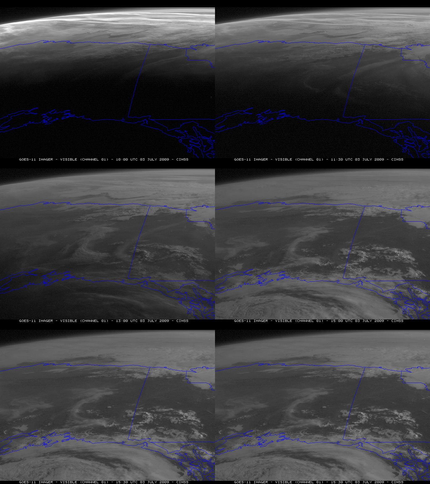
The large and dense smoke plume originating east of Fort Yukon continued to drift southwestward overnight, and had moved over the Anchorage area (station identifier PANC) by the morning hours on 03 July.
Also, in spite of the very large satellite viewing angle, another feature that could be followed on the GOES-11 visible imagery was the southwestward movement of fog and stratus from the Arctic Ocean into interior portions of the North Slope region of Alaska after about 06:00 UTC on 03 July. The visibility dropped to less than 1/2 mile at Kuparuk (station identifier PAKU) at 06:00 UTC, with an air temperature at that time of 34º F (+1º C).
It is interesting to note the presence of a thin volcanic plume (likely from an earlier eruption of the Sarychev Peak volcano in the Kuril Islands) farther to the east, located over the Alaska/Yukon border region (above) — this very high altitude volcanic plume feature is illuminated early in the day (when the sun angle was low, and forward scattering was the highest), but then “disappears” on the visible imagery as the sun angle increases and forward scattering diminishes. In contrast, the low-altitude smoke features become brighter as the sun angle increases during the day, allowing more solar reflection to better illuminate the top of the thick smoke (below).
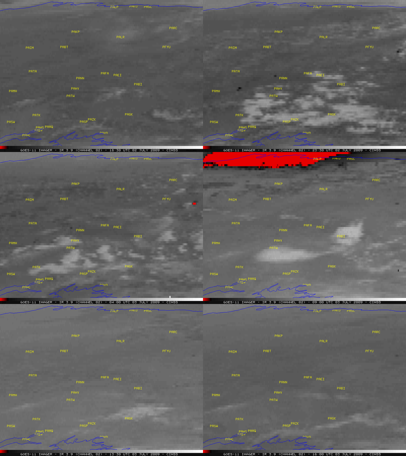
GOES-11 3.9 µm shortwave IR images (below) revealed a number of very hot fire pixels (black to red color enhancement) — the hottest pixels in the “Little Black One” fire exhibited an IR brightness temperature of 341.0 K (the saturation temperature of the GOES-11 shortwave IR detectors) at 06:30 UTC. The fire located to the west-northwest of Nenana (station identifier PANN) exhibited IR pixels as hot as 340.0 K at 02:30 UTC. The large area of saturated (red) pixels across the Arctic Slope region at 09:00 UTC was due to sun glint (which also caused the very bright pixels to appear at 09:00 UTC on the visible imagery).
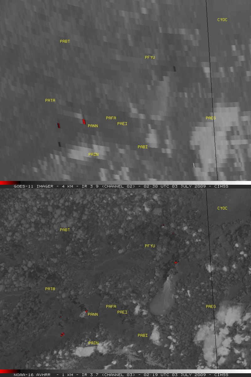
A comparison of the 1-km resolution NOAA-16 AVHRR 3.7 µm and the 4-km resolution GOES-11 3.9 m shortwave IR images (below) demonstrates the importance of better spatial resolution for detecting hot fire pixels. The hottest IR pixels in both the NOAA-16 and the GOES-11 images were 330.0º K (darker red color) — but note that the large fire located southeast of Fort Yukon (PFYU) was only as hot as 307.0º K (darker black color) on the GOES-11 shortwave IR image.
The GOES-11 Wildfire Automated Biomass Burning Algorithm (ABBA) product (below) analyzed the first fire pixels east of the Fort Yukon region around 19:30 UTC on 02 July, several hours before the large smoke plume began to form.


