Snow cover in northern Quebec, Canada
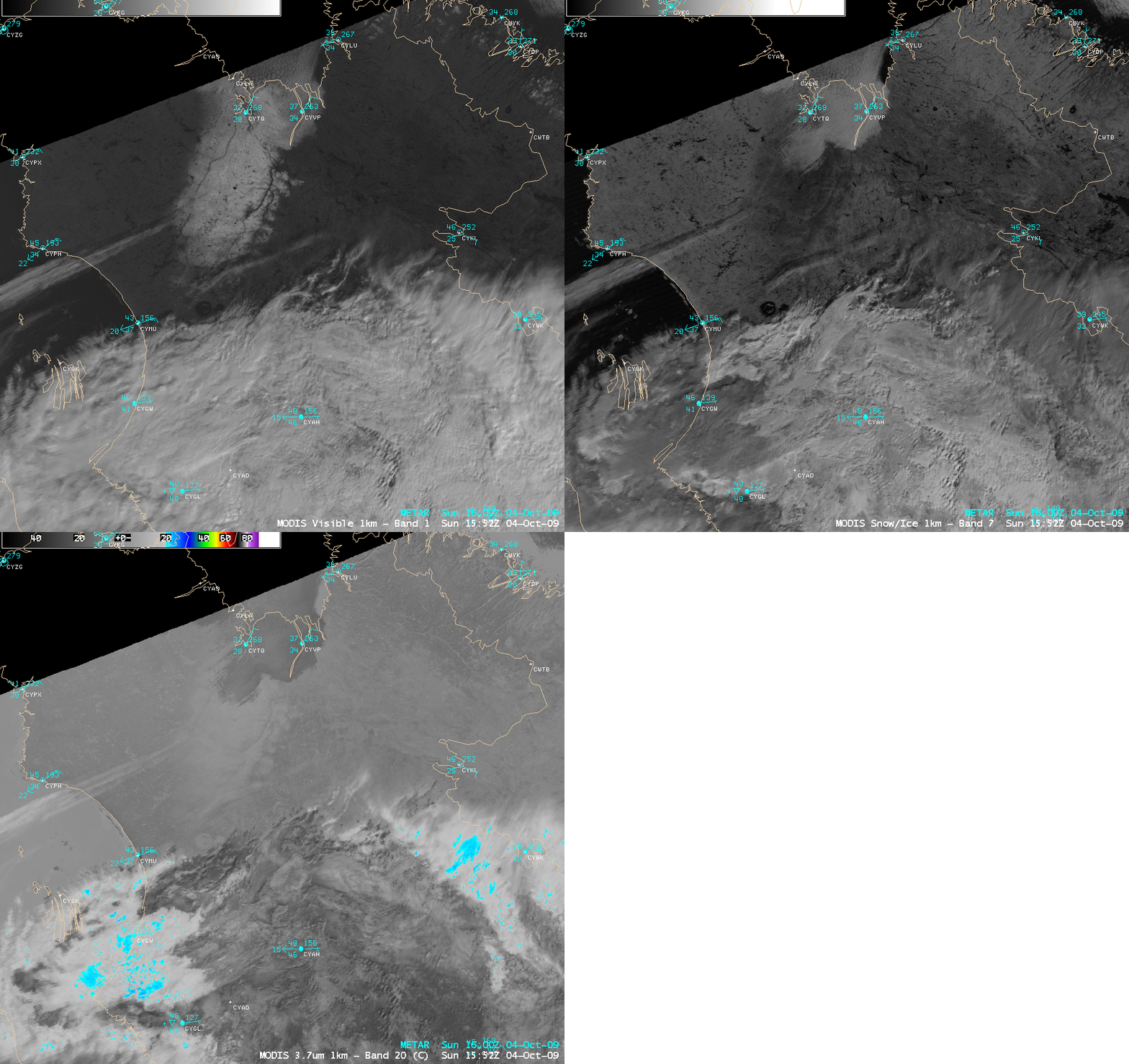
AWIPS images of the MODIS visible channel, the 2.1 µm near-IR “snow/ice” channel, and the 3.7 µm shortwave IR channel (above) displayed a swath of snow cover on the ground in far northern Quebec, Canada on 04 October 2009. The Environment Canada snow cover analysis at 06 UTC placed a maximum of 21 cm (8 inches) in that area. The area of snow cover appeared bright on the visible image, and darker on the 2.1 µm near-IR snow/ice image (due to the strong absorption of snow at that wavelength) — however, there was a patch of supercooled water cloud over the northern portion of the snow cover, which appeared brighter white on the snow/ice image and darker (warmer) on the shortwave IR image (due to increased solar reflection off the supercooled water droplets).
A comparison of the MODIS visible image and the corresponding MODIS false color Red/Green/Blue (RGB) image constructed using the visible and the near-IR snow/ice channels (below) shows the value of RGB imagery for helping to distinguish between snow cover (which appears darker red on the false color image) and supercooled water droplet clouds (which appear as cyan to white shades on the false color image). Note the semi-transparent nature of this particular cloud deck: surface features (such as rivers, and the edges of the snow cover) can be seen through the thin cloud feature. Farther to the south, glaciated clouds that are composed primarily of ice crystals also appear as varying shades of red on the false color image. The ability to display these types of false-color RGB images will hopefully be available to forecasters using the next generation of AWIPS II software.
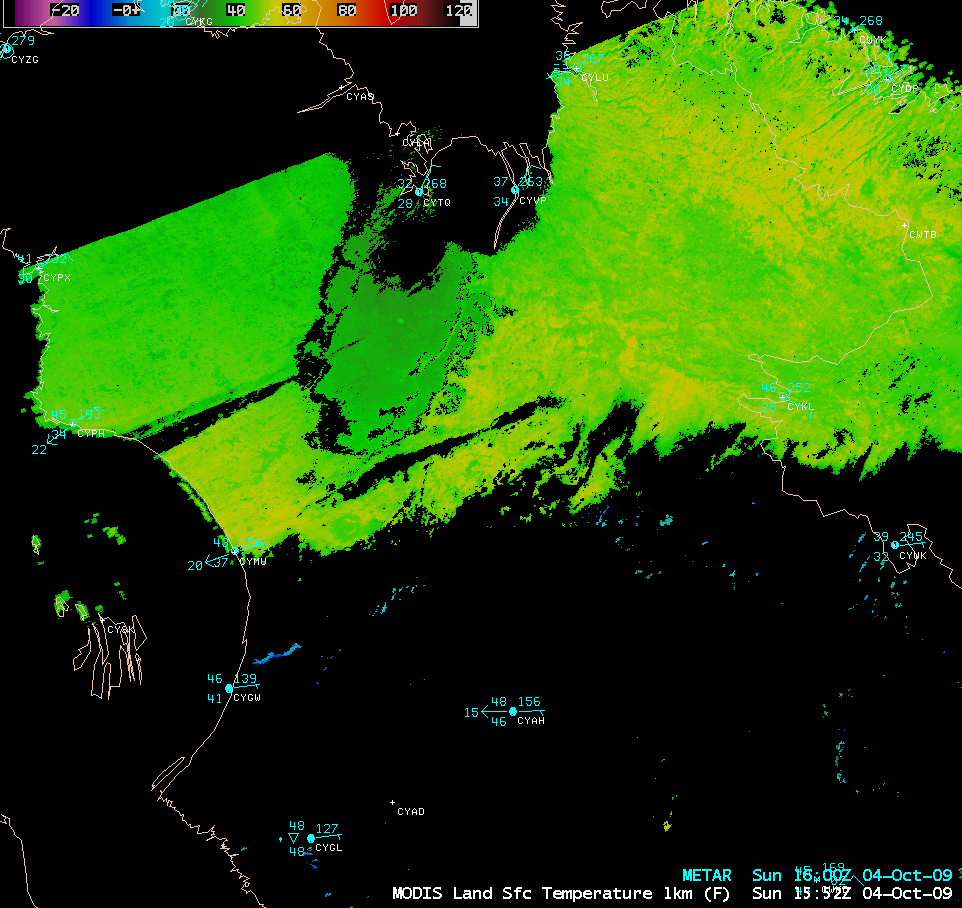
The MODIS Land Surface Temperature product (below) indicated that LST values were only in the 30s F (darker green color enhancement) in the region of snow cover, compared to much warmer 40s and 50s F (lighter green to yellow color enhancement) in the surrounding bare ground areas.


