Freezing fog in the Upper Midwest region
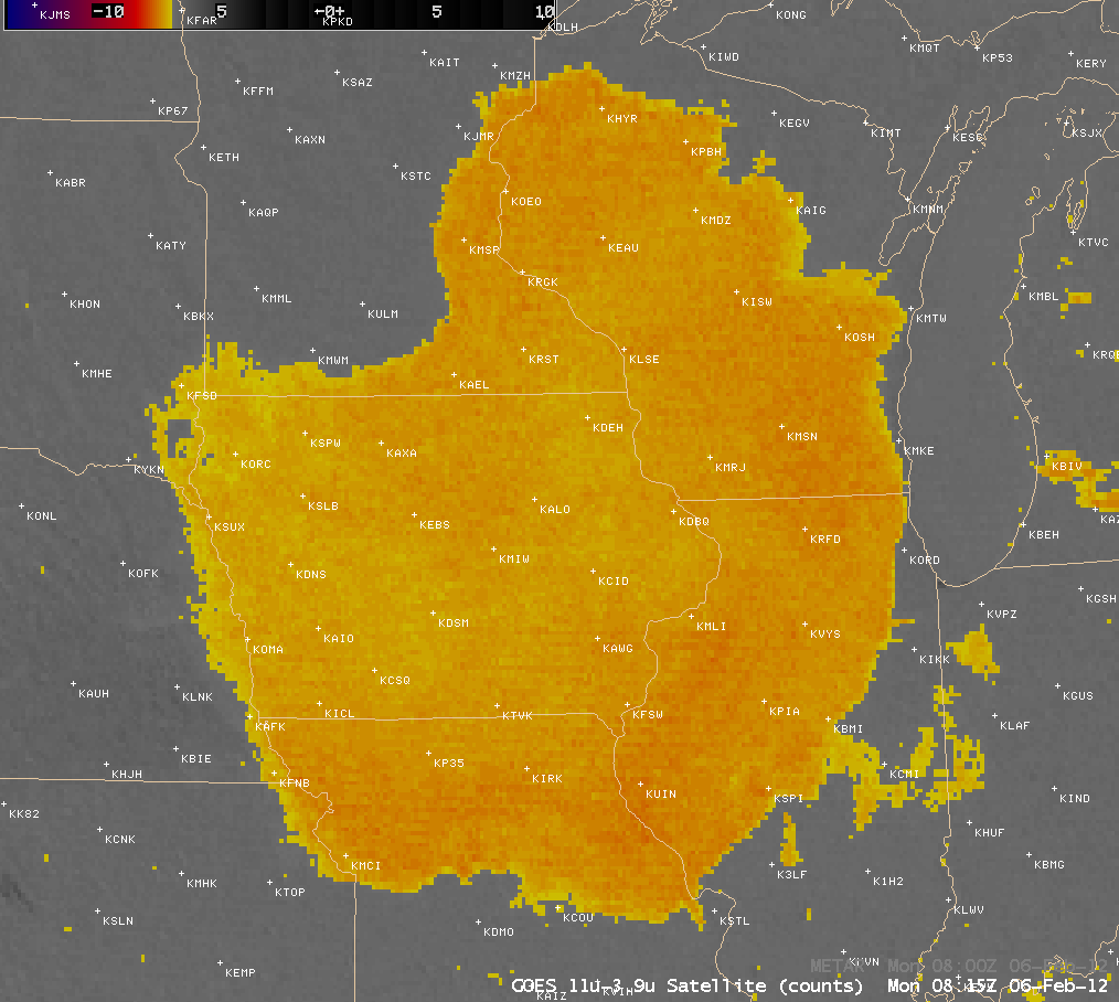
AWIPS images of the 4-km resolution GOES-13 10.7 µm – 3.9 µm “fog/stratus product” (above; click image to play animation) showed a large area of fog and/or stratus (yellow to orange color enhancement) that was increasing in areal coverage during the pre-dawn hours on 06 February 2012. Although the fog/stratus product is useful for locating the presence and temporal trends of such features, it does not offer any reliable indication of whether it is fog on the ground or stratus cloud aloft.
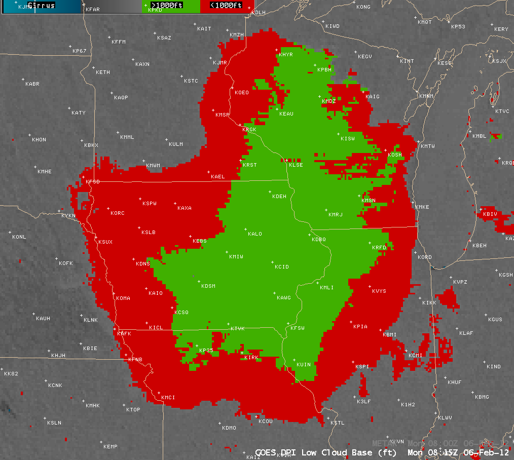
One product that attempts to give the forecaster some quantitative information is the GOES Low CLoud Base (LCB) prodcut (below; click image to play animation), which attempts to blend surface observations with satellite data to indicate whether the cloud base is above or below the threshold of 1000 feet.
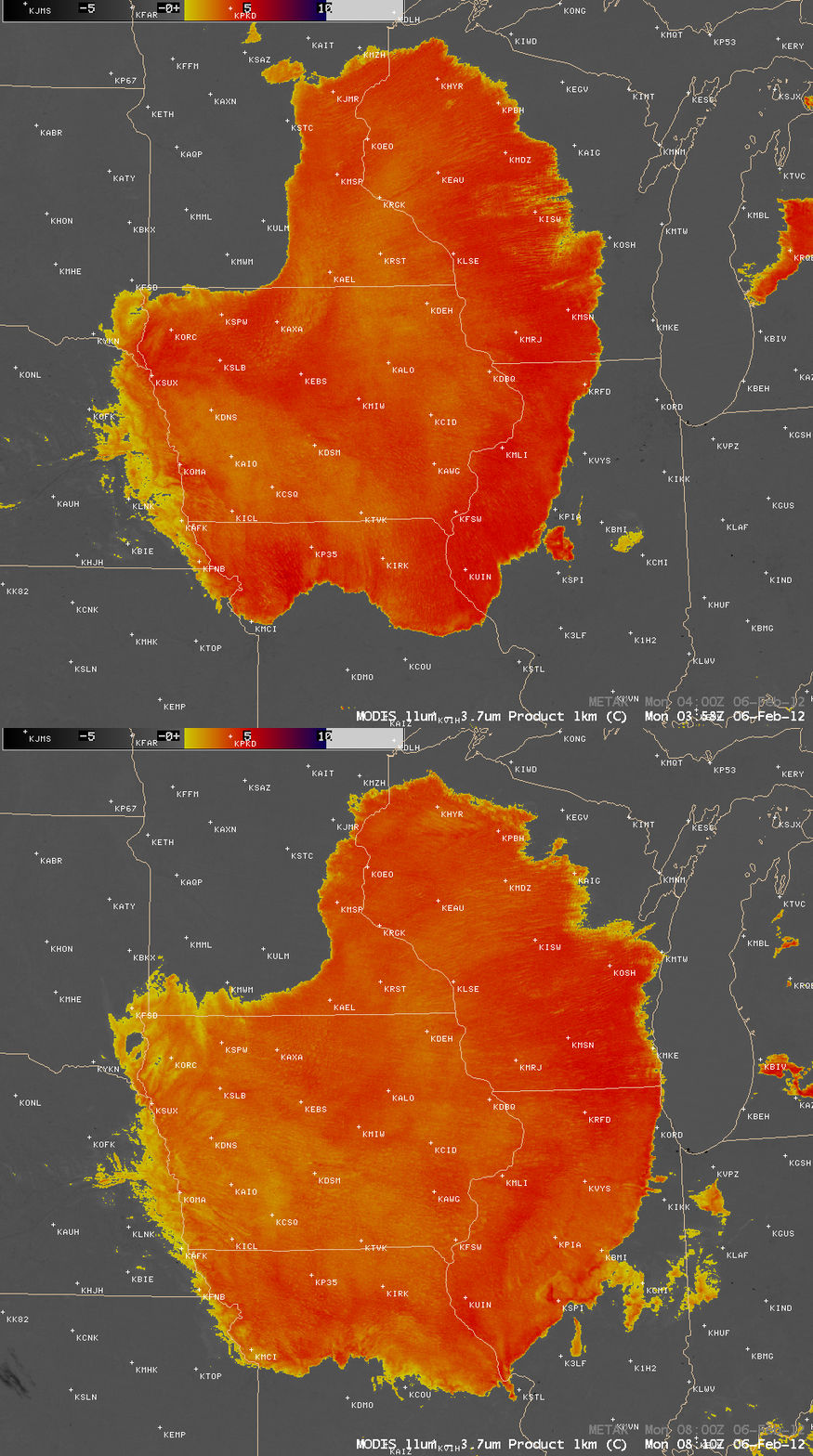
With 1-km resolution data, the MODIS instrument aboard the polar-orbiting Terra and Aqua satellites offers a similar “fog/stratus product” (below) that provides better clarity, especially regarding the exact location of the edges of the fog and/or stratus.
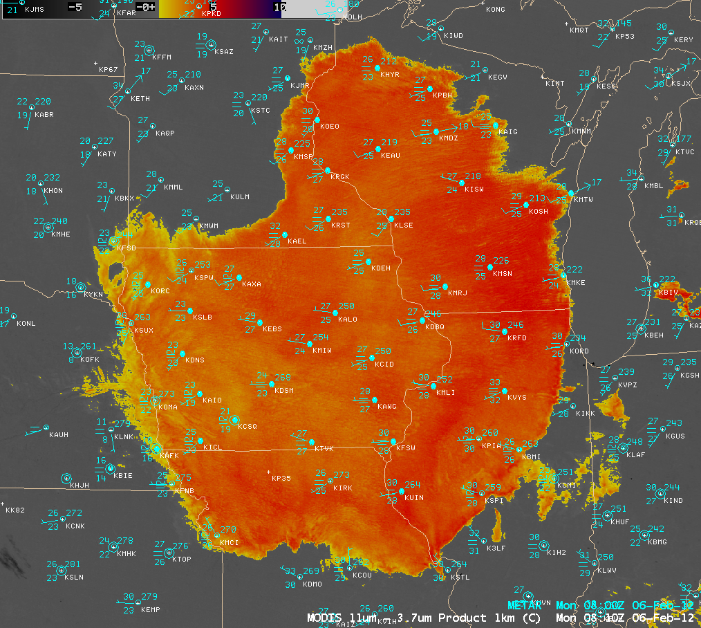
In this particular case, a number of locations beneath the western and southern edge of the fog/stratus feature were expereincing freezing fog (below) and visibilities of 1/4 mile or less, which was creating hazardous road conditions and prompting the issuance of Freezing Fog Advisories.
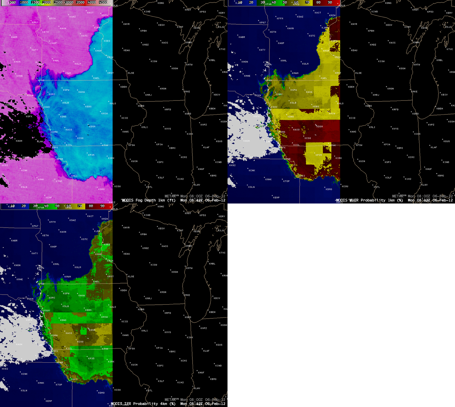
As part of CIMSS participation in GOES-R Proving Ground activities, products are being developed which can provide more quantitative information about such parameters as Fog Depth and the Probability of Marginal Visual Flight Rules (MVFR) or Instrument Flight Rules (IFR) conditions (below). In this case, across the southwestern part of Iowa (where widespread freezing fog was being reported), the fog depth was as high as 1400-1500 feet, with probabilities of MVFR and IFR conditions as high as 75-90% and 60-75%, respectively.
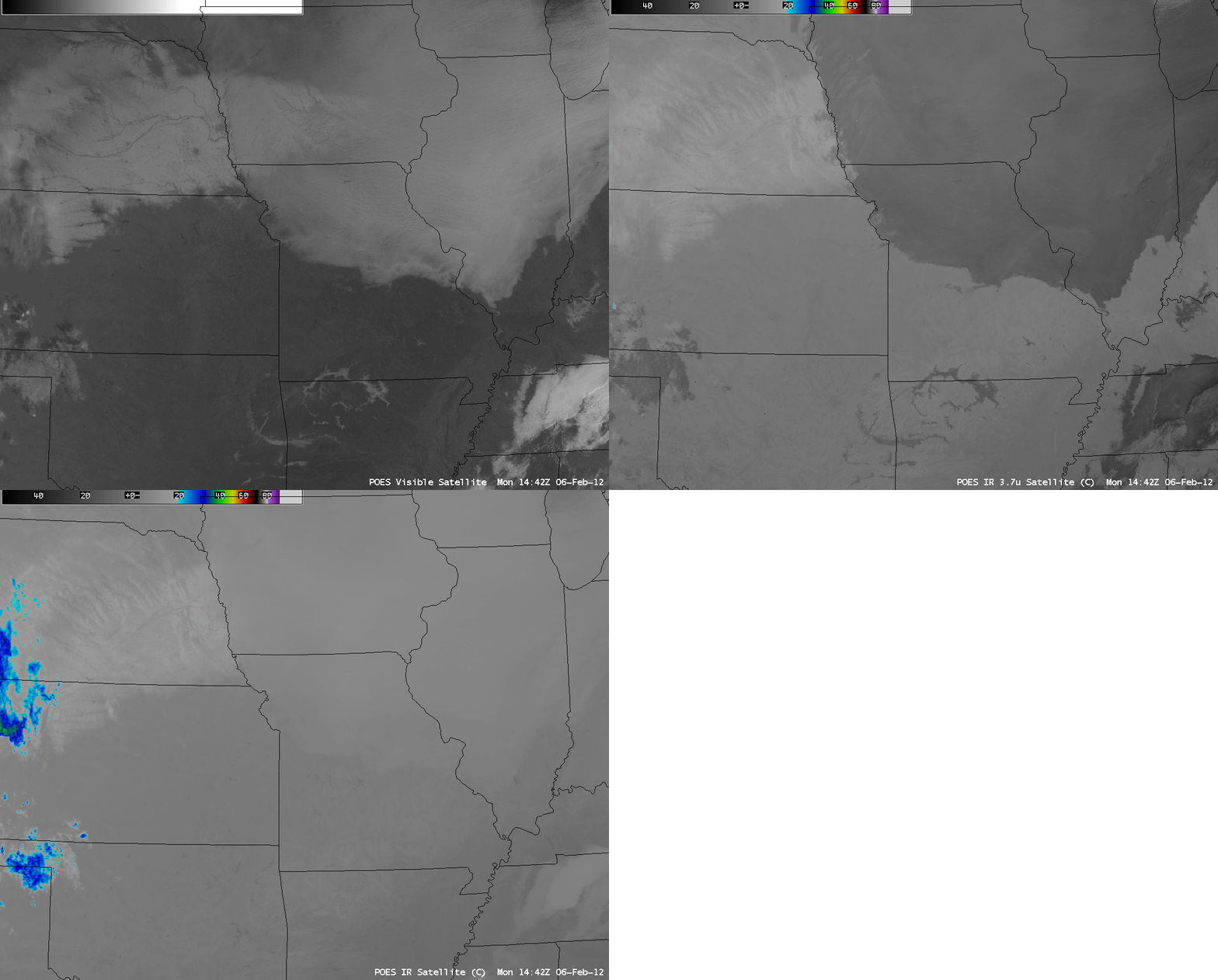
Shortly after sunrise, it is interesting to note that a comparison of 1-km resolution POES AVHRR 0.63 µm visible channel, 3.74 µm “shortwave IR” channel, and 10.8 µm channel “IR window” channel images (below) revealed that part of the swath of fresh snow cover (as deep as 4-6 inches) across western Iowa could be seen through the translucent western edge of the fog/stratus deck that was beginning to burn off during the morning hours. The fog/stratus deck appears warmer (darker gray enhancement) om the 3.74 µm image, due to the sensitivity of that channel to the reflection of solar radiation off the tops of supercooled water droplet clouds.
Farther to the south, note the presence of narrow fingers of valley fog in the Ozark Mountains and surrounding regions in Oklahoma, Arkansas, and Missouri.


