Severe weather outbreak across the southeastern US
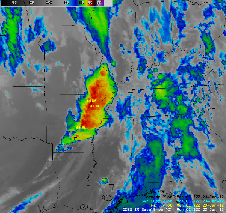
A major outbreak of severe thunderstorms along a strong cold frontal boundary swept eastward across much of the southeastern US on 22 January – 23 January 2012, producing widespread damaging winds, large hail, and tornadoes (SPC storm reports). Two tornadoes produced EF-3 damage in Alabama. AWIPS images of 4-km resolution GOES-13 10.7 µm IR channel data with overlays of severe weather reports (above; click image to play animation) showed the cold cloud top IR brightness temperatures of -60 to -70 C (red to black color enhancement) associated with some of the strongest storms. For more information, see summaries from the National Weather Service forecast offices at Litttle Rock AR, Jackson MS, and Birmingham AL.
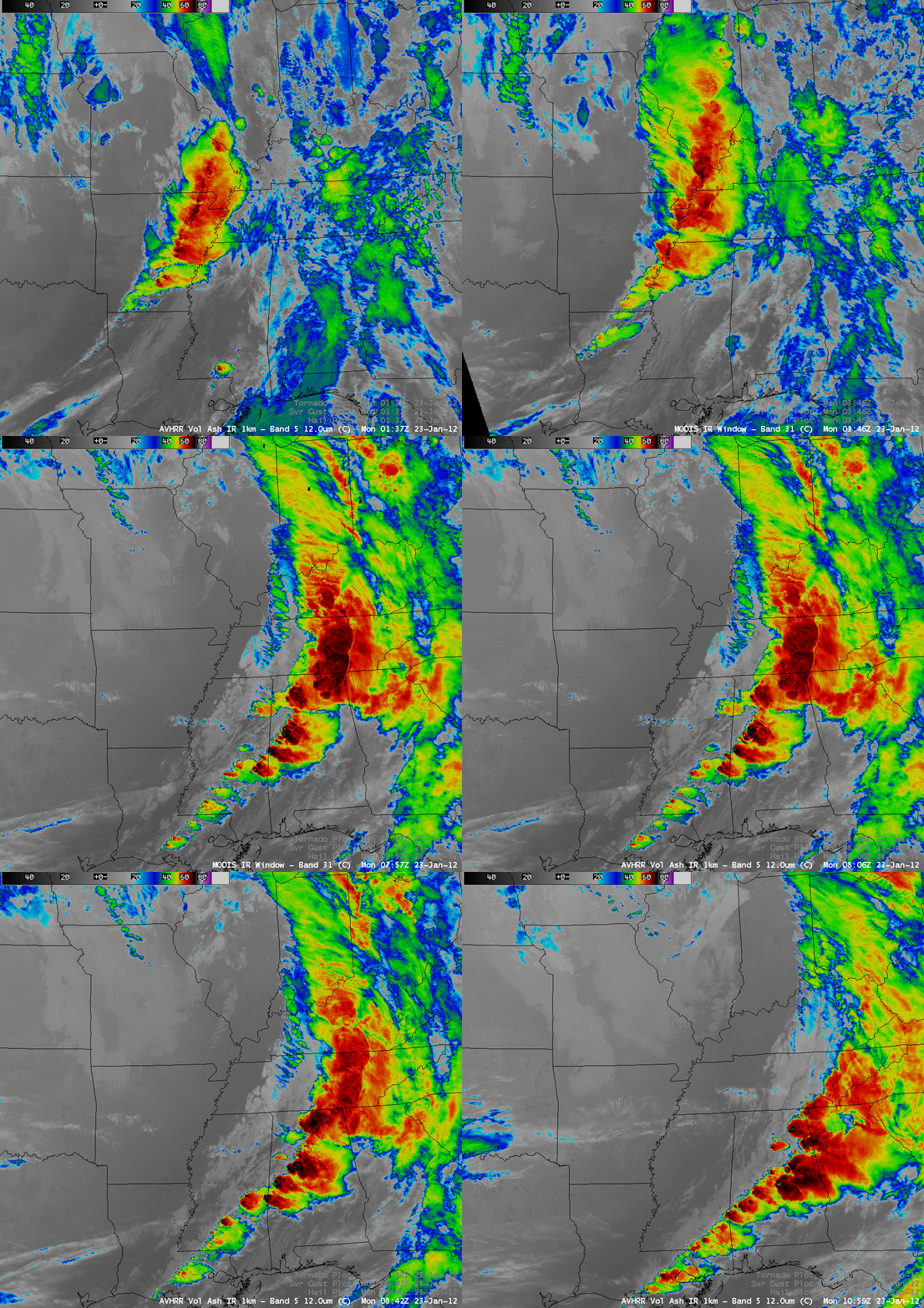
A sequence of 1-km resolution POES AVHRR 12.0 µm IR and MODIS 11.0 µm IR images (above) displayed greater detail in the storm top thermal structures, with a number of -70 to -80 C (black to light gray color enhancement) IR brightness temperature values seen on the higher resolution imagery.
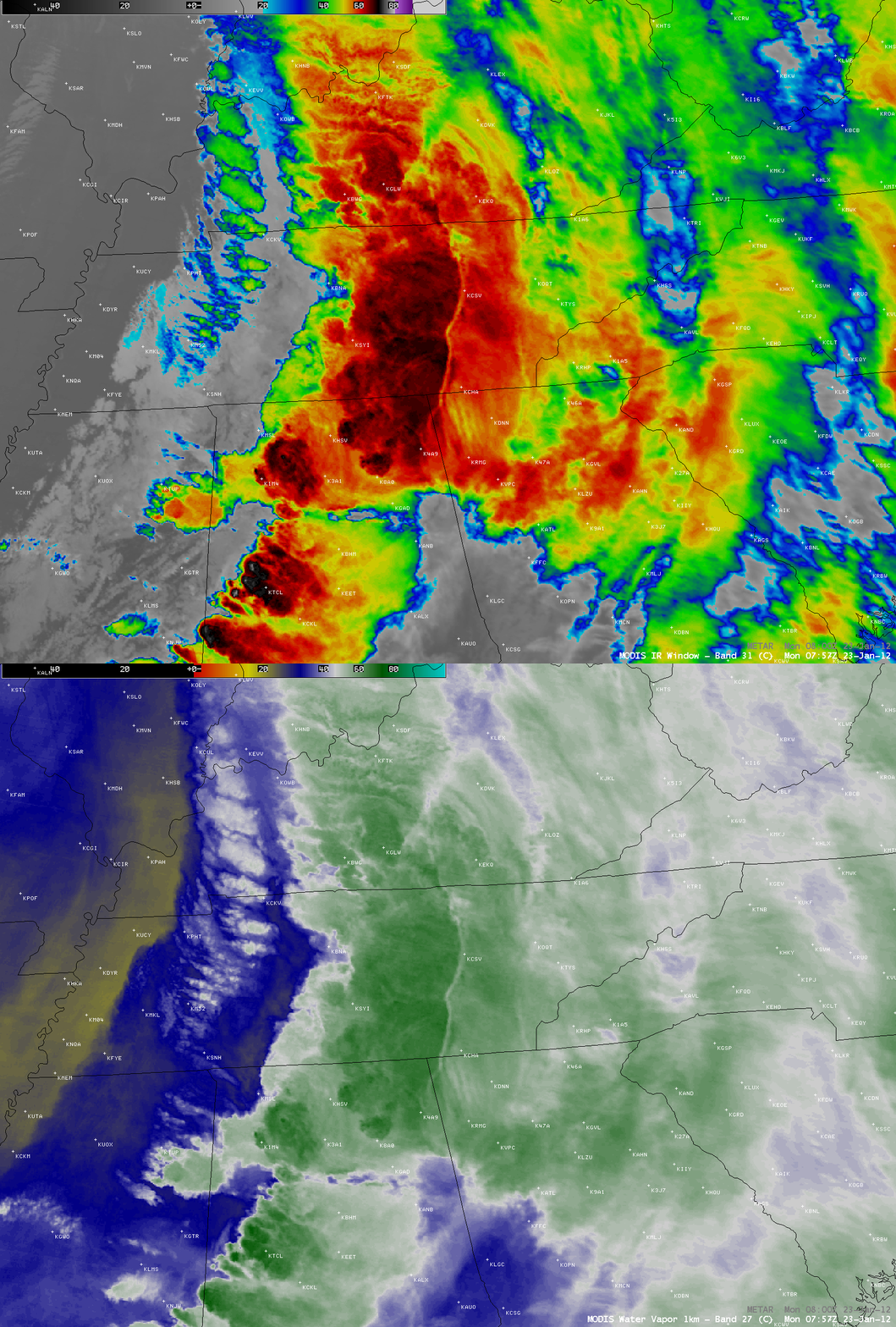
Of particular interest was what appeared to be some sort of “cloud trench” oriented from north to south across Tennessee around 08:00 UTC, which exhibited significantly warmer MODIS 11.0 µm IR brightness temperatures and a warmer/drier signal on the corresponding MODIS 6.7 µm water vapor image (below). This feature was also apparent on a few of the 4-km resolution GOES-13 IR images around that time. The etiology of this satellite signature is unclear at this time.


