“Outflow boundaries” from Tropical Storms Hanna and Josephine
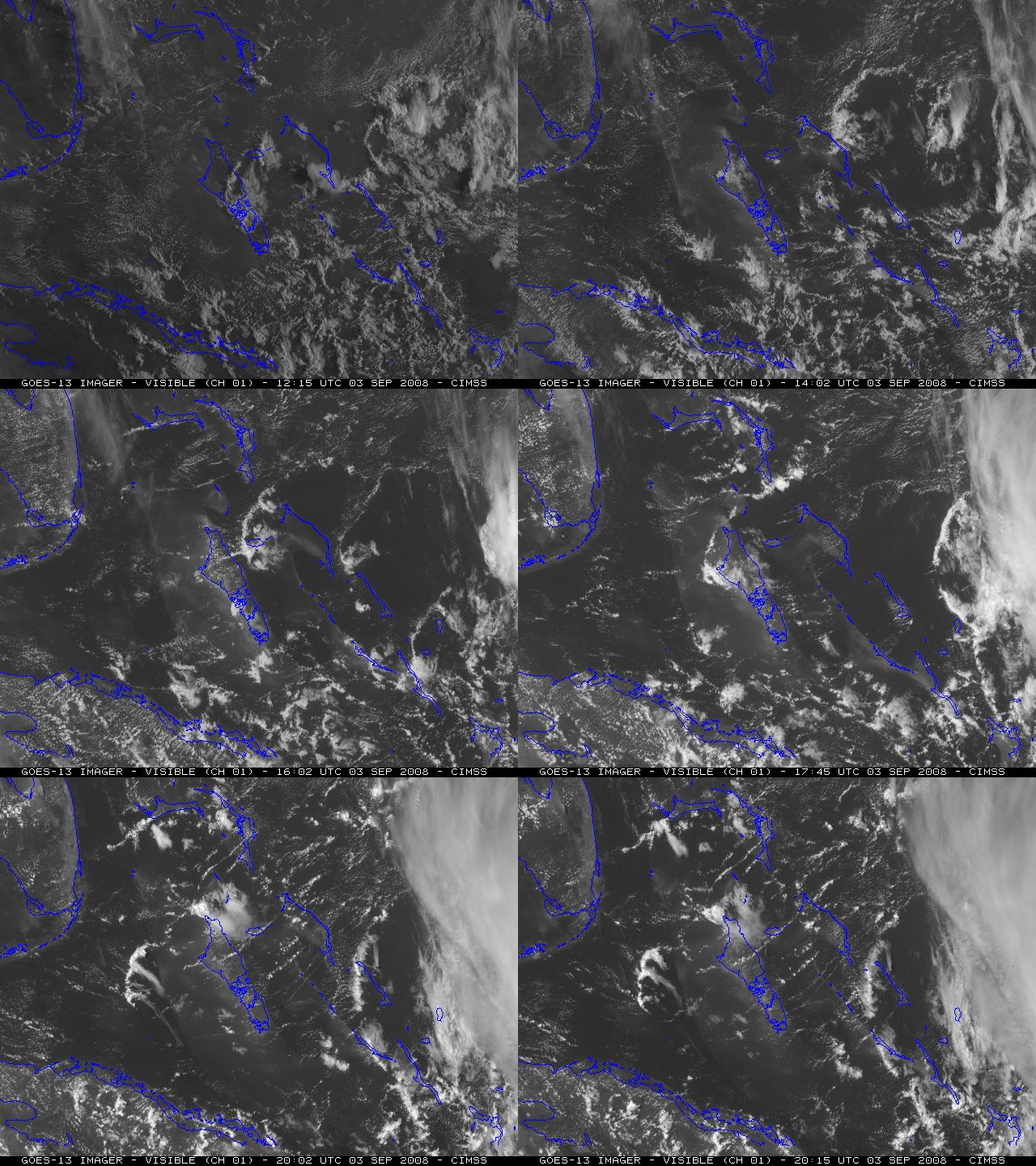
A series of low-level “outflow boundaries” was seen on GOES-13 visible imagery (above), propagating westward from the shield of high clouds associated with Tropical Storm Hanna, moving across the Bahamas on 03 September 2008. The air behind each of these pulses appeared to be quite dry, judging from the general lack of cloudiness in their wake.
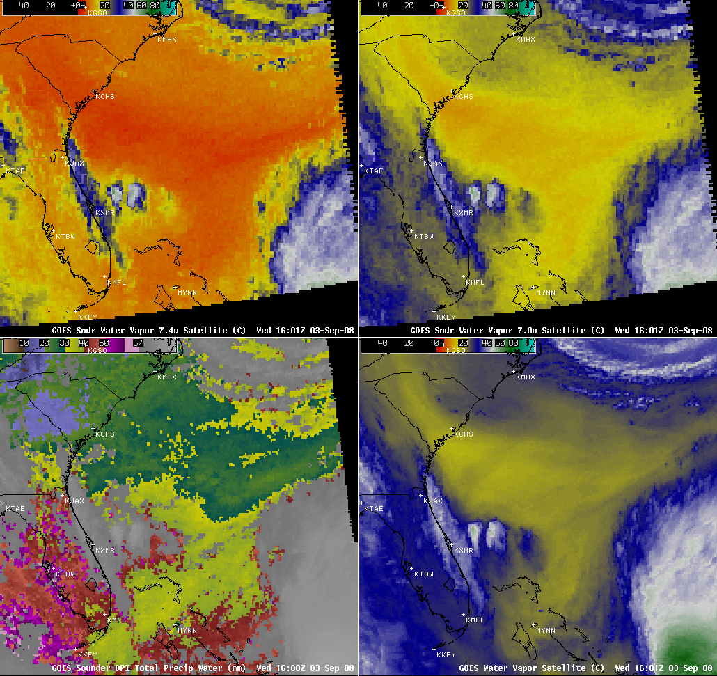
AWIPS images of the GOES sounder 7.4 and 7.0 µm water vapor channels, the GOES sounder Total Precipitable Water product, and the GOES imager water vapor channel at 16 UTC (below) indicated that a tongue of dry air existed over the Bahamas, sandwiched in between Hanna and the clouds/moisture over Florida. The rawinsonde report from Nassau in the Bahamas showed that the air mass was indeed quite dry within the 700-500 hPa layer.
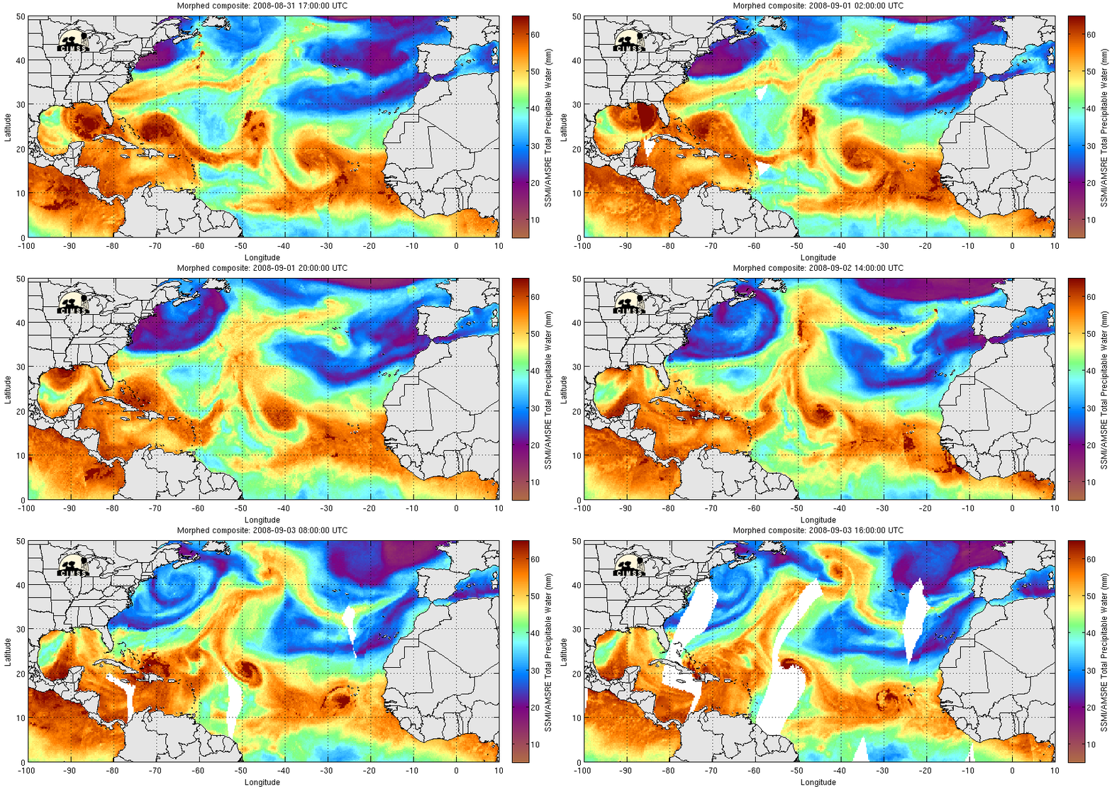
The MIMIC Total Precipitable Water (TPW) product (below) suggested that a large pocket of dry air (TPW values around 35 mm, cyan colors) was situated east of Hanna on 01 September, with part of this dry air then moving westward around the northern periphery of the tropical storm on 02-03 September.
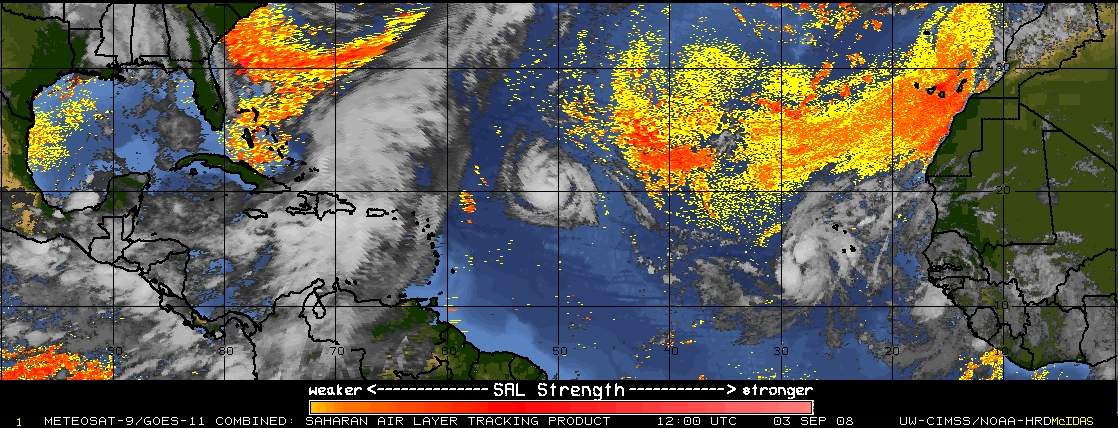
The Saharan Air Layer (SAL) product (below) displayed a weak SAL signal (yellow to red colors) over the Bahamas region, supporting the idea that the pocket of dry SAL air had indeed moved around to the northwestern quadrant of Hanna. In addition, MODIS Aerosol Optical Depth values were slightly elevated over that region, suggesting the presence of African dust. Some of this dry mid-tropospheric SAL air may have been mixed downward behind the westward-propagating outflow boundaries noted on the GOES-13 visible imagery above.
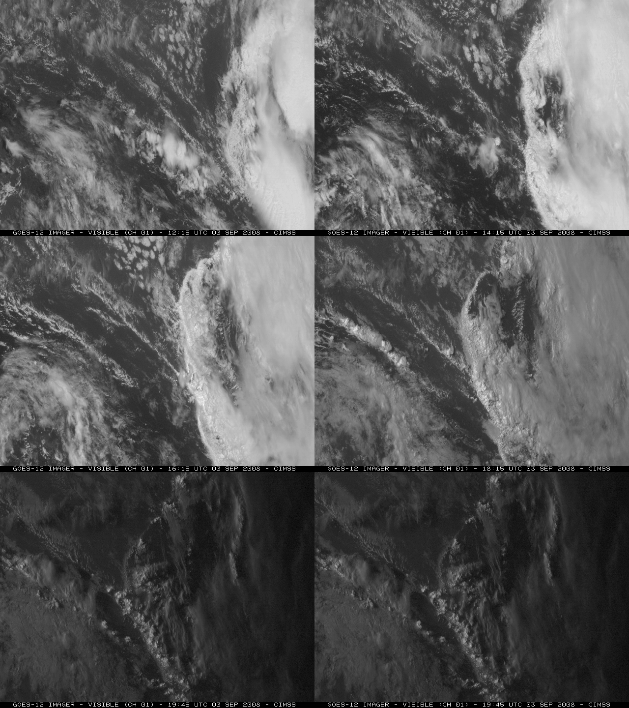
Farther to the east, an even more pronounced “outflow boundary” was seen moving westward away from Tropical Storm Josephine, as shown on GOES-12 visible imagery (below). A strong SAL signature was depicted on the MIMIC TPW and SAL products, covering a large portion of the eastern Atlantic to the north of Josephine.


