Upper Midwest Derecho, and a Seiche in southern Lake Michigan
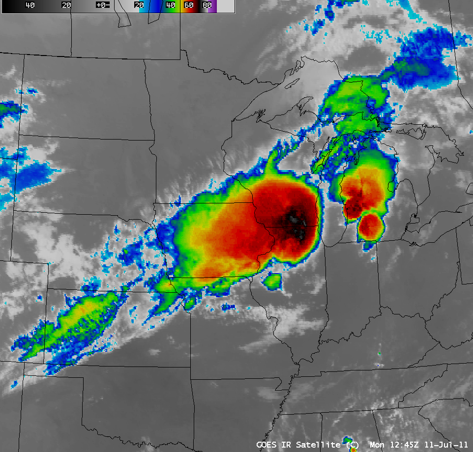
AWIPS images of GOES-13 10.7 µm IR data (above; click image to play animation) showed the progression of two long-lived Mesoscale Convective Systems (or “derechos”) on 11 July 2011 — one moving southeastward from the Dakotas and Minnesota, and another moving northeastward from Nebraska. These two MCS features were responsible for a large number of severe weather reports (SPC: 10 July reports | 11 July reports).
Note the elongated band of cirrus that developed behind the departing MCS feature, curving across parts of Iowa, Nebraska, Kansas, and Colorado toward the end of the IR image animation above — this striated cloud band marked the location of a well-defined deformation zone. Areas of light to moderate turbulence aloft are often present in association with such deformation zones, as was seen by the number of pilot reports overlaid on a GOES-13 6.5 µm water vapor channel image at 17:45 UTC (below).
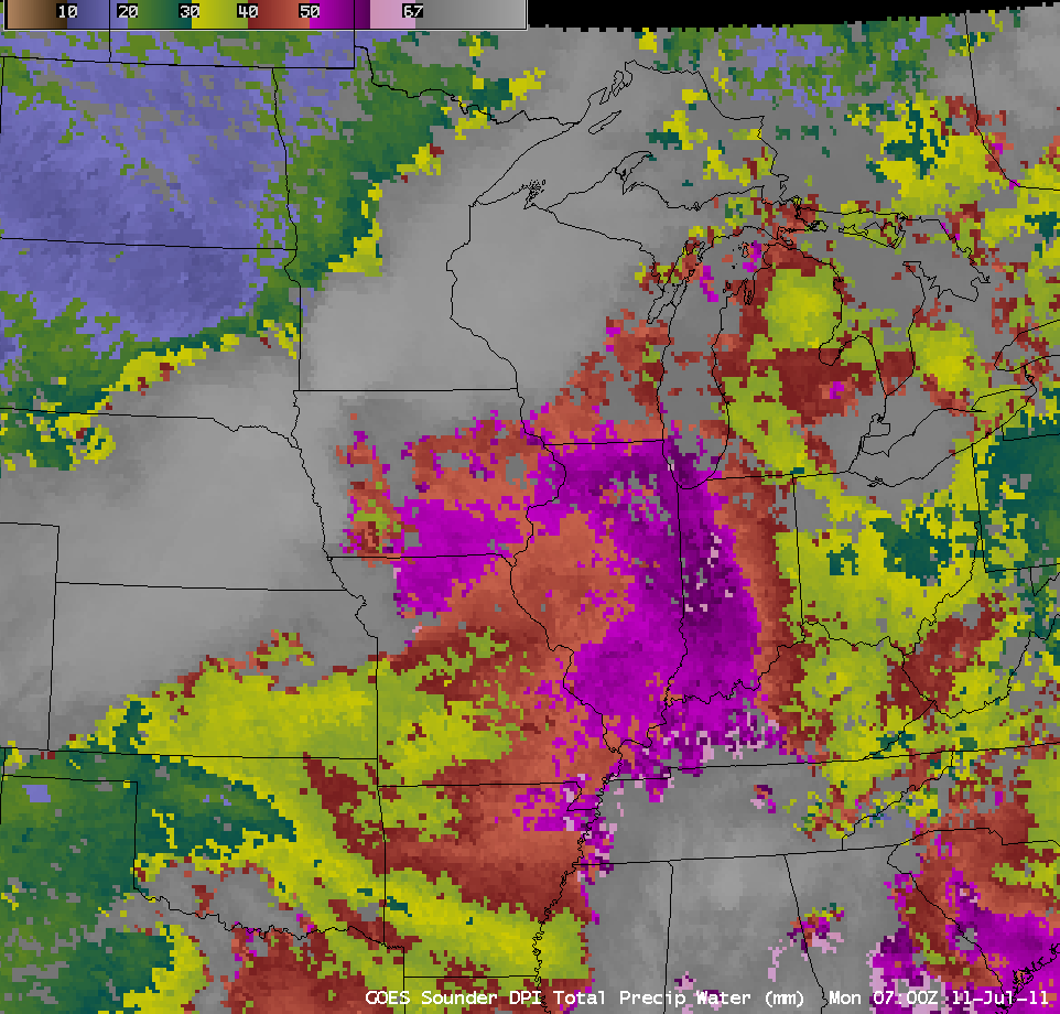
The GOES-13 sounder Total Precipitable Water (TPW) derived product (below; click image to play animation) showed that abundant moisture (TPW values of 50-60 mm or 2.0 to 2.4 inches, violet color enhancement) was in place ahead of the storms as they moved rapidly eastward.
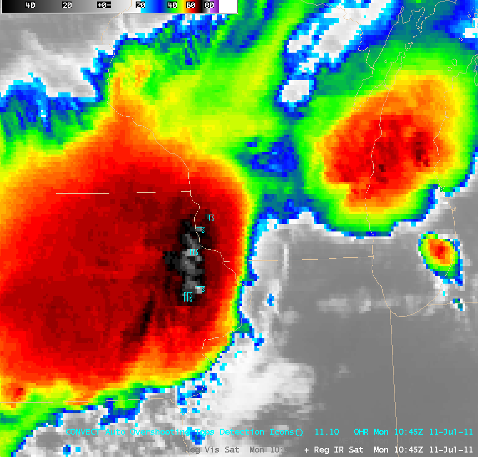
A closer view of GOES-13 10.7 µm IR images with overlays of the Automated Overshooting Top Detection product (below; click image to play animation) revealed a number of overshooting tops, with the minimum cloud top IR brightness temperature of -81ºC occurring over eastern Iowa at 09:45 UTC. The overshooting tops were very evident after sunrise on GOES 0.63 µm visible channel imagery, as they cast shadows upon the thunderstorm anvil tops below (11:45 UTC visible image + overshooting top detection product comparison).
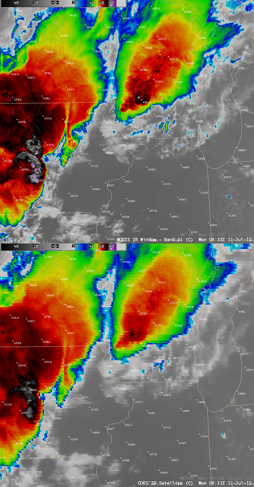
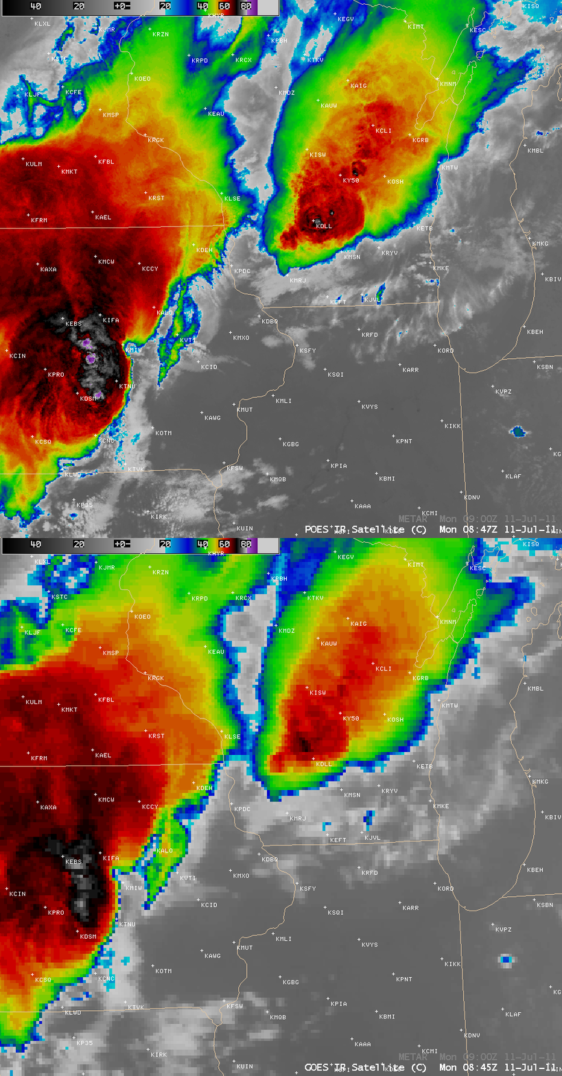
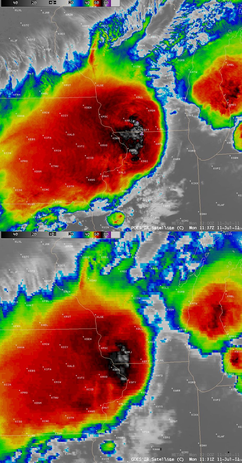
A set of three comparisons of 1-km resolution POES AVHRR 10.8 µm IR images with their corresponding 4-km resolution GOES-13 10.7 µm IR images (below) demonstrated the value of improved spatial resolution for more accurate detection of the location and magnitude of the coldest cloud tops on severe thunderstorms. On the 08:22 UTC, 08:47 UTC, and 11:37 UTC POES AVHRR images, the coldest cloud top IR brightness temperatures were -84ºC, -90ºC, and -85ºC, respectively (the coldest GOES-13 IR brightness temperatures were -78ºC for all three of those times). Note that the apparent northwestward displacement of cloud features on the GOES-13 images is a result of parallax error due to the large viewing angle from the geostationary satellite.
Very strong surface winds were observed along and in the wake of the well-defined bow echo seen on radar — peak wind gusts included 74 mph at Dubuque, Iowa, 75 mph at Chicago Midway Airport, and 85 mph at Michigan City, Indiana. These strong winds created a seiche across southern Lake Michigan (Seiche Warning | NWS Chicago event summary), with oscillations in water levels seen at Calumet Harbor, Illinois, Milwaukee, Wisconsin, and Holland, Michigan.


