Atlantic Tropical Invest 93L: a residual MCV from a Midwest MCS?
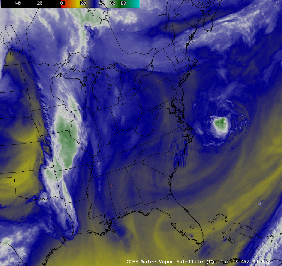
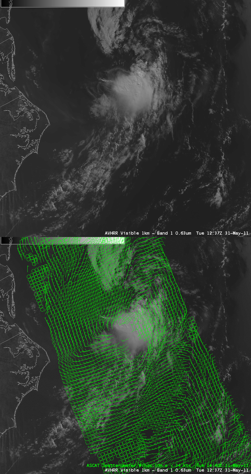
An area of organized convection was seen moving rapidly southwestward across the western Atlantic Ocean on 31 May 2011, not far off the East Coast of the US. AWIPS images of GOES-13 6.5 µm “water vapor channel” data (above; click image to play animation) suggested that this area of convection over the Atlantic (which was designated Atlantic Tropical Invest 93L on the morning of 01 June) may have been due to a residual Mesoscale Convective Vortex (MCV) that was created by a large Mesoscale Convective System (MCS) over the Upper Midwest region of the US 2 days earlier (for additional information, see the WeatherMatrix Blog and the Weather Underground WunderBlog). A comparison of a POES AVHRR 0.63 µm visible image at 12:37 UTC with ASCAT scatterometer surface winds about 2 hours later at 14:40 UTC (below) revealed a well-defined cyclonic circulation within the convective cluster on 31 May.
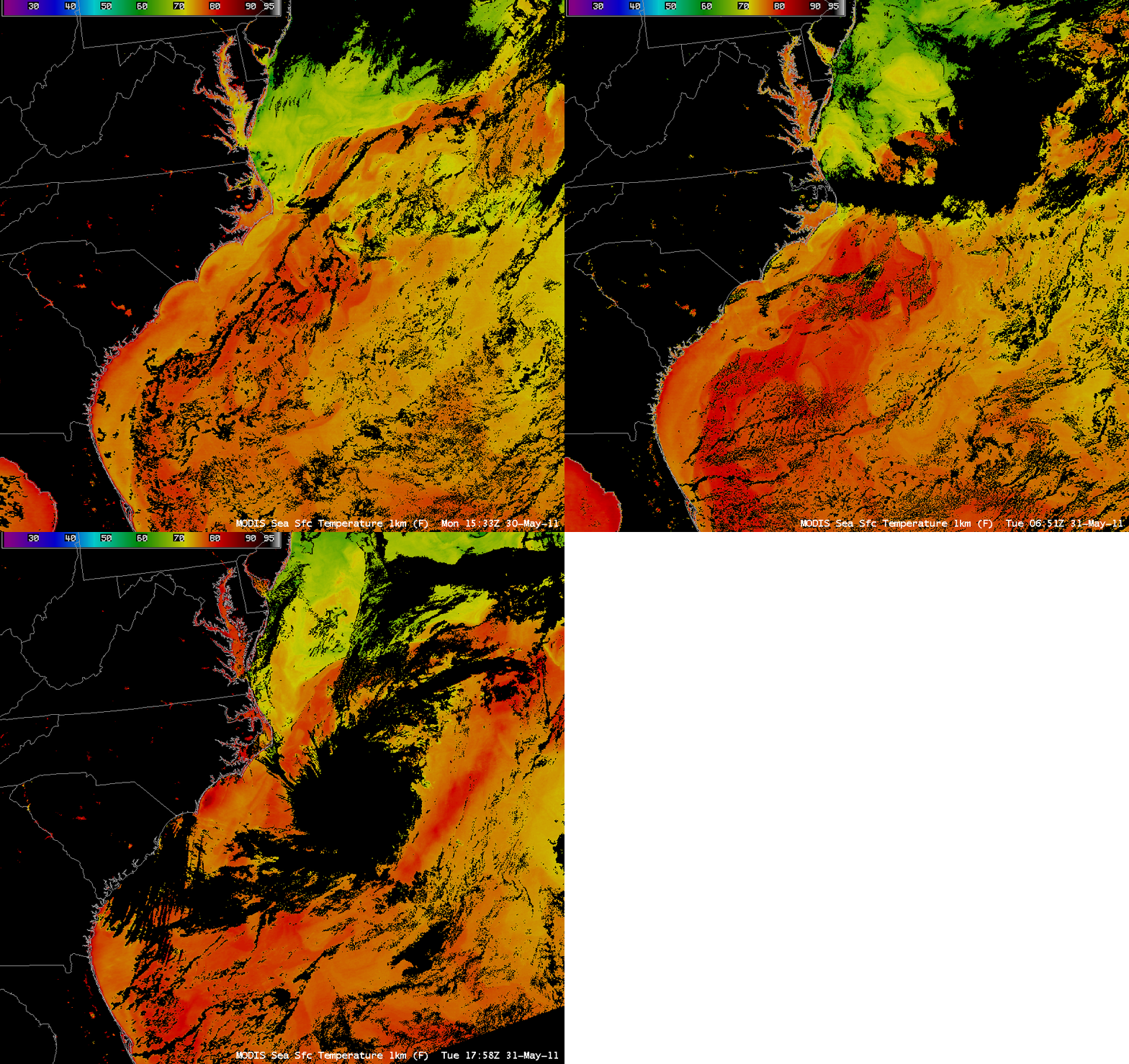
MODIS Sea Surface Temperature (SST) product images (below) indicated that the SST values within the Gulf Stream were in the upper 70s to low 80s F (darker red color enhancement) — and these warm waters may have helped the MCV convection to organize and intensify as it eventually moved southwestward over the Gulf Stream.
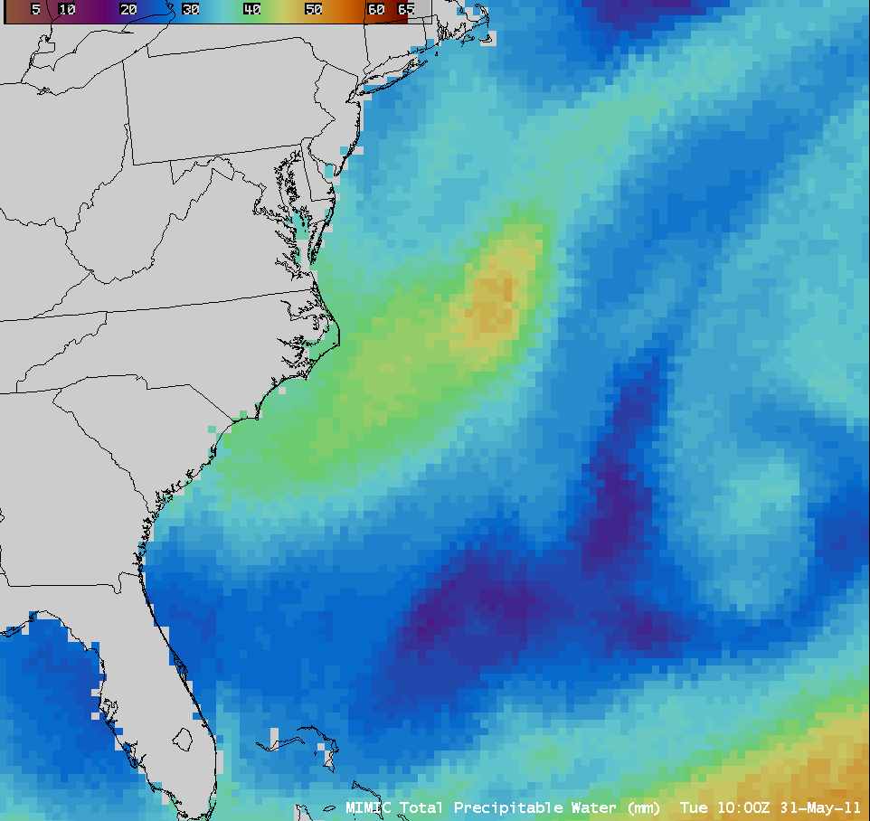
The feature could also be followed on the MIMIC Total Precipitable Water (TPW) product (below; click image to play animation) — TPW values remained above 40-45 mm during the entire journey across the western Atlantic Ocean, and peaked at 58 mm at 18:00 UTC on 31 May as the disturbance began to move over the warmer waters of the Gulf Stream.
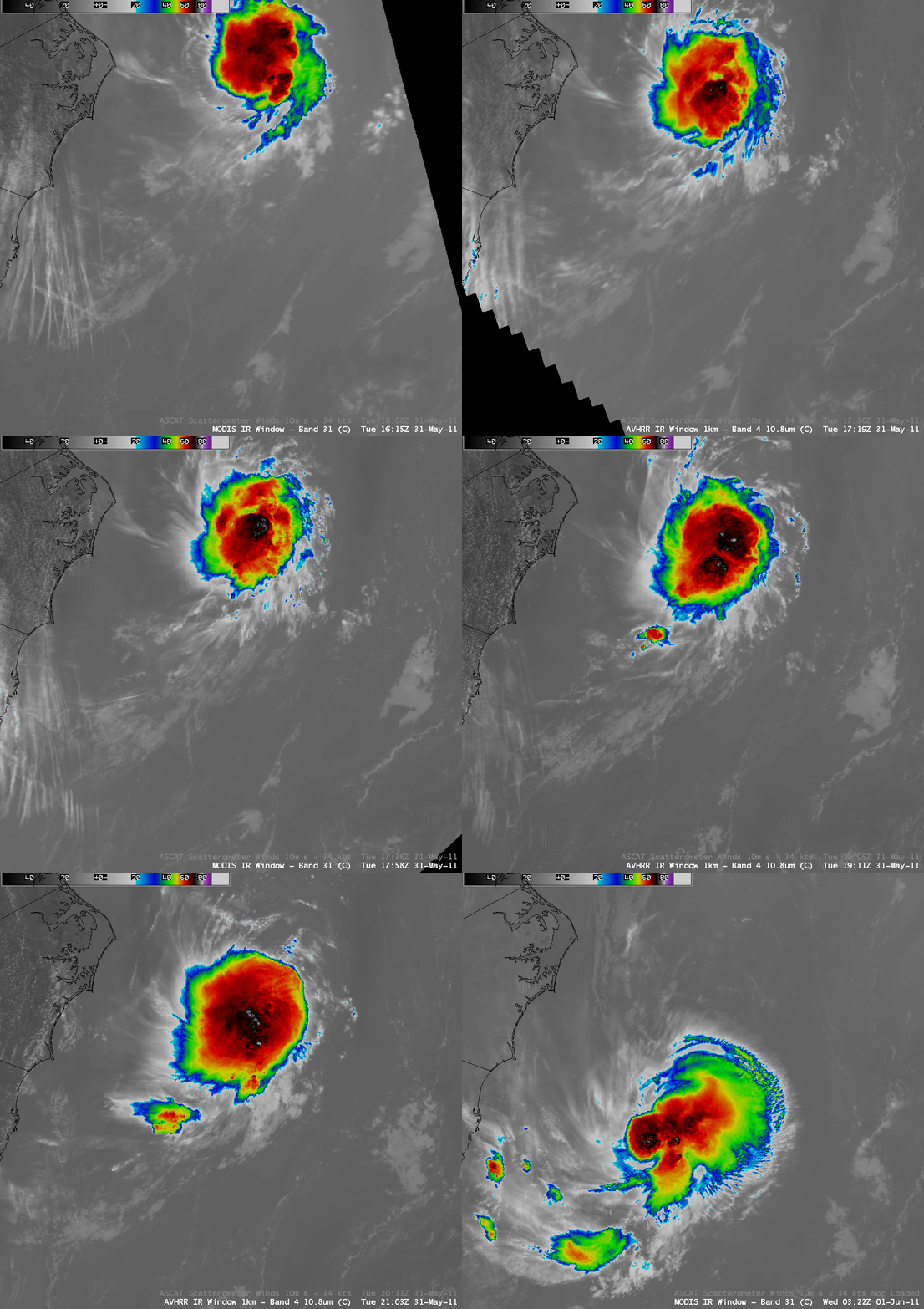
A sequence of MODIS 11.0 µm IR and POES AVHRR 10.8 µm IR images (below) showed minimum cloud top IR brightness temperature values in the -71º C to -83º C range during the 31 May to 01 June period.
A somewhat similar case was noted back in July 1999, when MCV-related convection moved inland produving large hail, damaging winds, and heavy rain in parts of North Carolina and South Carolina.
CIMSS participation in GOES-R Proving Ground activities includes making a variety of POES AVHRR, MODIS, and MIMIC TPW images and products available for National Weather Service offices to add to their local AWIPS workstations. The VISIT training lessons “POES and AVHRR Satellite Products in AWIPSâ€, “MODIS Products in AWIPS“, and “Morphed TPW Detection (MIMIC)” are available to help users understand these products and their applications to weather analysis and forecasting.
[Added, 7 June 2011: An enhanced infrared loop using data from GOES-13 that shows the entire life of the MCV is available here. Note: 34 megabyte file size]


