Strong convection in the Gulf of Mexico
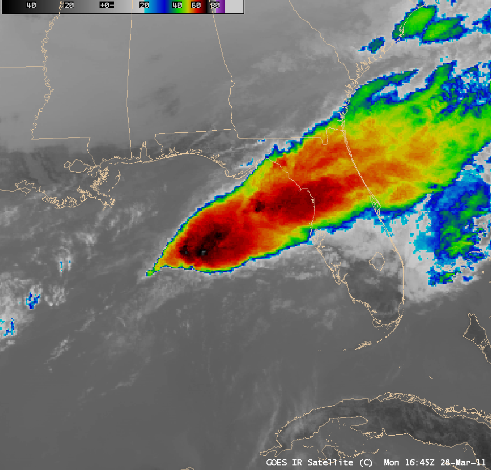
AWIPS images of GOES-13 10.7 µm IR data (above; click image to play animation) showed the development of two strong Mesoscale Convective Systems over the Gulf of Mexico on 28 March 2011. These storms prompted the Storm Prediction Center to issue Severe Thunderstorm Watch #70 and #71 for the threat of strong winds and large hail — however, no reports of severe weather were received from these particular storms.
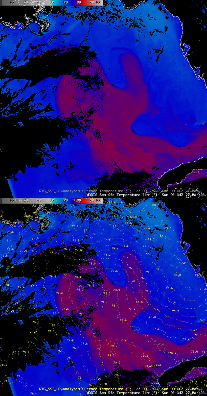
The MODIS Sea Surface Temperature (SST) product from the previous day (below) revealed that the northern edge of the Gulf of Mexico Loop Current (warmer SST values in the upper 70s to around 80º F, red color enhancement) was located near the areas of development of these two Mesoscale Convective Systems — raising the question as to the role that this warmer water may have played in their initiation. In addition, an overlay of the High Resolution Real-Time Global Sea Surface Temperature (RTG_SST_HR) model SST failed to capture the warmer tongue of SSTs located to the east of the main core of the Loop Current. MODIS SST values were 2-3 degrees F warmer than the model SST values in the eastern warm tongue feature — and 3-4 degrees F cooler within the main core of the Loop Current.
=================================
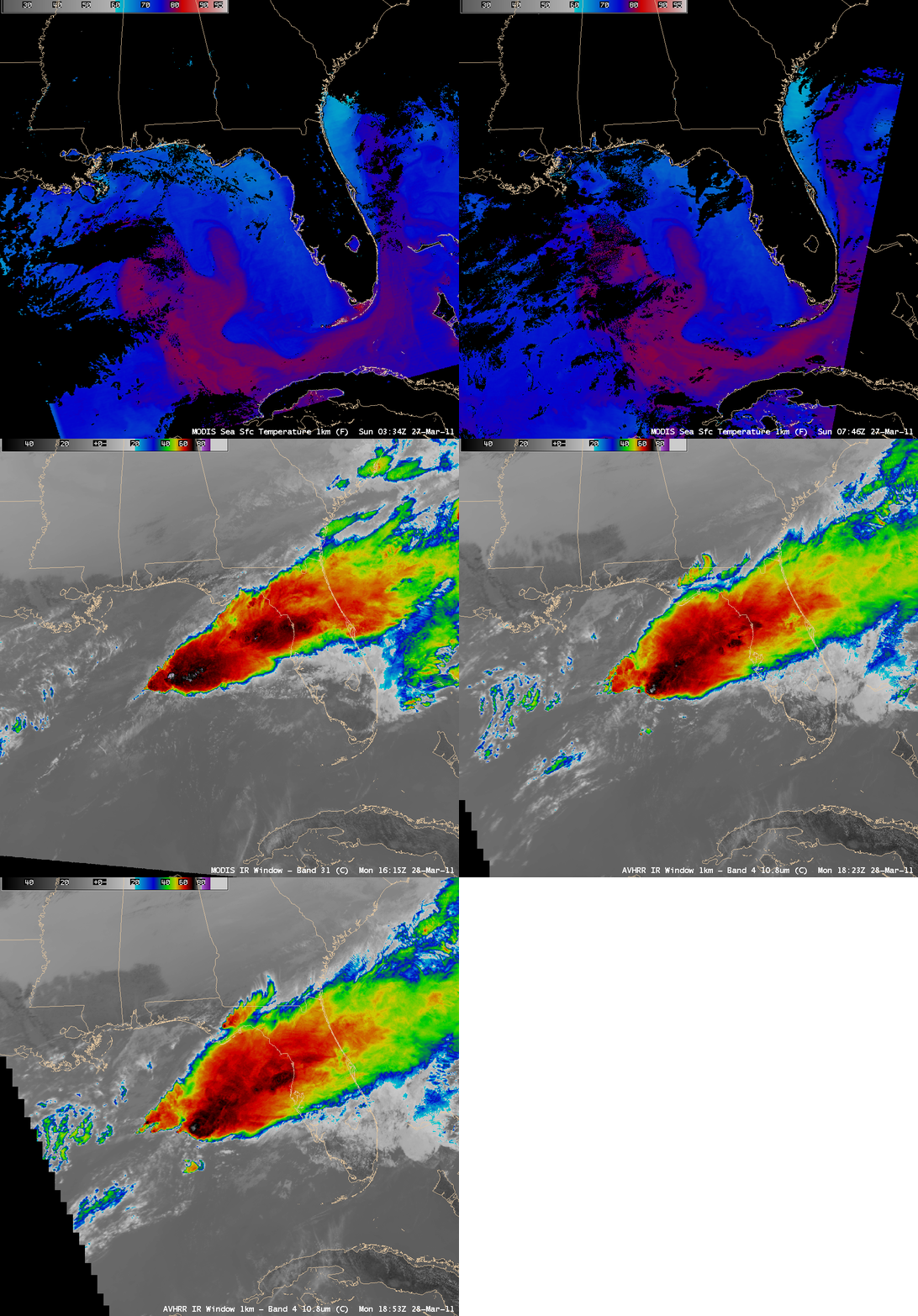
A comparison of the MODIS SST product with MODIS 11.0 µm IR images of the first MCS (above) along with a similar comparison of the MODIS SST with a combination of MODIS 11.0 µm IR and POES AVHRR 10.8 µm IR images (below) showed the development of each MCS in the general proximity of the areas of warmer SST values associated with the Loop Current.
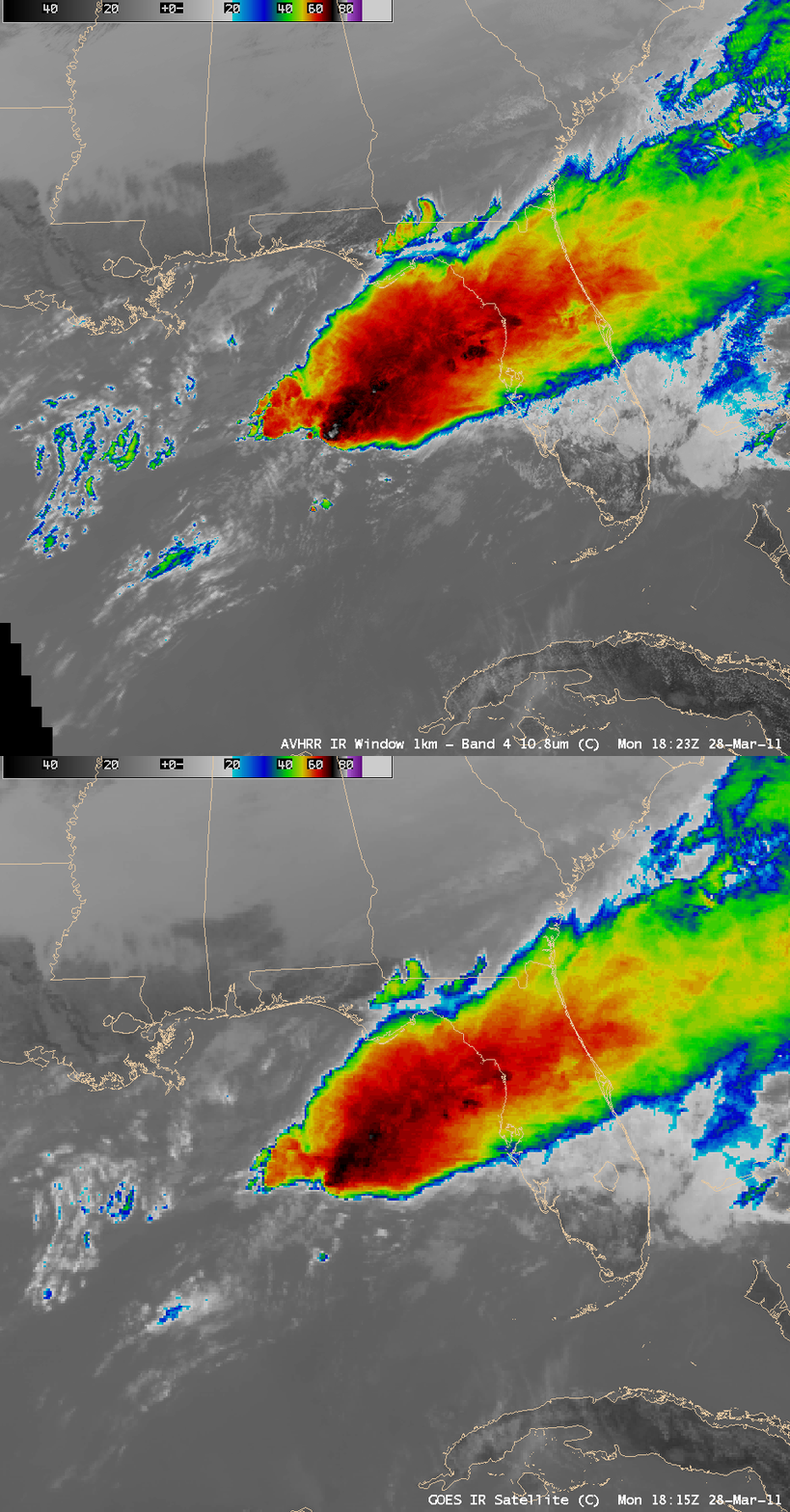
A comparison of a 4-km resolution GOES-13 10.7 µm image with the corresponding 1-km resolution POES AVHRR image (below) demonstrated the value of higher spatial resolution for locating the colder cloud top IR brightness temperatures associated with overshooting tops of intense deep convection. The coldest IR temperature on the GOES-13 image was -71º C, compared to -80º C on the POES AVHRR image.
CIMSS participation in GOES-R Proving Ground activities includes making a variety of MODIS and POES AVHRR images and products available for National Weather Service offices to add to their local AWIPS workstations.


