Lake-effect snow in northeastern Minnesota
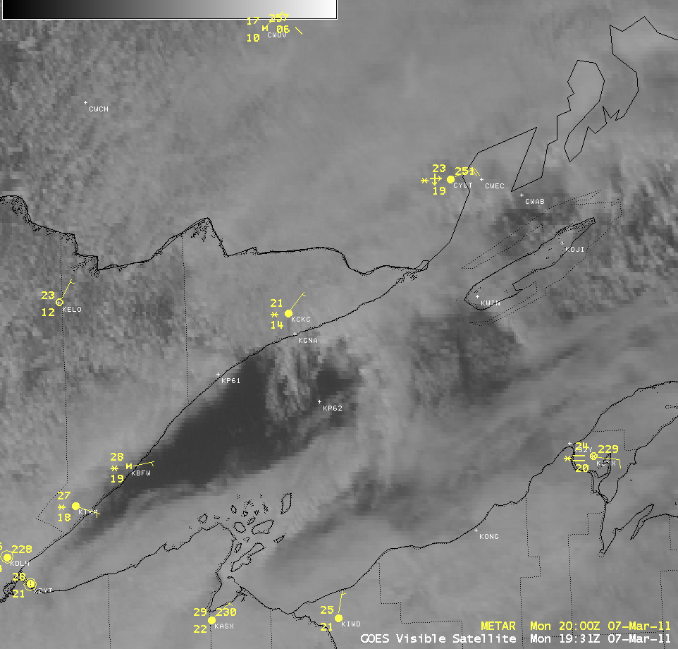
AWIPS images of 1-km resolution GOES-13 0.63 µm visible channel data (above; click image to play animation) revealed the formation of convergence bands withing a weak cyclonic circulation over western Lake Superior on 07 March 2011. These convergence bands were responsible for producing some lake-effect snowfall along the north shore of the lake, over parts extreme northeastern Minnesota — Lutsen reported 8.5 inches of snow, with 5.8 inches falling north of Grand Marais.
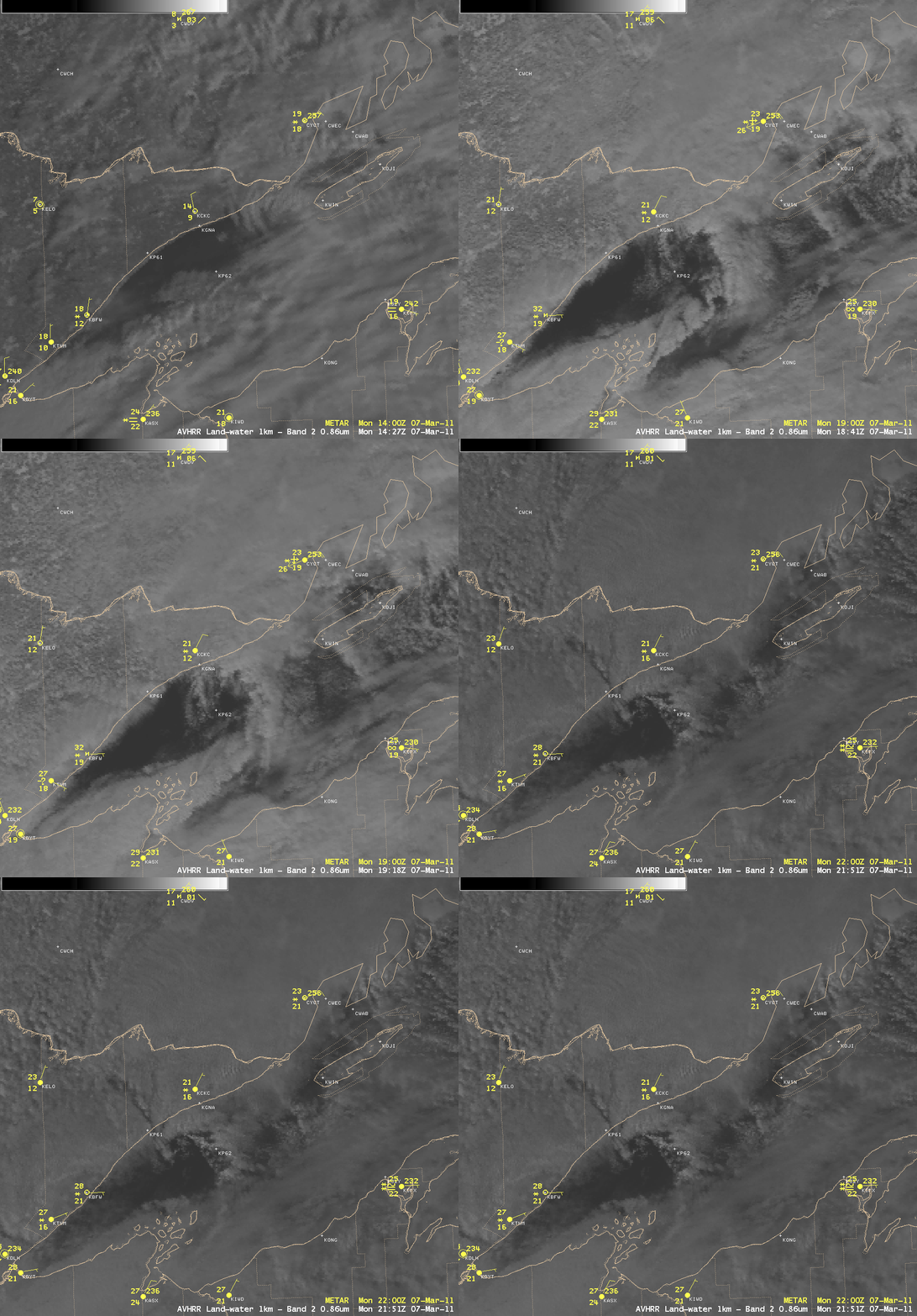
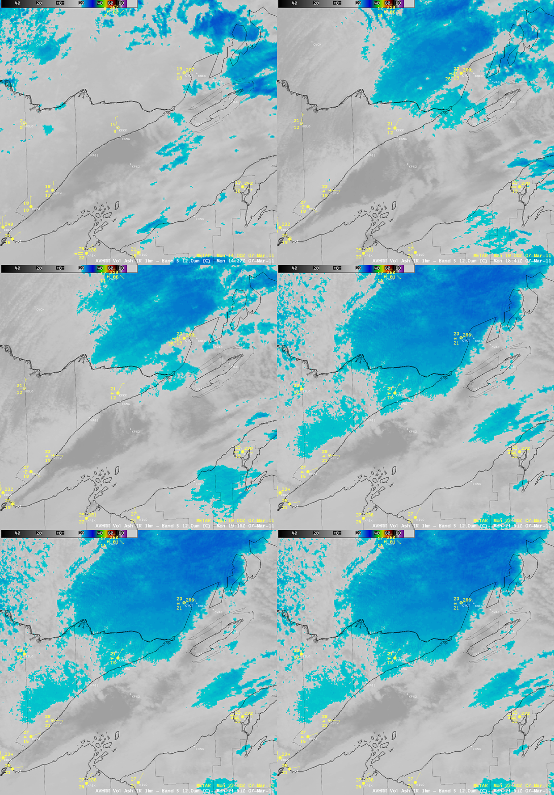
A sequence of 1-km resolution POES AVHRR 0.86 µm visible channel images (above) and the corresponding 1-km resolution POES AVHRR 12.0 µm IR images (below) showed a slightly more detailed view of the convergence bands.
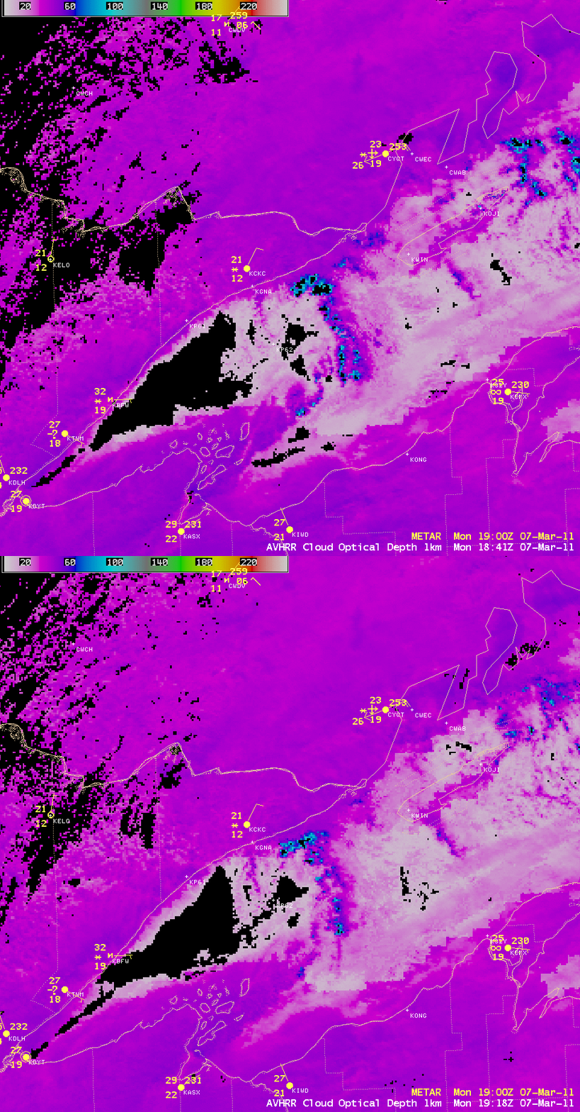
A comparison of 1-km resolution POES AVHRR Cloud Optical Depth products at 18:41 and 19:18 UTC (below) showed that the primary convergence band along the eastern side of the cyclonic circulation feature exhibited significantly higher cloud optical depth values (blue to cyan color enhancement).
===== 08 MARCH UPDATE =====
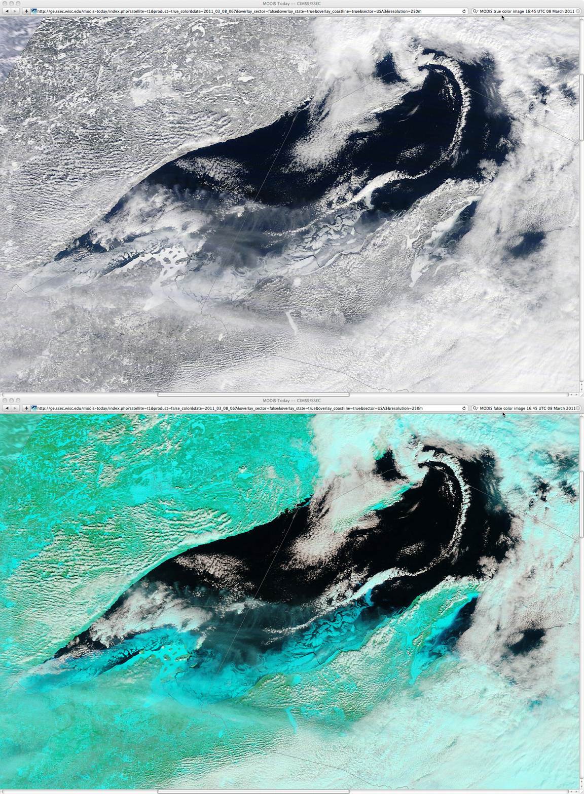
Another well-defined vortex was observed over northern Lake Superior on the following day. A comparison of 250-meter resolution MODIS true color and false color Red/Green/Blue (RGB) images from the SSEC MODIS Today site (below) showed the vortex cloud feature with a very long and narrow “tail” extending southward and westward from the center of the circulation, along with a complex ice structure across the far southern portion of Lake Superior. Ice and snow cover appear as cyan-colored features on the MODIS false color image, in contrast to supercooled water droplet clouds (which appear as brighter white features).


