Gulf of Mexico “Loop Current” affecting cumulus cloud development
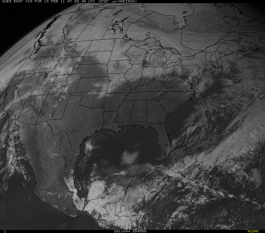
McIDAS images of GOES-13 0.63 µm visible channel data (above; click image to play animation) showed the development of a batch of cumulus clouds over the central Gulf of Mexico during the day on 13 February 2011. Other features of interest on the visible imagery include the rapidly-melting snow cover over the portions of the southern Plains, and a few small smoke plumes drifting northeastward due to fires burning in some of the Gulf Coast states.
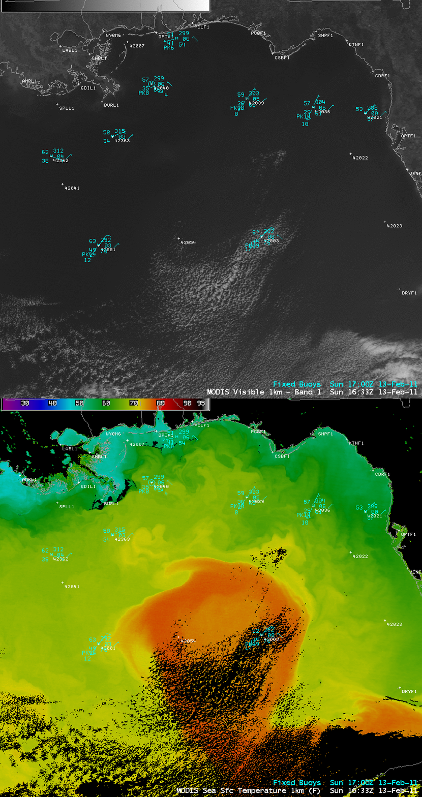
A comparison of AWIPS images of the 1-km resolution MODIS 0.65 µm visible channel and the corresponding MODIS Sea Surface Temperature (SST) product (below) indicated that this area of cumulus development was occurring over the warmer waters of the Gulf of Mexico “Loop Current”, where SST values were as warm as 78º F (darker orange color enhancement). As a seasonally cool northeasterly flow of air moved across the warmer Loop Current, enough instability was generated to lead to the formation of shallow cumulus clouds.
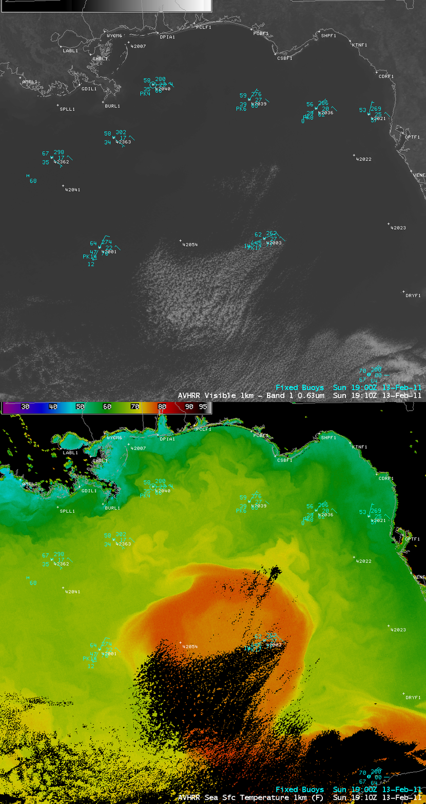
About 3 hours later, a similar comparison of a 1-km resolution POES AVHRR 0.63 µm visible image with the corresponding POES AVHRR Sea Surface Temperature product (below) showed a few more cumulus lines forming over the northern portion of the Loop Current, with the cumulus cloud field becoming more dense in the southern portion.


