Cold air outbreak (and ice formation) across Hudson Bay, Canada
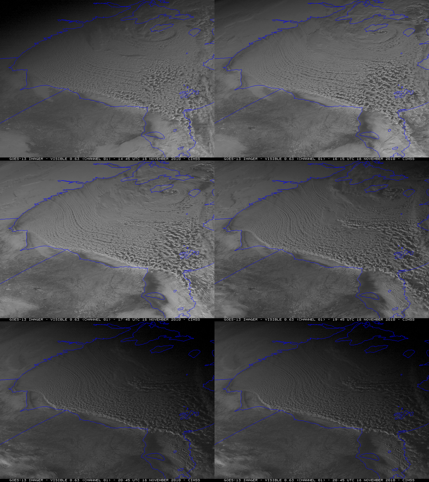
A strong cyclone was located over the northern portion of Hudson Bay, Canada on 18 November 2010 — and McIDAS images of GOES-13 0.63 µm visible channel data (above) showed the formation of widespread cloud bands due to very cold arctic air flowing over the still-unfrozen waters of Hudson Bay.
The strong westerly component of the surface winds was apparently helping to cause some of the land-fast ice along the far western shoreline to begin to drift eastward into the open waters of Hudson Bay. This was more easily seen on a zoomed-in version of the GOES-13 visible images. According to lower-tropospheric GOES-13 atmospheric motion vectors, the speed of motion of the cloud band features was generally in the 25-35 knot range.
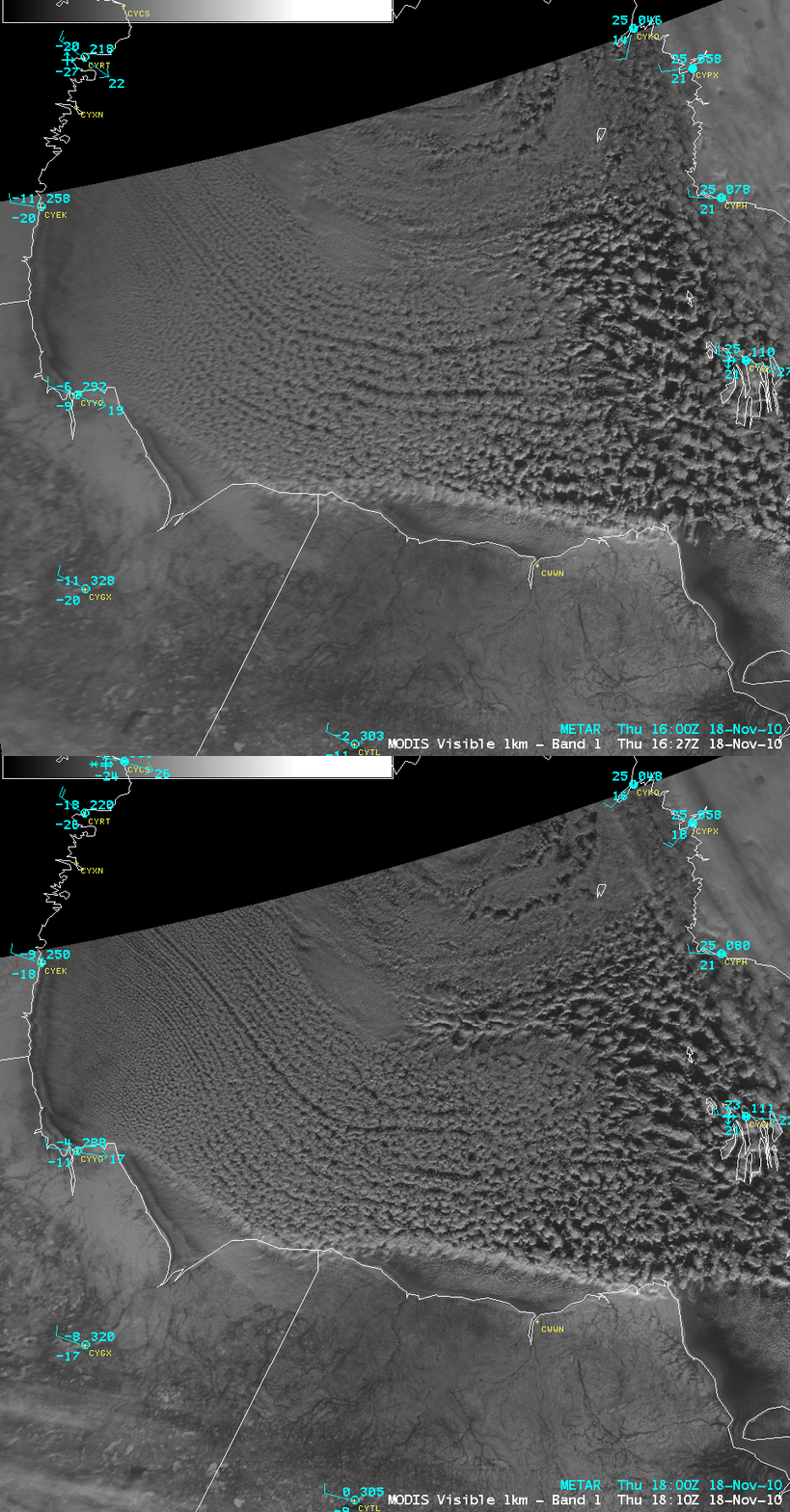
A closer view using AWIPS images of 1-km resolution MODIS 0.65 µm visible channel data (below) revealed better detail in the cloud band structure — but also suggested the initiation of ice formation along the western and southwestern near-shore waters of Hudson Bay.
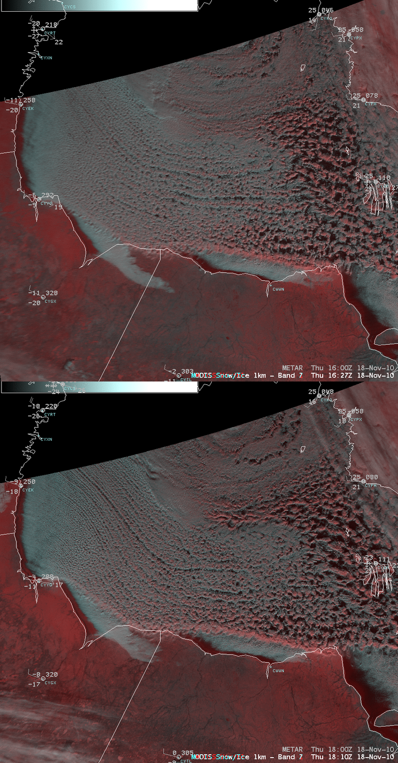
To verify that the brighter near-shore features seen on the MODIS visible images were indeed ice forming in Hudson Bay, a pair of false-color Red/Green/Blue (RGB) images were created using the MODIS 0.65 µm visible channel data as the Red component and the MODIS 2.1 µm “snow/ice channel” data as the Green and Blue components of the image. Snow cover (which was generally 3-5 inches at the first-order reporting stations in the region) and thick ice show up as darker red features on the RGB images.
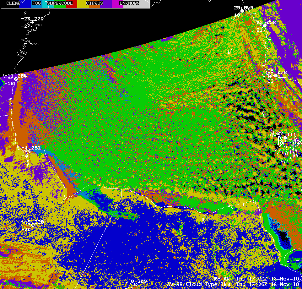
An AWIPS image of the POES AVHRR Cloud Type product (below) indicated that many of the cloud bands likely consisted of supercooled water droplets (green color enhancement), although a number of the cloud bands were beginning to show signs of glaciating farther downstream (as indicated by the yellow and orange color enhancements).
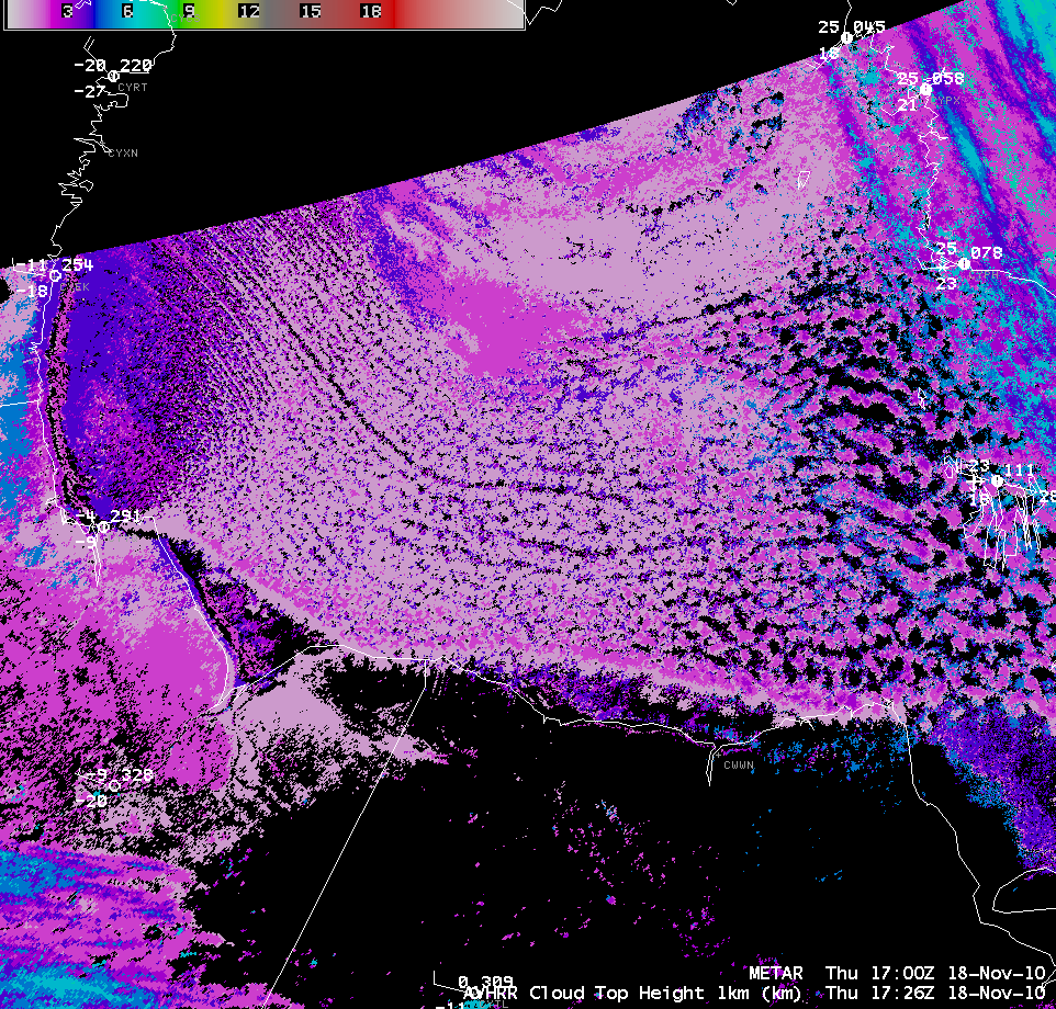
The POES AVHRR Cloud Top Height product (below) showed that the tops of most of thee cloud bands were in the 3-4 km range.
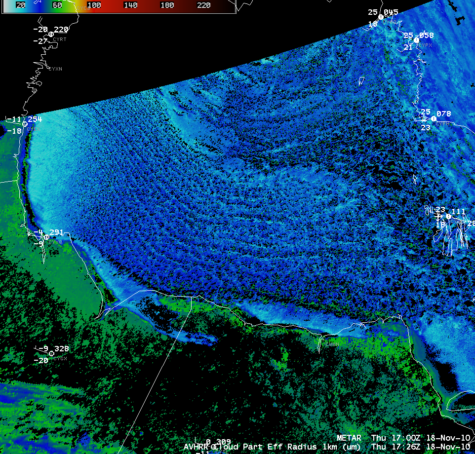
Another indication of the change from supercooled water droplets to more of a glaciated composition could be seen on the POES AVHRR Cloud Particle Effective Radius product (below), with an increasing presence of the larger size ice crystals showing up as increasingly darker blue colors farther downstream.


