Mountain waves over the Mid-Atlantic states
An AWIPS image comparison of MODIS 6.7 µm and GOES-13 6.5 µm “water vapor channel” data (above) demonstrated the advantage of improved spatial resolution for detecting the structure and areal coverage of mountain waves that were present over the Mid-Atlantic states on 17 November 2010. The spatial resolution of the MODIS water vapor image is 1 km, compared to 8 km for the GOES-13 water vapor image (note that the native resolution of the water vapor channel on GOES-13 is actually 4 km, but this image was viewed on the AWIPS “CONUS” scale, which downgrades the resolution to 8 km).
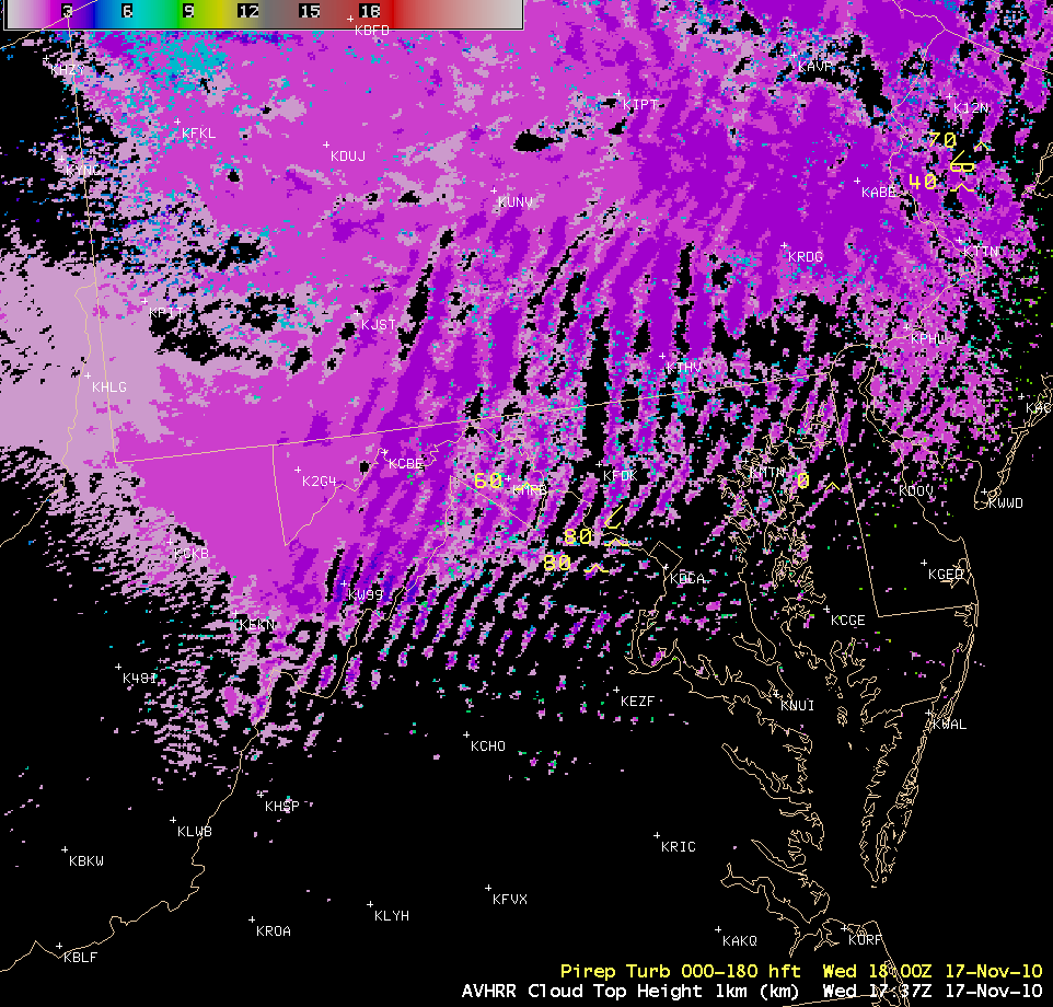
About 2 hours later, an AWIPS image of the POES AVHRR Cloud Top Height product (below) indicated that the tops of the mountain wave cloud bands at that time were generally in the 3-4 km range, which corresponded well to some of the altitudes of pilot reports of moderate turbulence (8,000-10,000 feet above ground level).
As part of the CIMSS involvement in GOES-R Proving Ground activities, MODIS and POES AVHRR satellite images and products are currently being made available in an AWIPS format for interested NWS forecast offices to add to their local AWIPS workstations (via LDM subscription). For more information, see the MODIS Imagery in D-2D and AVHRR Imagery and Products in D-2D sites. VISIT training lessons are also available for these MODIS and AVHRR images and products.


