Strong Northeast US coastal storm
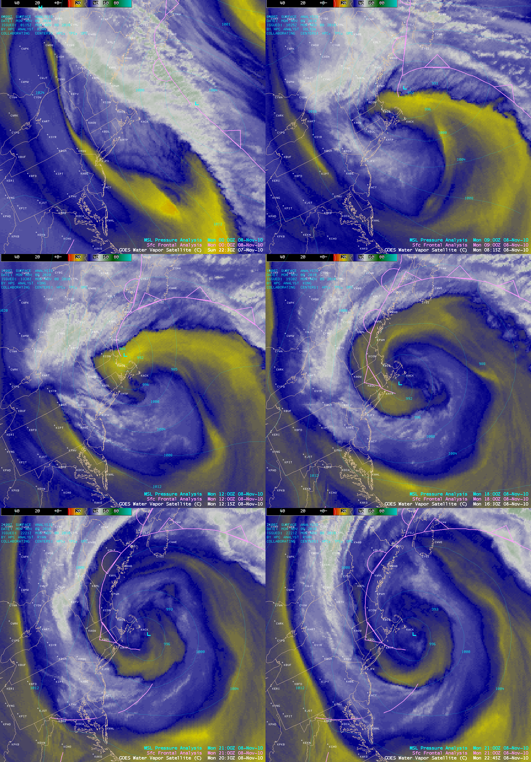
A strong Northeast US coastal storm developed on 08 November 2010, which produced as much as 3.56 inches of rainfall in Maine, 2.5 inches of snow in Massachusetts and New York, and wind gusts to 63 mph in Maine (and 75 mph on top of Mt. Washington, New Hampshire). AWIPS images of 4-km resolution GOES-13 6.5 µm “water vapor channel” data (above) showed a classic example of a signature of an occluding cyclone, with a spiral of dry air (yellow to orange color enhancement) wrapping inward around the storm center.
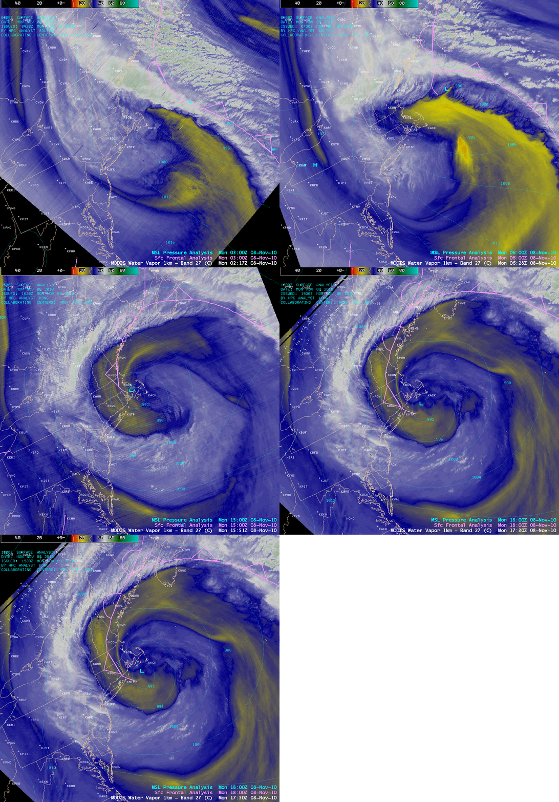
A sequence of 1-km resolution MODIS 6.7 µm water vapor images (below) shows a bit more detail at various stages of the storm’s life cycle.
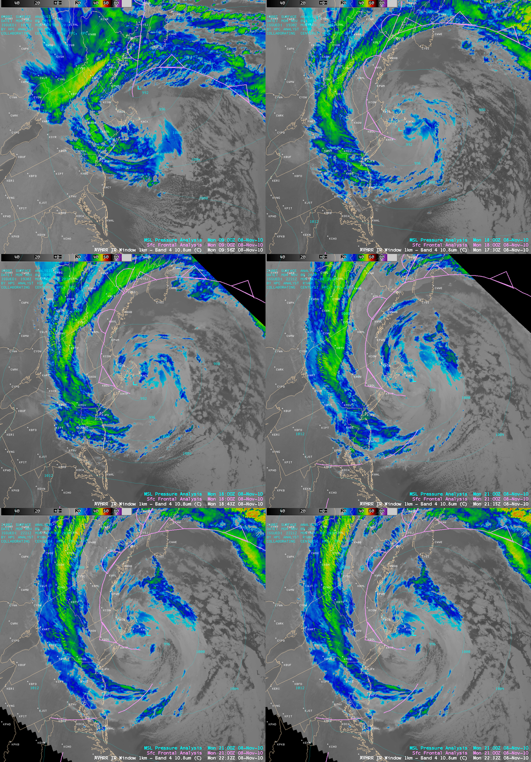
A sequence of 1-km resolution POES AVHRR 10.8 µm “IR window” images (below) showed an arc of cold clouds that wrapped inland ahead of the occluded frontal boundary.
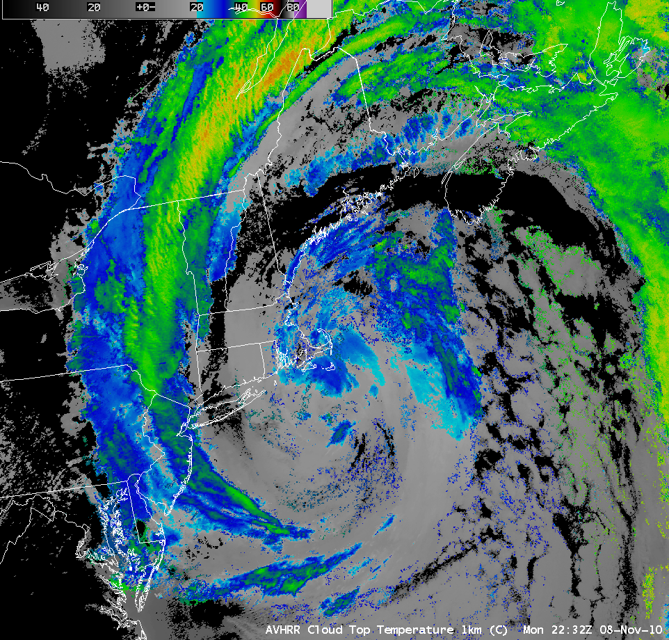
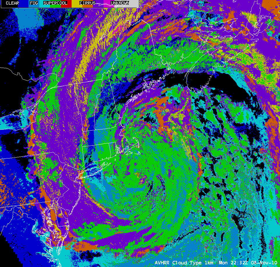
Additional 1-km resolution POES AVHRR derived products can be used to further characterize the clouds over a particular region. For example, the 22:32 UTC Cloud Top Temperature (CTT), Cloud Height, and Cloud Type products are shown below. The coldest CTT values associated with the well-defined inland cloud arc were -55º C, with a maximum cloud height value of 11 km. The Cloud Type product can be used to discriminate between water droplet clouds, supercooled water droplet clouds, opaque ice crystal clouds, cirrus clouds, or clouds that are likely overshooting the tropopause.
Note to NWS forecast offices: MODIS and POES AVHRR satellite images and products such as those seen above can be added to your local AWIPS workstations via Unidata LDM subscription.


