Strong winds in the Alaska Panhandle region
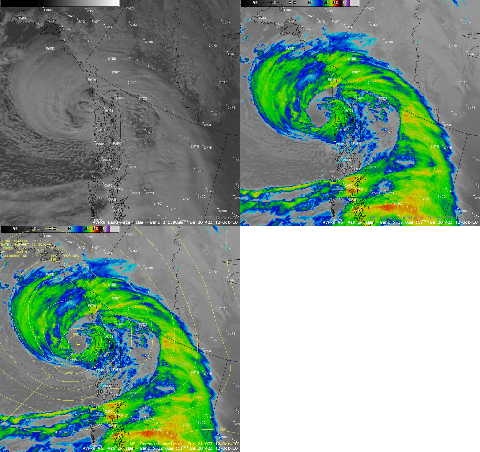
AWIPS images of POES AVHRR visible and IR channel data with an overlay of Mean Sea Level Pressure contours (above) showed a very intense Storm Force low that was approaching the Alaska Panhandle region at 20:42 UTC on 12 October 2010. This large storm was producing widespread reports of strong winds and heavy rainfall, with wind gusts as high as 126 mph reported from a boat equipped with wind instruments in Thomas Basin near Ketchikan. There were also reports of multiple trees down in nearby Saxman.
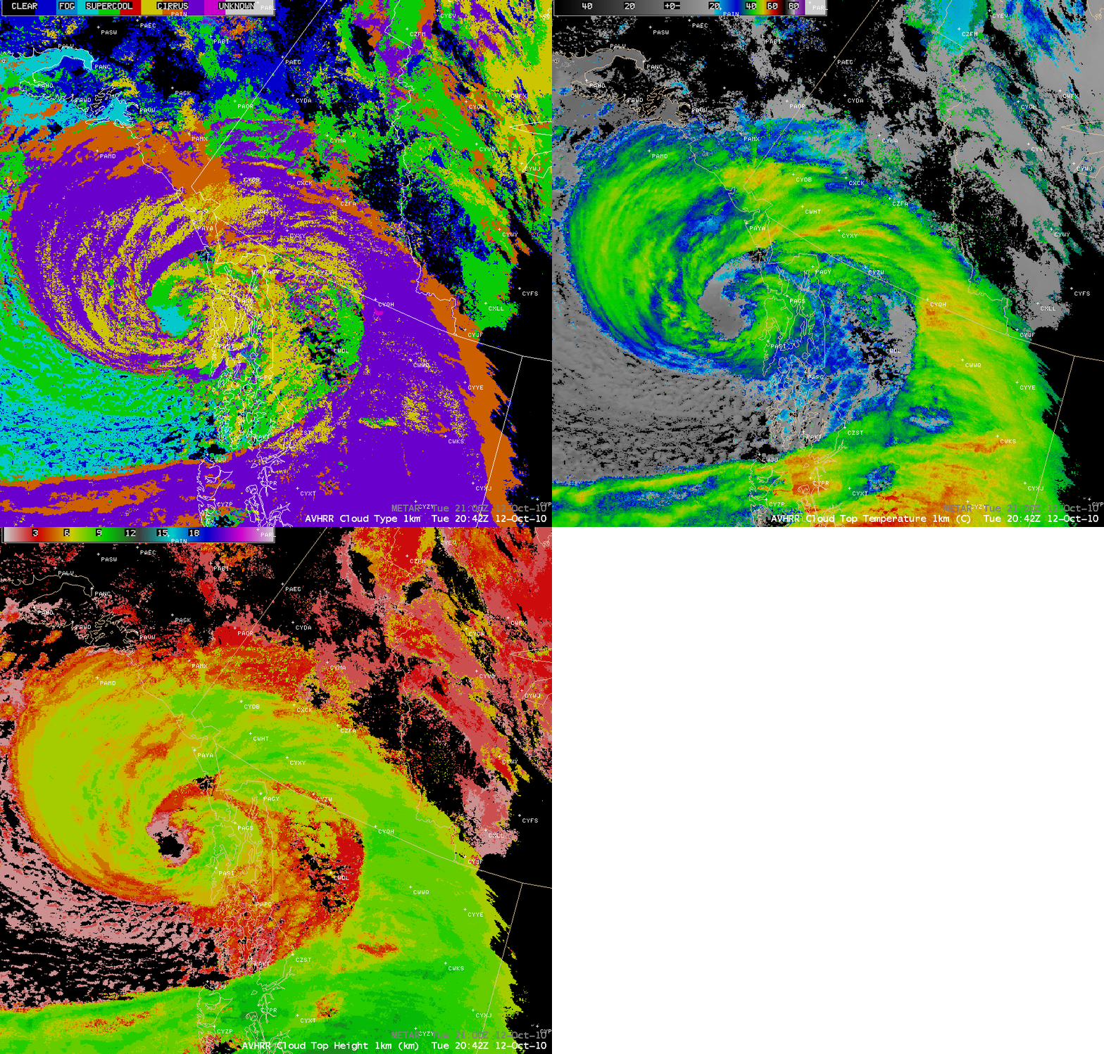
The cloud features at 20:42 UTC could be further characterized examining the POES AVHRR Cloud Type, Cloud Top Temperature (CTT), and Cloud Top Height (CTH) products (below). CTT values within portions of the large “comma cloud” were as cold as -50 to -55º C, with CTH values as high as 8-9 km.
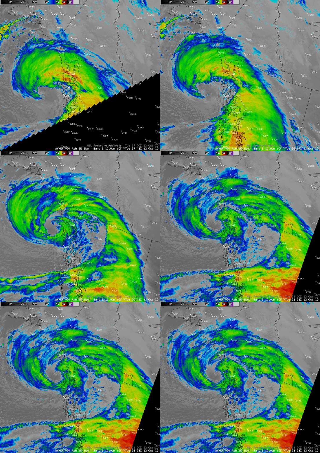
The evolution of this Storm Force low can be seen in a series of POES AVHRR IR images (below) — from the tell-tale “cusp” cloud feature indicative of strong cyclogenesis early in the day, to a closed-off, almost eye-like cloud structure later in the day.
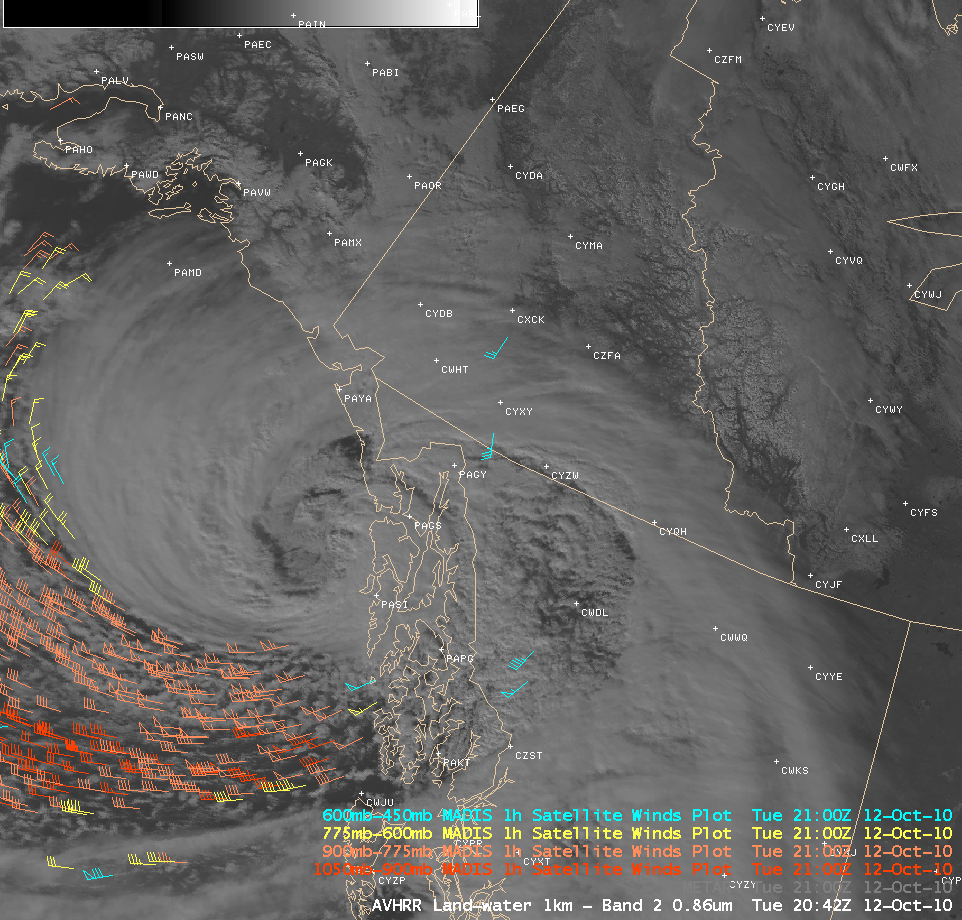
A POES AVHRR visible image with an overlay of 1-hour-interval GOES-derived Atmospheric Motion Vector (AMV) winds (below) showed the broad swath of strong winds associated with a low-level jet that was moving inland — a large number of AMVs had speeds in excess of 60 knots.
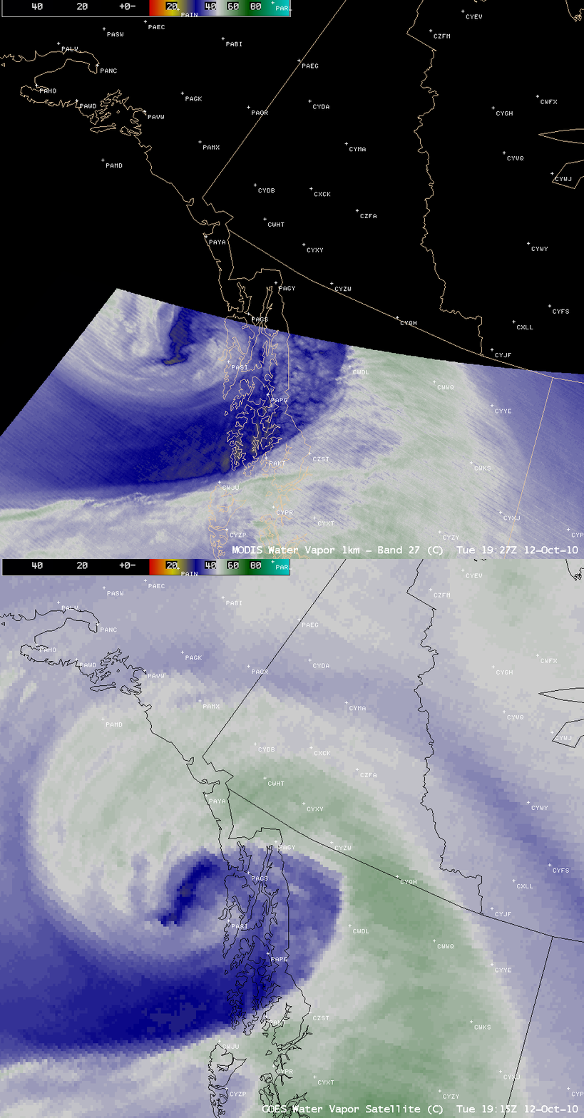
A comparison of an 8-km resolution GOES-11 water vapor image with the corresponding 1-km resolution MODIS water vapor image (below) revealed a well-defined dry slot moving inland. Strong momentum aloft was being transported downward to lower altitudes within this dry slot, contributing to the high winds that were being reported at the surface.
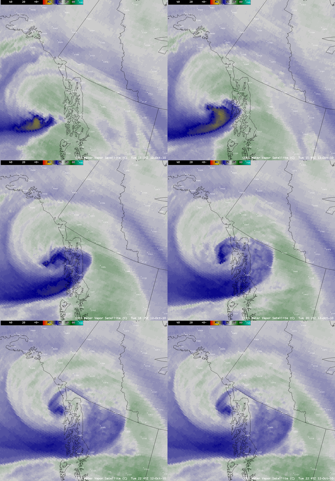
An animation of GOES-11 6.7 µm water vapor channel images (below) depicted the evolution of this dry slot during the day.
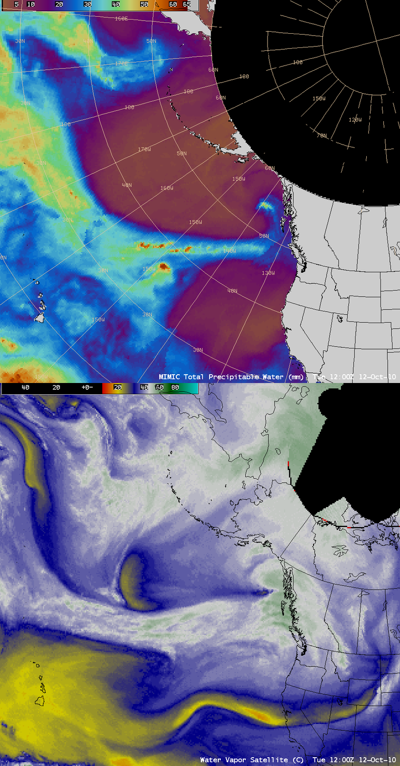
A comparison of the 12:00 UTC GOES-11 water vapor image with the corresponding MIMIC Total Precipitable Water product (below) indicated that a long atmospheric river of rich moisture was feeding into the developing cyclone. Note that not all of the “moist” features on the water vapor image necessarily correspond to areas of high total precipitable water content.


