Orographic waves downwind of the Hawaiian Islands

GOES-18 Mid-level Water Vapor (6.9 µm) and Upper-level Water Vapor (6.2 µm) images, from 0601 UTC on 23 October to 0001 UTC on 24 October [click to play MP4 animation]
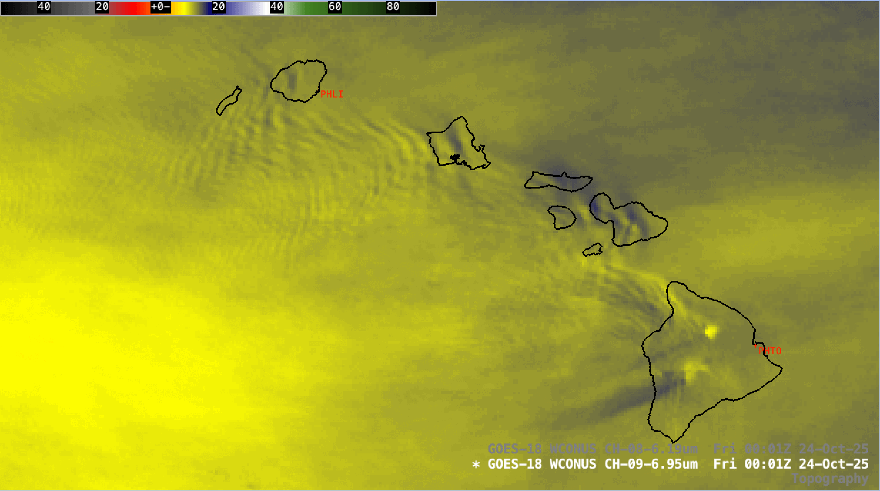
GOES-18 Mid-level Water Vapor (6.9 µm) image and Topography [click to enlarge]

GOES-18 Mid-level Water Vapor (6.9 µm) image at 0001 UTC on 24 October, with a cursor sample of a Pilot Report at 0011 UTC [click to enlarge]

GOES-18 Mid-level Water Vapor (6.9 µm) images at 1201 UTC on 23 October and 0001 UTC on 24 October [click to enlarge]
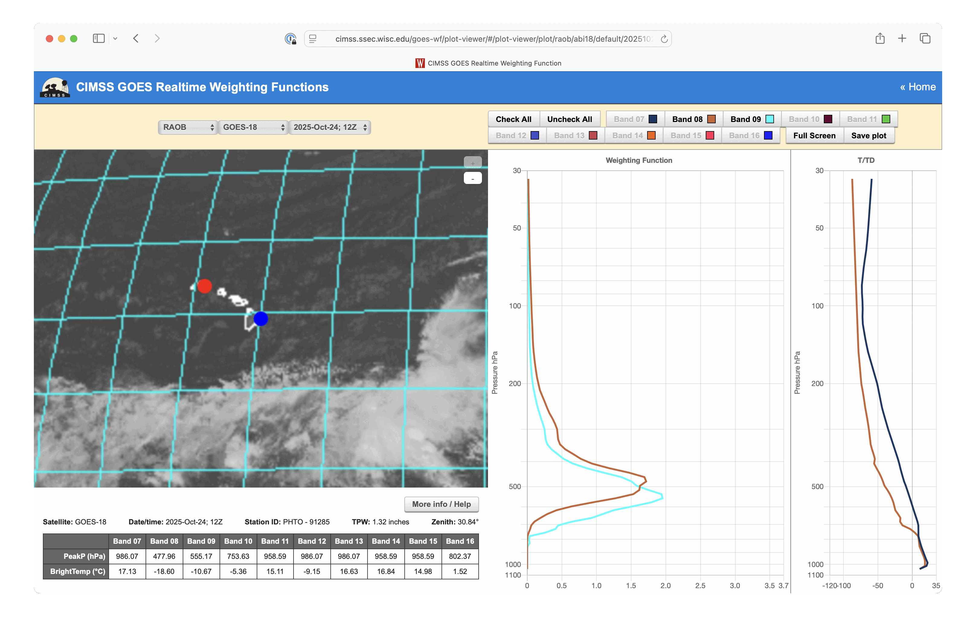
Weighting Function plots of GOES-18 Mid-level Water Vapor (6.9 µm / Band 09, cyan) and Upper-level Water Vapor (6.2 µm / Band 08, brown) spectral bands near the Big Island of Hawai`i [click to enlarge]