Water Vapor imagery sensing the surface of Hawai’i
![GOES-17 Low-level (7.3 µm, left), Mid-level (6.9 µm, center) and Upper-level (6.2 µm, right) Water Vapor images [click to play animation | MP4]](https://cimss.ssec.wisc.edu/satellite-blog/wp-content/uploads/sites/5/2018/11/181121_goes17_3waterVapor_Hawaii_anim.gif)
GOES-17 Low-level (7.3 µm, left), Mid-level (6.9 µm, center) and Upper-level (6.2 µm, right) Water Vapor images [click to play animation | MP4]
* GOES-17 images shown here are preliminary and non-operational *
GOES-17 Low-level (7.3 µm), Mid-level (6.9 µm) and Upper-level (6.2 µm) Water Vapor images (above) revealed the diurnal cycle of warming and cooling of the summits of Mauna Kea and Mauna Loa on the Big Island of Hawai’i on 21 November 2018. There was even a subtle warming signature of the higher terrain of Maui on 7.3 µm and 6.9 µm imagery. This example helps to underscore the fact that Water Vapor bands are Infrared bands, which — in the absence of clouds — essentially sense the mean temperature of a layer (or layers) of moisture within the troposphere.
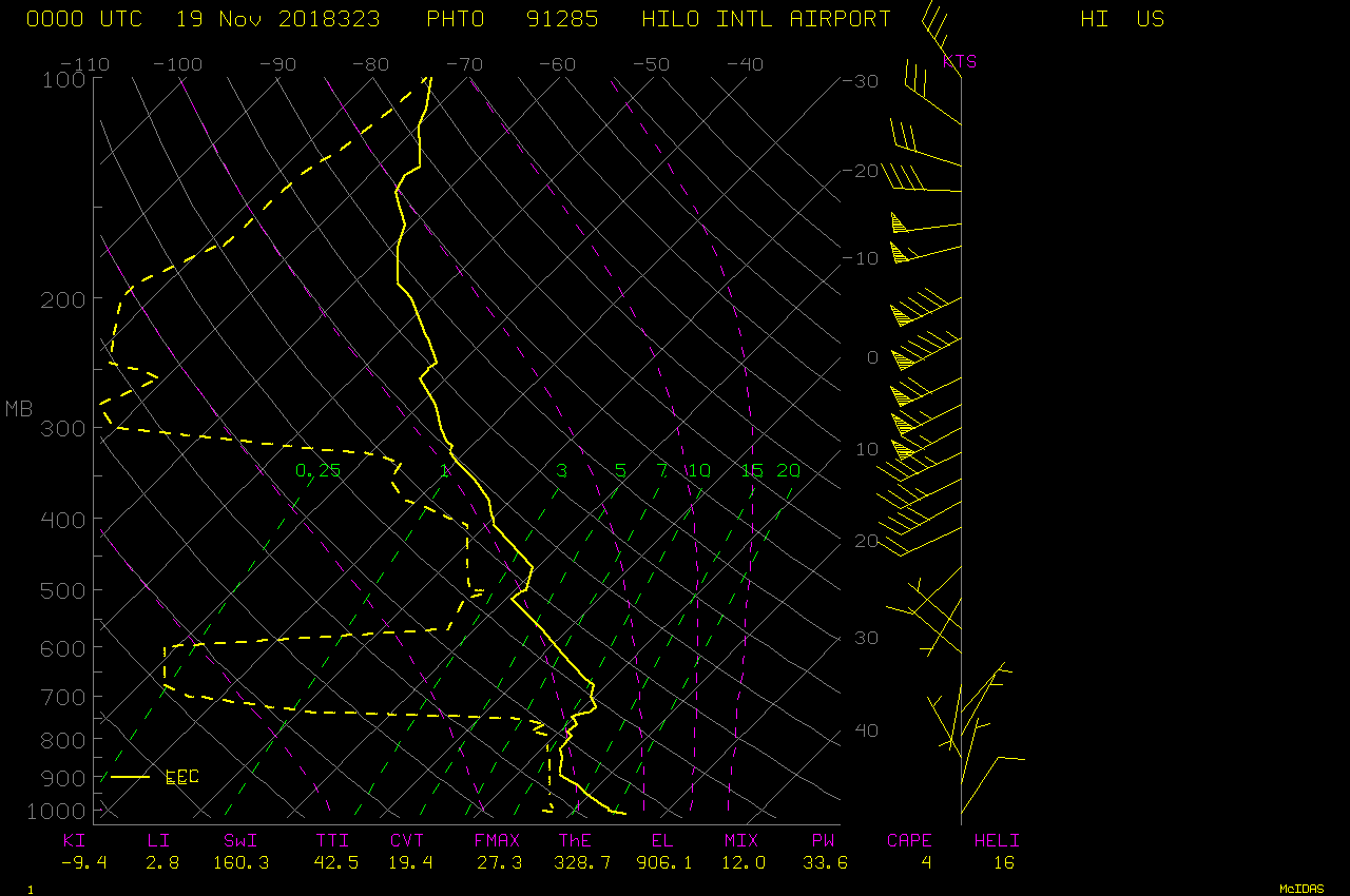
The presence of very dry air within the middle/upper troposphere over Hawai’i on 21 November had the effect of shifting the water vapor weighting functions to lower altitudes, as seen on plots for the 3 ABI Water Vapor bands calculated using 00 UTC rawinsonde data from Hilo PHTO (below). This allowed thermal radiation from the higher terrain to pass upward (un-attenuated) through what little high-altitude moisture was present and reach the 7.3 µm / 6.9 µm / 6.2 µm detectors on GOES-17.
![Plots of weighting functions for the 3 ABI Water Vapor bands, calculated from 00 UTC rawinsonde data from Hilo PHTO [click to enlarge]](https://cimss.ssec.wisc.edu/satellite-blog/wp-content/uploads/sites/5/2018/11/181122_00utc_phto_wv_wf.png)
Plots of weighting functions for the 3 ABI Water Vapor bands, calculated using 00 UTC rawinsonde data from Hilo [click to enlarge]
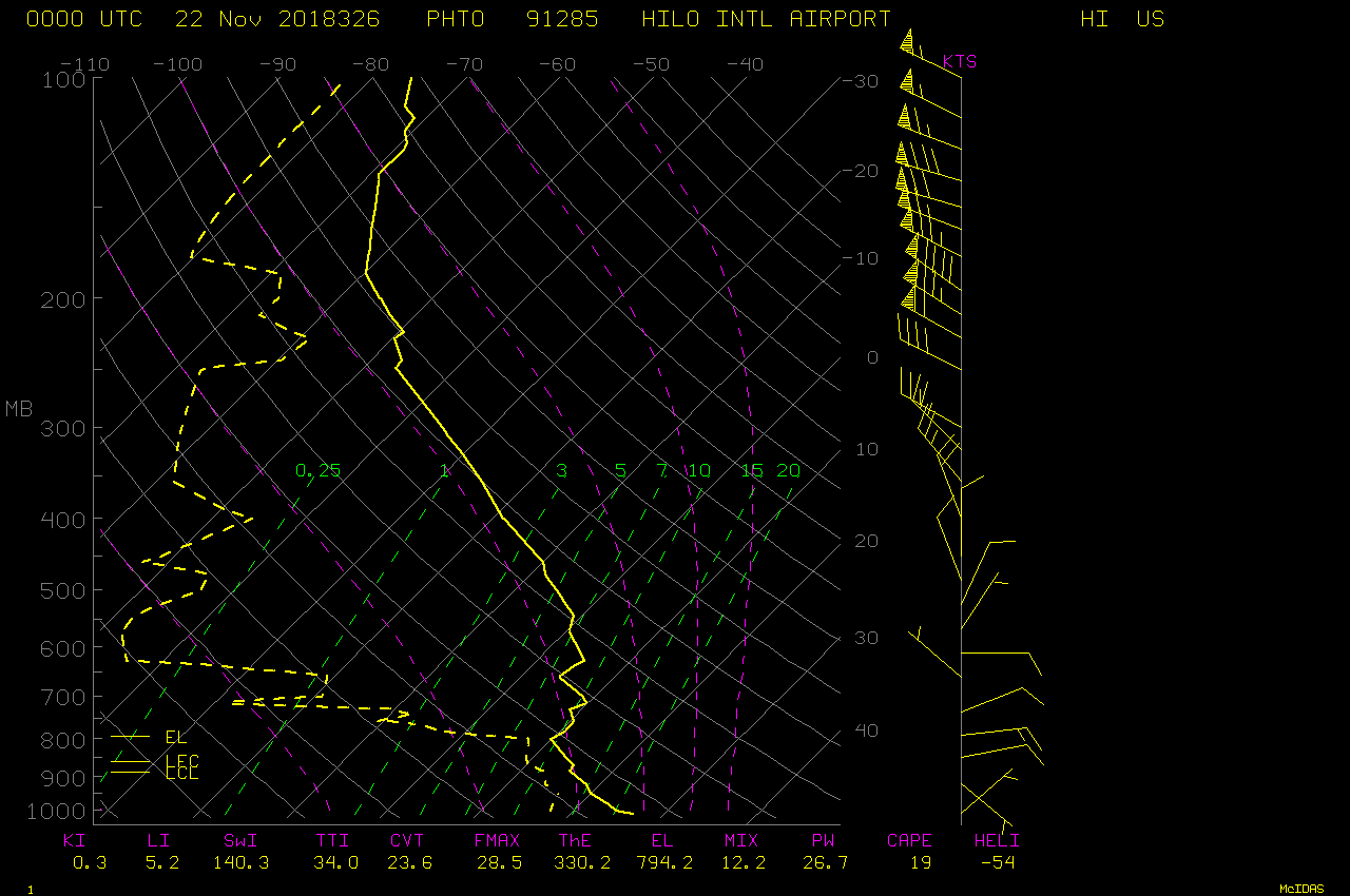
![Plots of Hilo Water Vapor weighting functions, 19 November vs 22 November at 00 UTC [click to enlarge]](https://cimss.ssec.wisc.edu/satellite-blog/wp-content/uploads/sites/5/2018/11/181119_181122_00utc_phto_waterVapor_weightingFunctions_anim.gif)
Plots of Hilo water vapor weighting functions, 19 November vs 22 November at 00 UTC [click to enlarge]