Hawai’i demonstrates that the Water Vapor channel is an Infrared channel
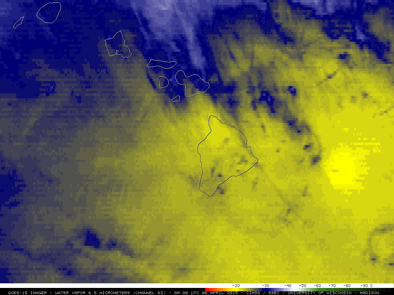
GOES-15 6.5 µm water vapor channel images (click to play animation)
GOES-15 (GOES-West) 6.5 µm “water vapor channel” images (above; click image to play animation; also available as an MP4 movie file) revealed an interesting transition in the signal displayed by the 2 summits (Mauna Kea and Mauna Loa) on the Big Island of Hawai’i on 06 April 2015 — beginning as a pair of colder (darker blue color enhancement) areas during the nighttime hours, becoming a pair of warmer (brighter yellow color enhancement) areas as daytime heating warmed the land surfaces.
As was discussed in a previous blog post, the water vapor channel is essentially an Infrared (IR) channel that senses the mean temperature of a layer of moisture — usually a layer which is located in the middle troposphere. However, if the middle troposphere is dry, the water vapor detectors are able to “see” lower into the atmosphere and detect radiation from the lower atmosphere (or even high-elevation terrain features, such as Mauna Kea and Mauna Loa). A comparison of the 00 UTC and 12 UTC rawinsonde profiles from Hilo (below) showed that the middle troposphere was indeed quite dry, with the typical tropical moisture residing below the 700 hPa pressure level.
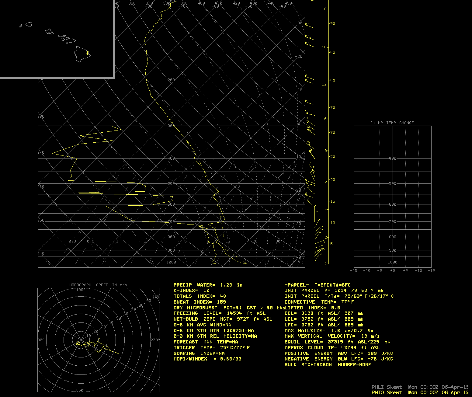
Hilo, Hawai’i rawinsonde data profiles (00, 12 UTC)
The altitude (and depth) of the layer being sensed by a water vapor channel is defined by its weighting function, which depends on (1) the temperature and moisture profile of the atmosphere, and (2) the satellite viewing angle or “zenith angle”. This site allows you to select a rawinsonde site of interest, and the GOES Imager (and Sounder) water vapor channel weighting functions are calculated and plotted. The GOES-15 Imager water vapor channel weighting functions for the 2 Hilo soundings are shown below (along with the weighting function for the US Standard Atmosphere). It can be seen that the peak of the weighting function response is at a lower altitude for both Hilo soundings than it would be for the US Standard Atmosphere, which in part allows the strong cold/warm thermal signatures of the two Big Island summits to be seen on the GOES-15 water vapor imagery.
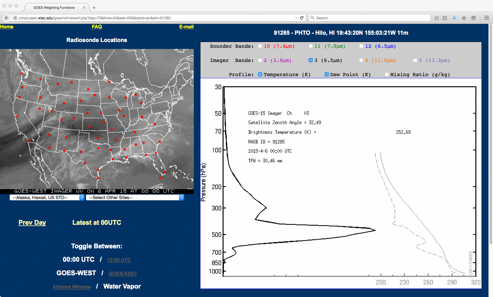
Hilo, Hawai’i GOES-15 imager water vapor weighting functions, compared with the US Standard Atmosphere