Hurricane Humberto reaches Category 5 intensity in the western Atlantic
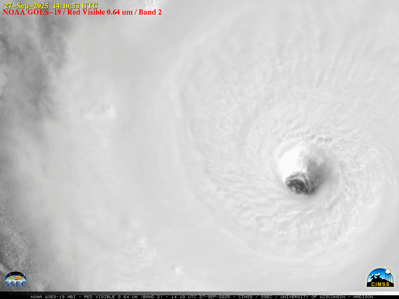
1-minute GOES-19 Visible images, from 1410-2121 UTC on 27 September [click to play animated GIF]
In an animation of 1-minute GOES-19 Infrared images (below), the eye began to exhibit a slight amount of trochoidal motion as Humberto intensified later in the day.
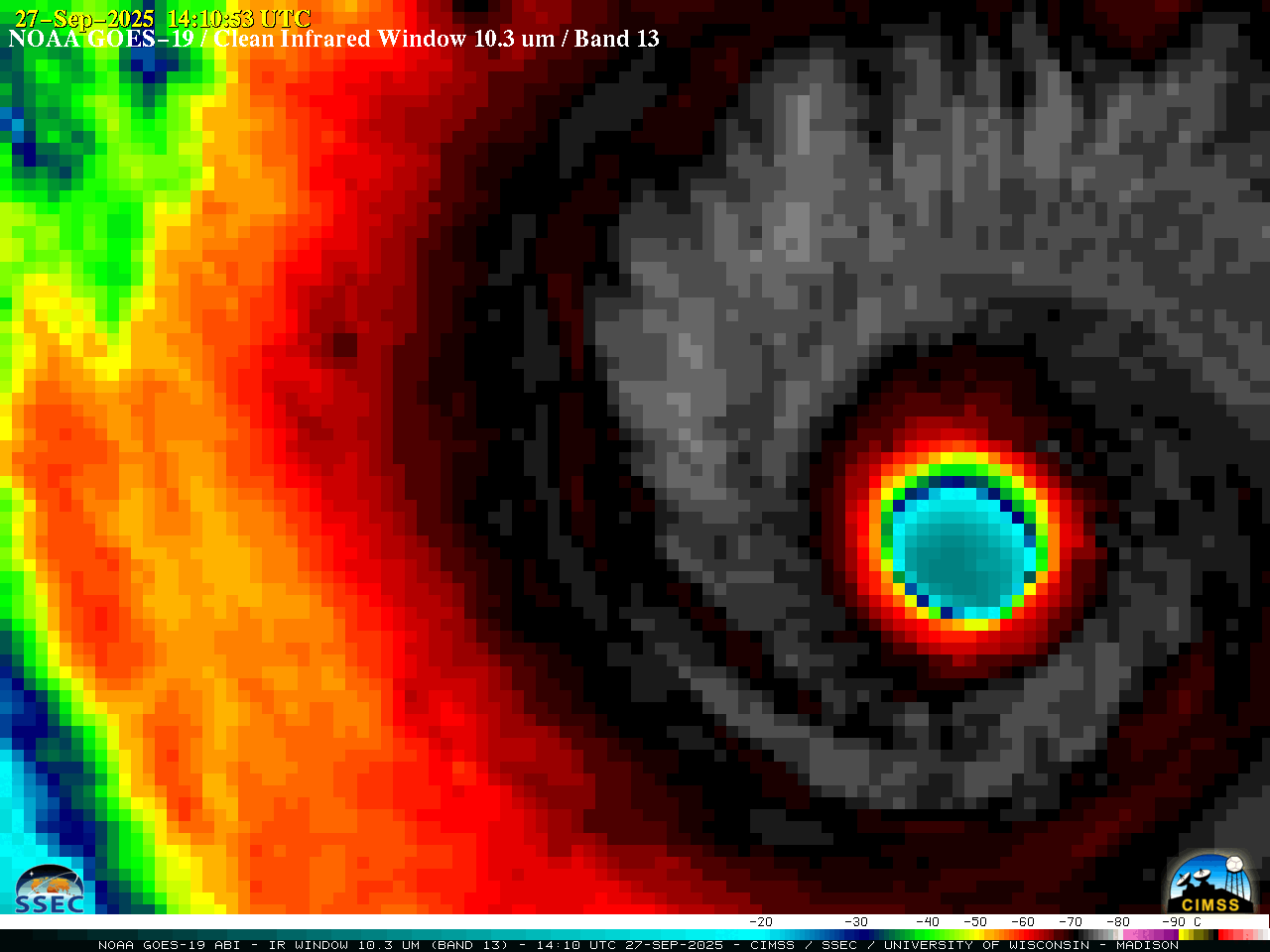
1-minute GOES-19 Infrared images, from 1410-2300 UTC on 27 September [click to play animated GIF]

DMSP-18 SSMIS Microwave image at 2013 UTC on 27 September
Humberto’s intensification to Category 5 occurred as the hurricane was moving through an environment of weak deep-layer wind shear (below) and traversing warm water.
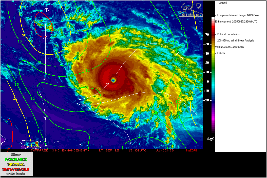
GOES-19 Infrared images with an overlay of contours and streamlines of deep-layer wind shear at 2300 UTC on 27 September
Microwave, wind shear and sea surface temperature imagery was sourced from the CIMSS Tropical Cyclones site.
A RCM-2 Synthetic Aperture Radar (SAR) image (source) at 2214 UTC (below) sensed wind speeds as high as 126.94 kt in the NW quadrant of Humberto.

RCM-2 SAR wind speed image at 2214 UTC on 27 September [click to enlarge]