Wildfire in Saskatchewan produces a pyrocumulonimbus cloud

10-minute GOES-18 Clean Infrared Window (10.3 µm, left) images and Red Visible (0.64 µm) images + Fire Mask derived product (right), from 1700 UTC on 02 June to 0300 UTC on 03 June [click to play MP4 animation]
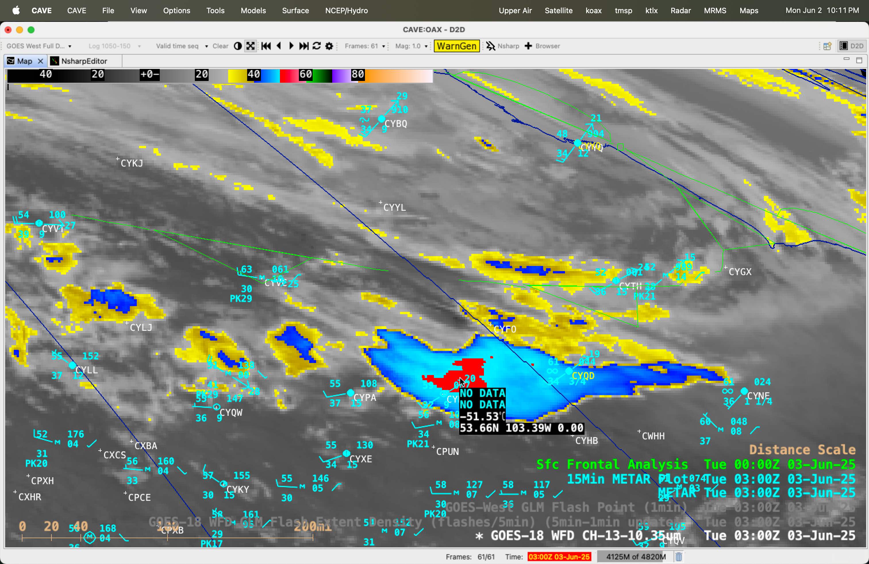
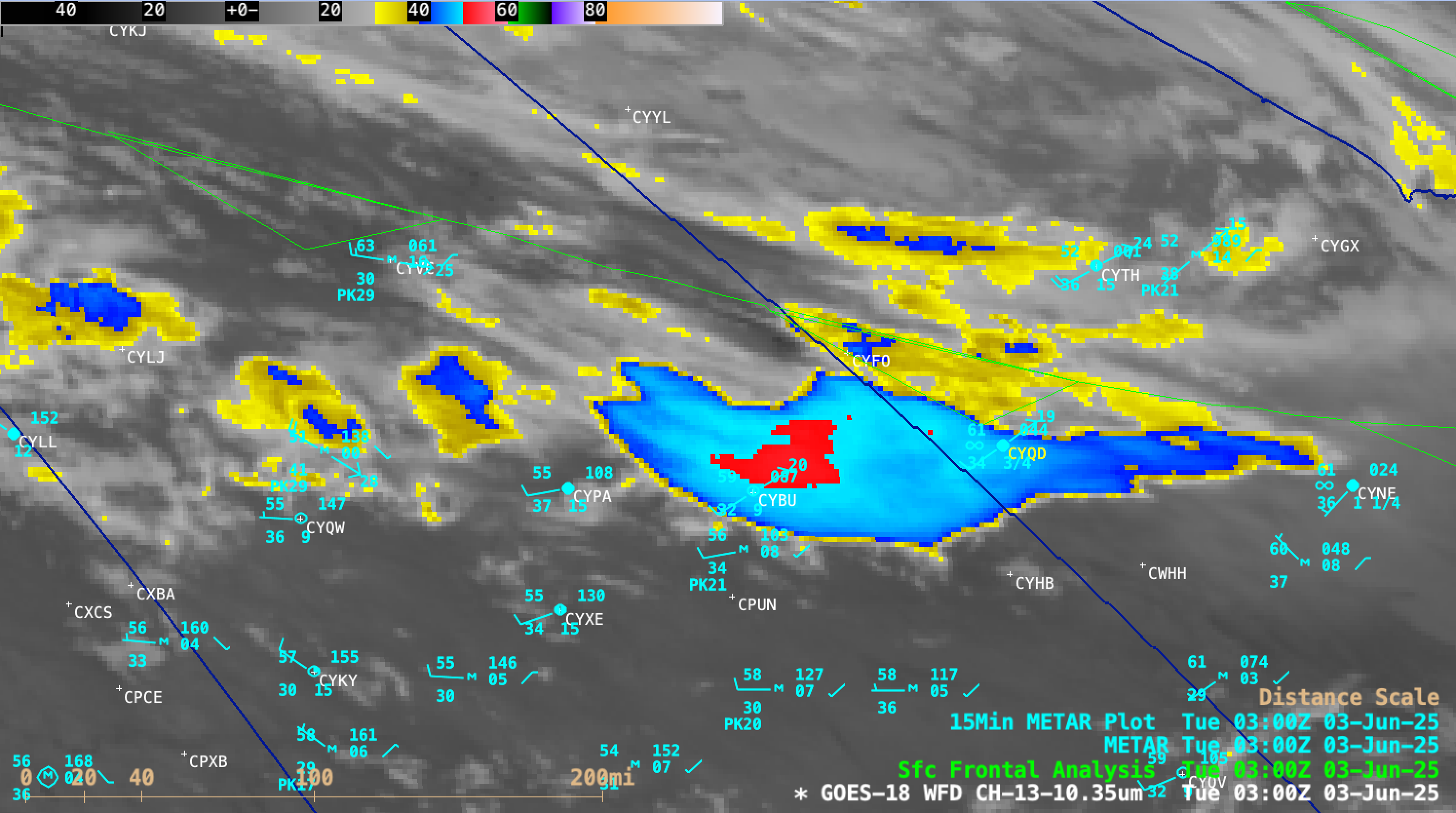
The pyroCb initially exhibited cloud-top 10.3 µm infrared brightness temperatures (IRBTs) in the -40s C (denoted by shades of blue to cyan) — a necessary condition to be classified as a pyroCb — beginning at 2020 UTC (below); nearly 7 hours later, the coldest pyroCb cloud-top IRBT had cooled to -51.53ºC at 0300 UTC on 03 June. The peak wind gust at La Ronge during the time period shown was 43 knots (49 mph). Note that in western Manitoba haze (not smoke) restricted the surface visibility to 3/4 mile at The Pas (CYQD) and 1-1/4 mile at Norway House (CYNE) by 0300 UTC on 03 June — this was due to blowing dust originating in Saskatchewan (more on this blowing dust later in the blog post).
10-minute GOES-18 Clean Infrared Window (10.3 µm) images, from 1700 UTC on 02 June to 0310 UTC on 03 June [click to play MP4 animation]
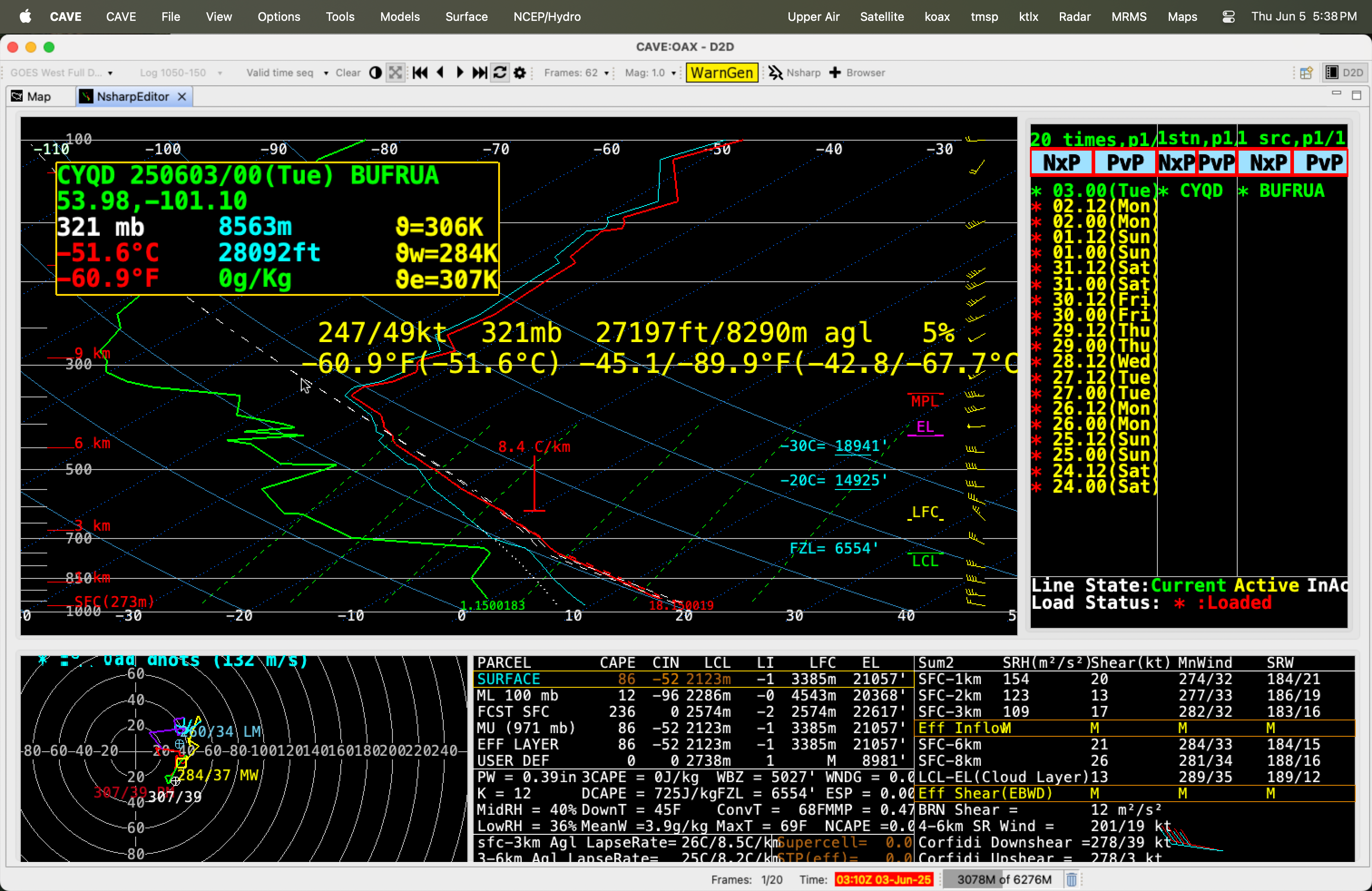
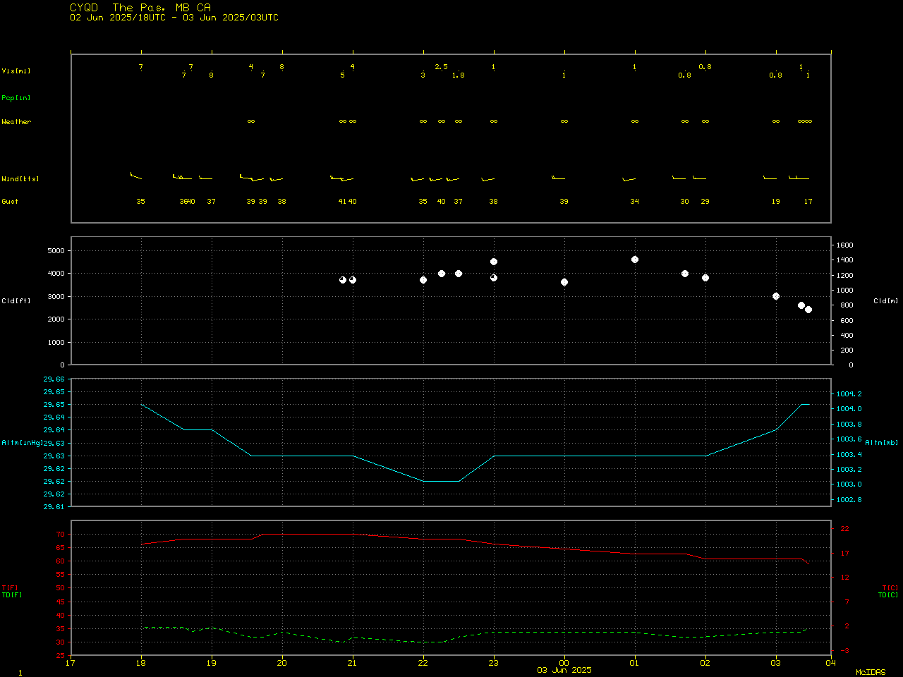
Plot of rawinsonde data from The Pas, Manitoba at 0000 UTC on 03 June — with a cursor sample of the height of the coldest cloud-top infrared brightness temperature of the pyroCb (sensed at 0300 UTC) [click to enlarge]

GOES-18 Clean Infrared Window (10.3 µm) image at 2130 UTC on 02 June, with/without an overlay of GLM Flash Extent Density (large dark-blue pixels) [click to enlarge]
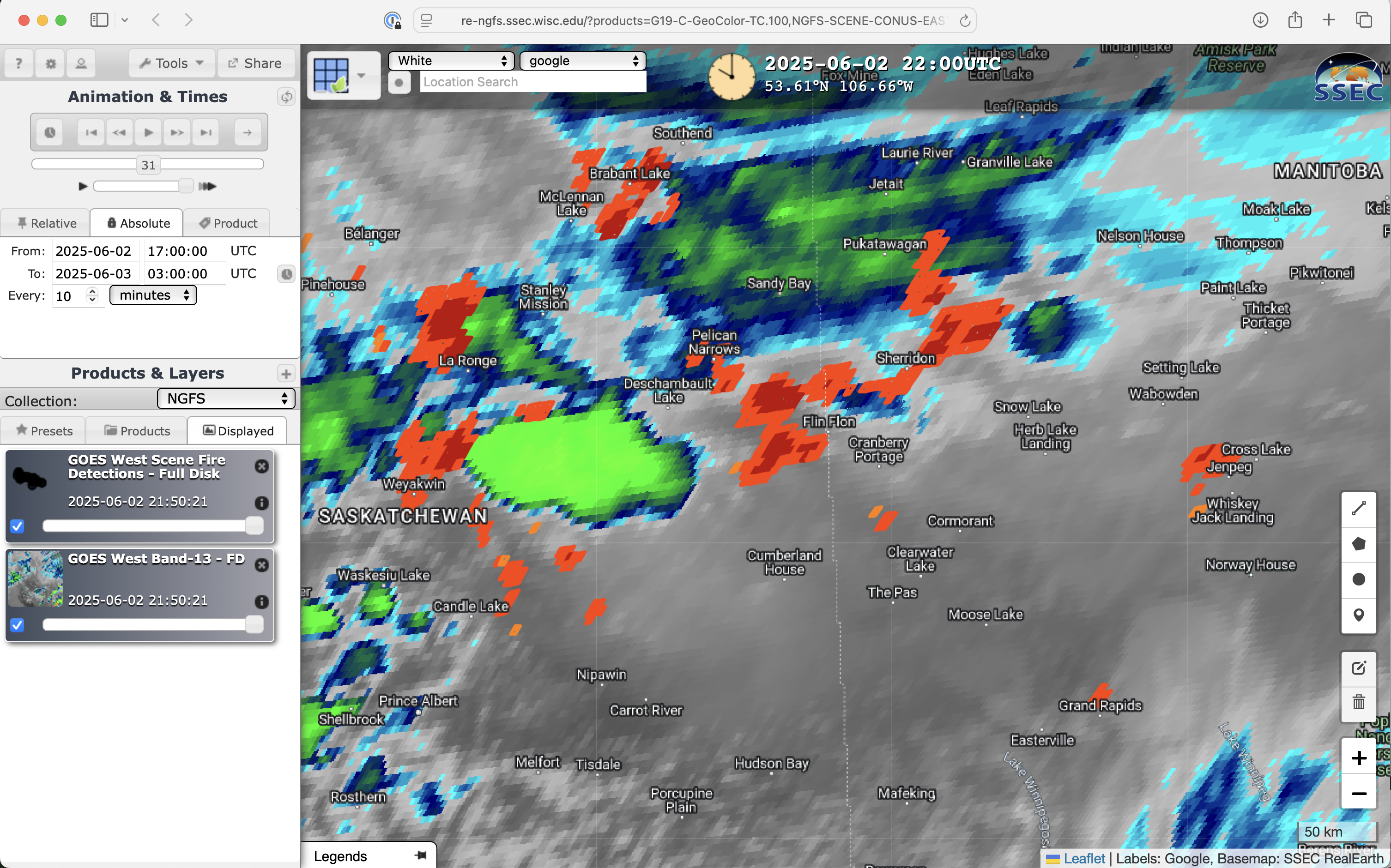
10-minute GOES-18 Infrared Window (10.3 µm) images with an overlay of NGFS Fire Detection polygons, from 1700 UTC on 02 June to 0300 UTC on 03 June [click to play MP4 animation]
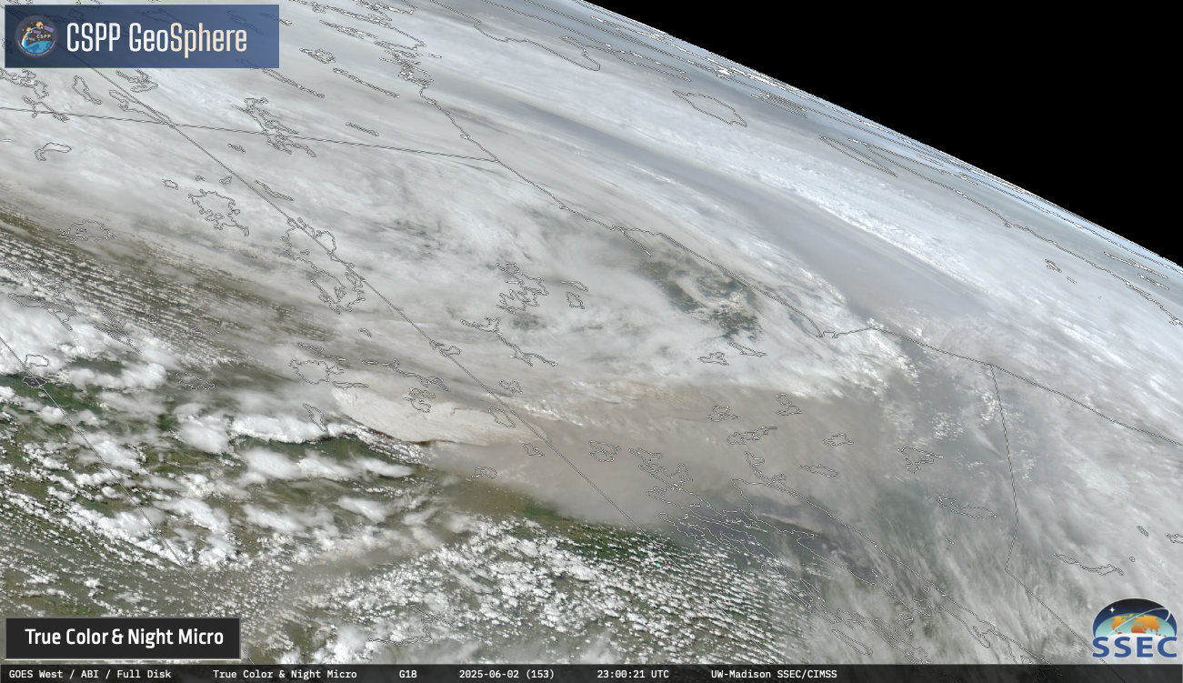
GOES-18 daytime True Color RGB + Nighttime Microphysics RGB images, from 1900 UTC on 02 June to 0850 UTC on 03 June [click to play MP4 animation]

GOES-19 daytime True Color RGB + Nighttime Microphysics RGB images, from 0000-2350 UTC on 03 June [click to play MP4 animation]
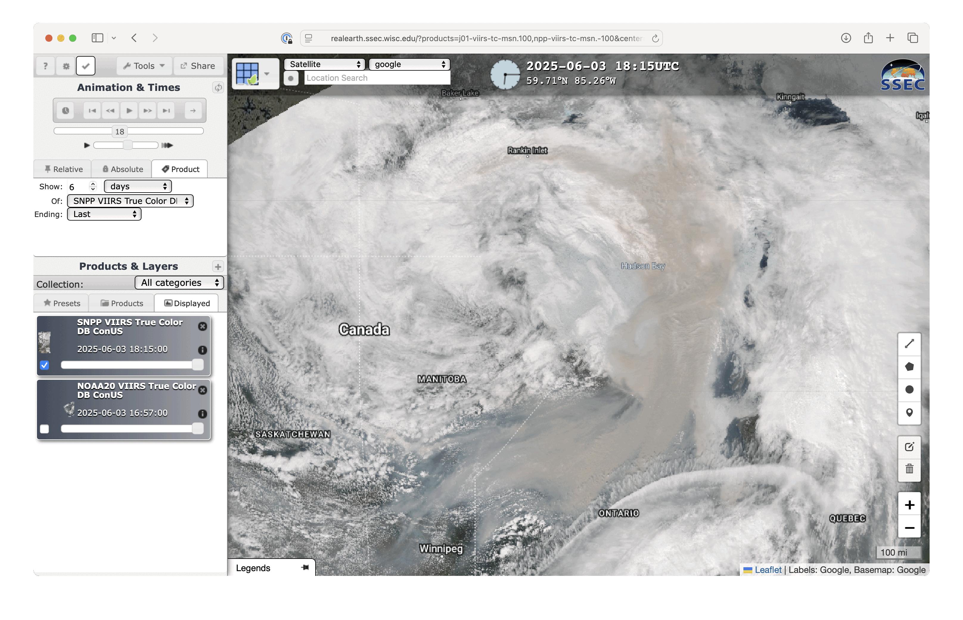
Suomi-NPP and NOAA-20 VIIRS True Color RGB images on 03 June [click to enlarge]