Tropical Storm Alvin forms in the eastern Pacific Ocean

Daily CSPP Geosphere imagery (direct link) showing 1710 UTC imagery from 25-29 May 2025, above, depict the slow organization and intensification of an area of disturbed weather south of Mexico (discussed here) as it became Tropical Storm Alvin, the first storm of the eastern Pacific Hurricane Season. This is the 4th Alvin storm in the tropical east Pacific, following ones in 2019 (that was named on June 26th, strengthened to a hurricane, and was present for almost 4 days), 2013 (that was named on May 15th and remained a tropical storm during its short life) and 2007 (that was named on May 28th and remained a tropical storm). The 2025 version of Alvin is not forecast to make landfall; it is forecast to move north and dissipate over the weekend.
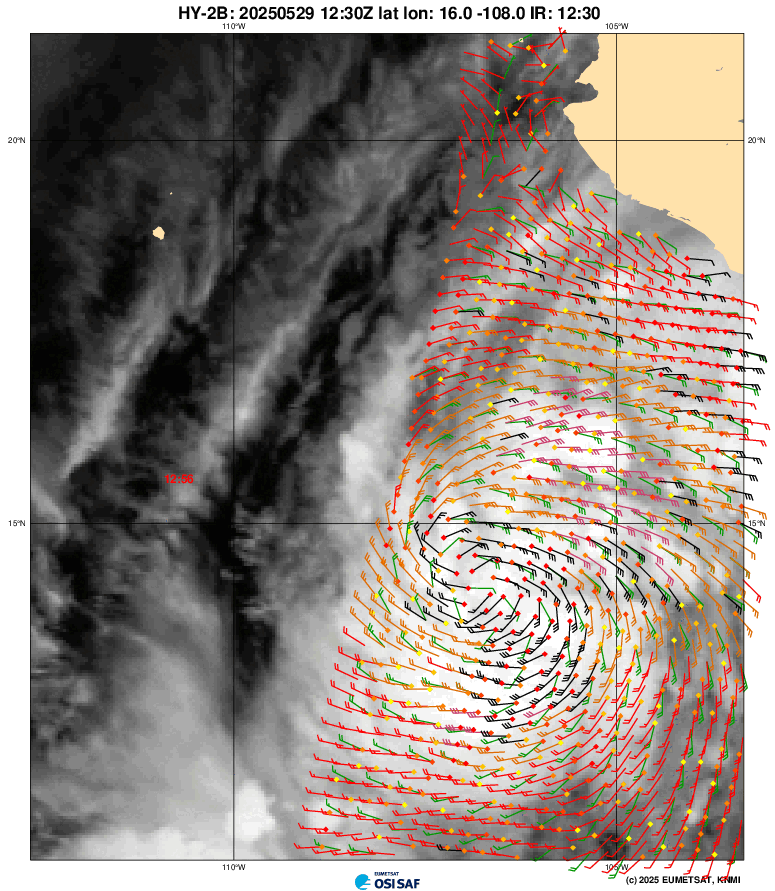
Scatterometry data captured from this KNMI website, below, shows two overpasses early on 29 May 2025, one from HY-2B and one from Metop-B. A closed circulation center and tropical storm-force winds are apparent.
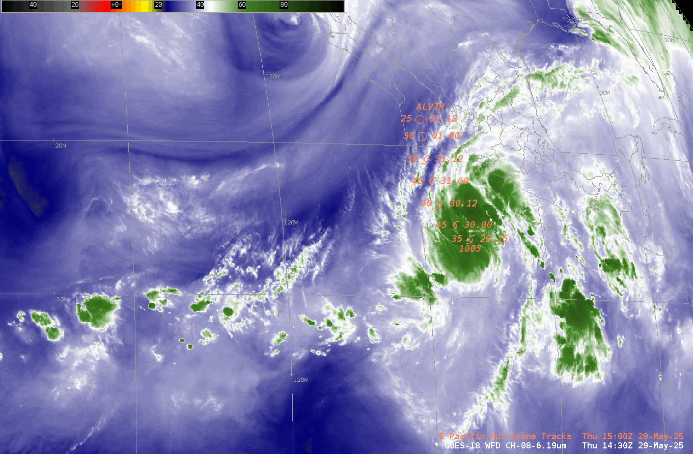
Upper-level water vapor imagery, below, shows the cold convective cloud tops associated with the developing system. Alvin is embedded within a moist airmass. The favorable environment suggests slow strengthening as indicated in the forecast.
The National Hurricane Center is issuing advisories on Alvin every 6 hours here.