Tropical Invest over the eastern Pacific Ocean
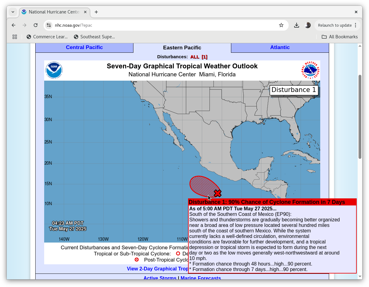
Imagery from the CSPP Geosphere site (link), above, shows an area of disturbed tropical weather to the south of Mexico in the eastern Pacific Ocean. The National Hurricane Center (link, and below) notes a lack of organization with slow development forecast over the next few days. (Note that GOES-West Mesoscale Sector #2 is monitoring this region. Here’s a 1-hour animation.)
Metop-B overflew the system at 0400 UTC on 27 May, as shown below (source). A possible circulation center — or perhaps better stated as a center of cyclonic vorticity — is apparent at the southwestern edge of the domain near 11oN, 100oW.

In what kind of environment does this disturbed weather find itself? Imagery from the SSEC/CIMSS Tropical Weather site, below, shows relatively low values of wind shear, and very warm Sea-Surface Temperatures. In addition, low-level convergence and upper-level divergence are very close to the vorticity maximum at 850mb. A second set of scatterometery, from HY-2C (also available at this KNMI website), shows the broad center of circulation.

A 24-hour animation of MIMIC Total Precipitable Water, below, shows that this system is embedded within the abundant moisture of the Intertropical Convergence Zone.
This invest is in a moisture-rich environment, with warm sea-surface temperatures and fairly low shear. Slow development is forecast. For more information on this system, refer to the SSEC Tropical Website, or the website of the National Hurricane Center.