Transverse banding: a satellite signature of potential turbulence
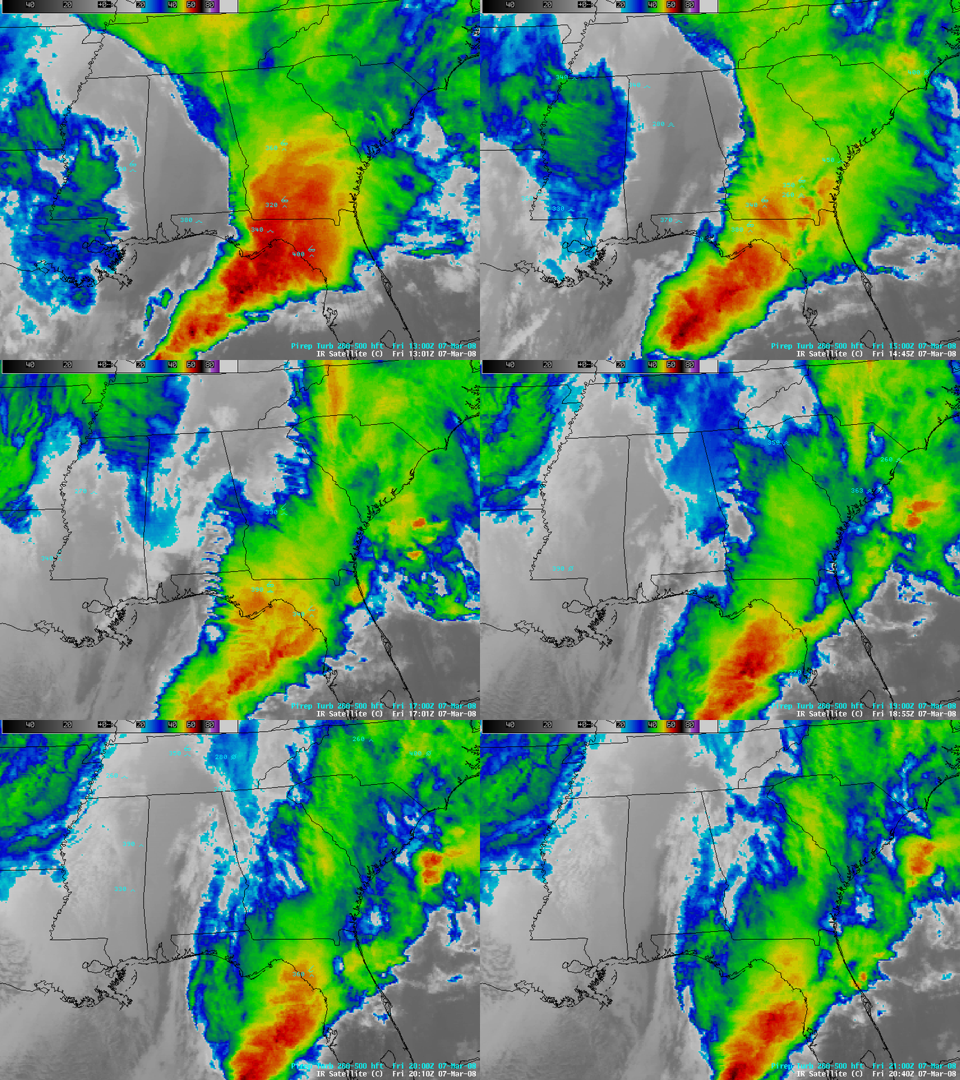
AWIPS images of the GOES-12 10.7 µm IR channel (above) revealed 2 separate periods where packets of “transverse banding” (thin, banded cloud elements oriented perpendicular to the ambient flow) were forming over parts of Florida, Alabama, and Georgia on 07 March 2008. These transverse bands were located at high altitudes along the western edge of the large convective cloud mass that was moving across the region; severe thunderstorms along the eastern flank of this line produced several tornadoes in northern Florida and southern Georgia (including a tornado responsible for 2 fatalities near Lake City, Florida).
A comparison of the 4-km resolution GOES-12 IR image at 16:32 UTC with the 1-km resolution NOAA-17 AVHRR IR image at 16:20 UTC (below) shows a closer view of one area of transverse banding moving over the Florida panhandle region, and demonstrates that more accurate identification of this type of small-scale cloud feature is possible with improved spatial resolution satellite imagery. The IR channels available on the Advanced Baseline Imager (ABI) instrument on GOES-R will provide 2-km resolution data, which should improve the ability to detect subtle features such as transverse banding.
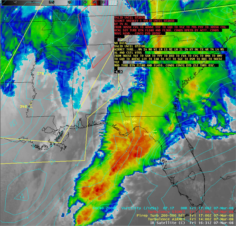
There were large areas across the southeastern US that were covered by aviation AIRMET (Airmen’s Meteorological Information) turbulence advisories (outlined in yellow, below), but these advisories were for locations a bit farther to the west than the transverse banding seen on the satellite imagery. In fact, there were indeed a couple of pilot reports of high-altitude turbulence indicated near the regions of transverse banding.
In addition to the AIRMET advisories, there was also a SIGMET (Significant Meteorological Information, outlined in red) that had been issued due to isolated aircraft reports of severe to extreme turbulence at the 28,000-29,000 feet altitude range over northern Alabama and western Tennessee during the 15:00-16:00 UTC period. Note that there were also some transverse banding signatures evident in the patch of cloud that was located over northern Mississippi at that time — once again, the structure of these banded cloud features was much more obvious when viewed using the 1-km resolution NOAA-17 AVHRR IR imagery (below).
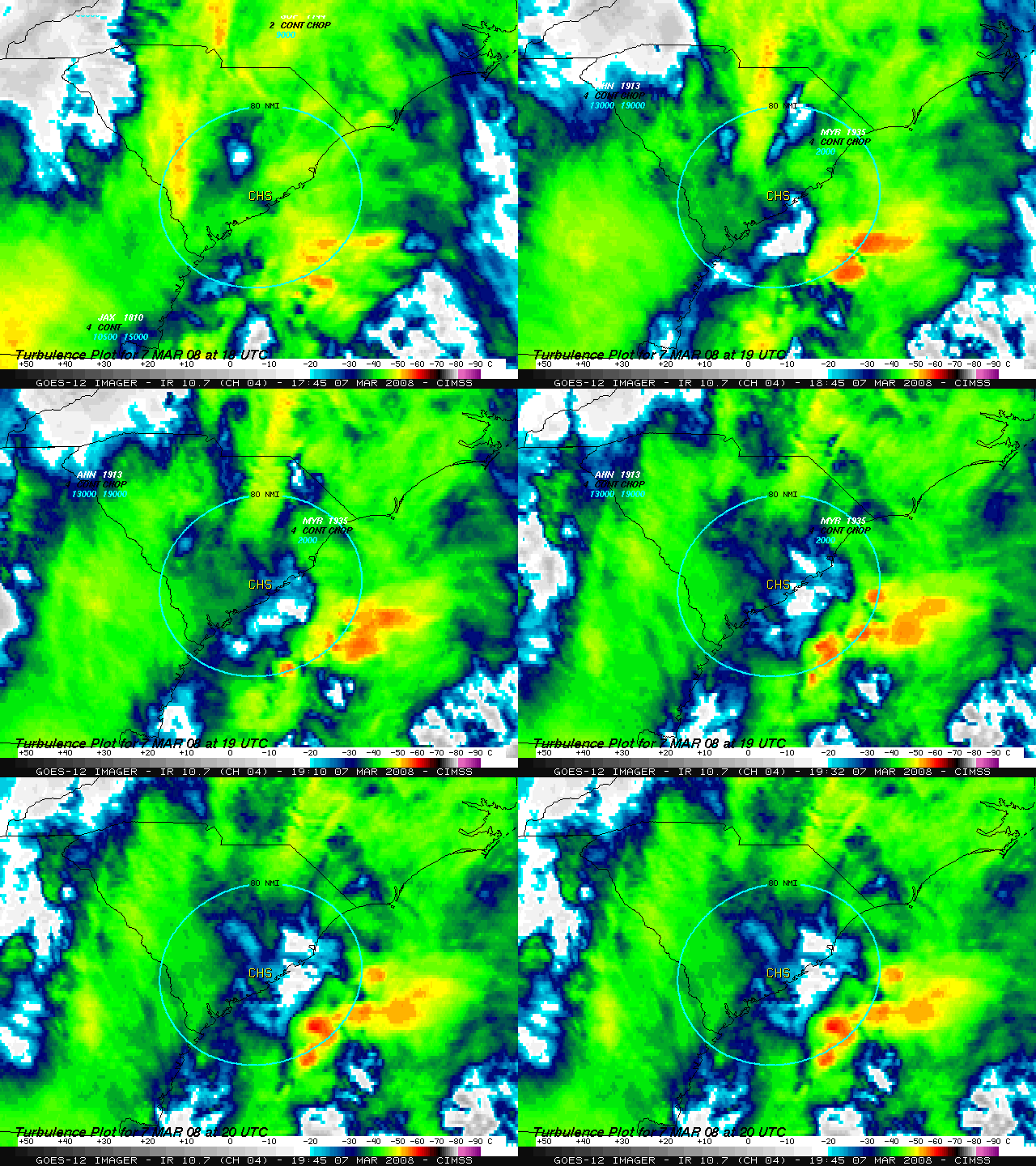
On that same day, a Lufthansa Airbus A340 passenger jet flying from Frankfurt, Germany to Atlanta, Georgia encountered severe turbulence around 19:15 UTC, at an altitude of 36,300 feet (while over the Atlantic Ocean, about 80 nautical miles southeast of Charleston, South Carolina):
CHS UUA /OV 80SE CHS/TM 1915/FL363/TP HA343/TB SEV FL350-FL363/RM CLIMB 130 FT ZJX=
The aircraft apparently lost about 1300 feet of altitude after encountering the severe turbulence. Ten persons aboard that flight received injuries (with a few requiring hospitalization), and the plane landed with priority clearance at Atlanta around 20:07 UTC. While the GOES-12 10.7 µm IR imagery in the vicinity of the incident (below) did not exhibit any of the transverse banding signatures that were seen farther inland, there were some rapidly developing thunderstorms in the vicinity (around 80 nautical miles southeast of Charleston, CHS) that likely contributed to the high-altitude turbulence. Note that the Lufthansa pilot report of turbulence did not show up in the database that was plotted by the McIDAS software shown below, but it was plotted by the AWIPS software (although in the wrong location, directly over Charleston, instead of 80 miles southeast of CHS).


