Convective outflow boundaries: sometimes innocuous, sometimes important
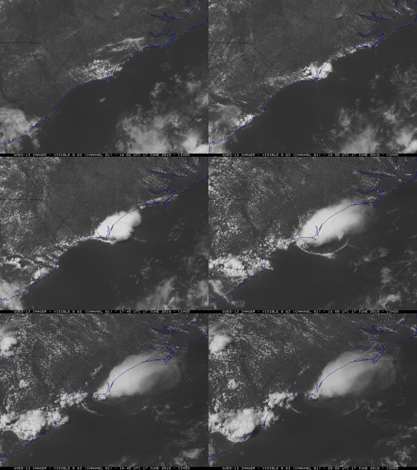
McIDAS images of GOES-13 0.63 µm visible channel data (above) showed the development of a distinct convective outflow boundary along the coast of North Carolina on 17 June 2010. While appearing interesting on the satellite imagery, this outflow boundary dissipated quickly and did not appear to have any major impact on sensible weather or subsequent convective development.
A NOAA-19 false color Red/Green/Blue (RGB) image created using AVHRR channels 01/02/04 (below) offered another view of the outflow boundary at 18:53 UTC.
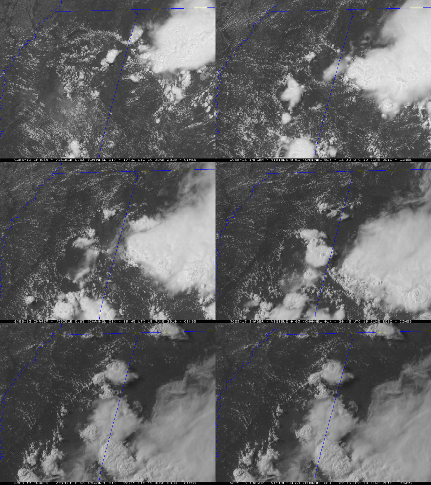
In contrast, another series of GOES-13 0.63 µm visible images (below) showed the development of a new convective cell as 3 outflow boundaries intersected over eastern Mississippi on 19 June 2010. This new convective cell produced hail of 1.00 inch in diameter (plotted as “A100” on the image) at 20:00 UTC and strong wind gusts that downed multiple trees (plotted as “W” on the image) at 21:27 UTC.
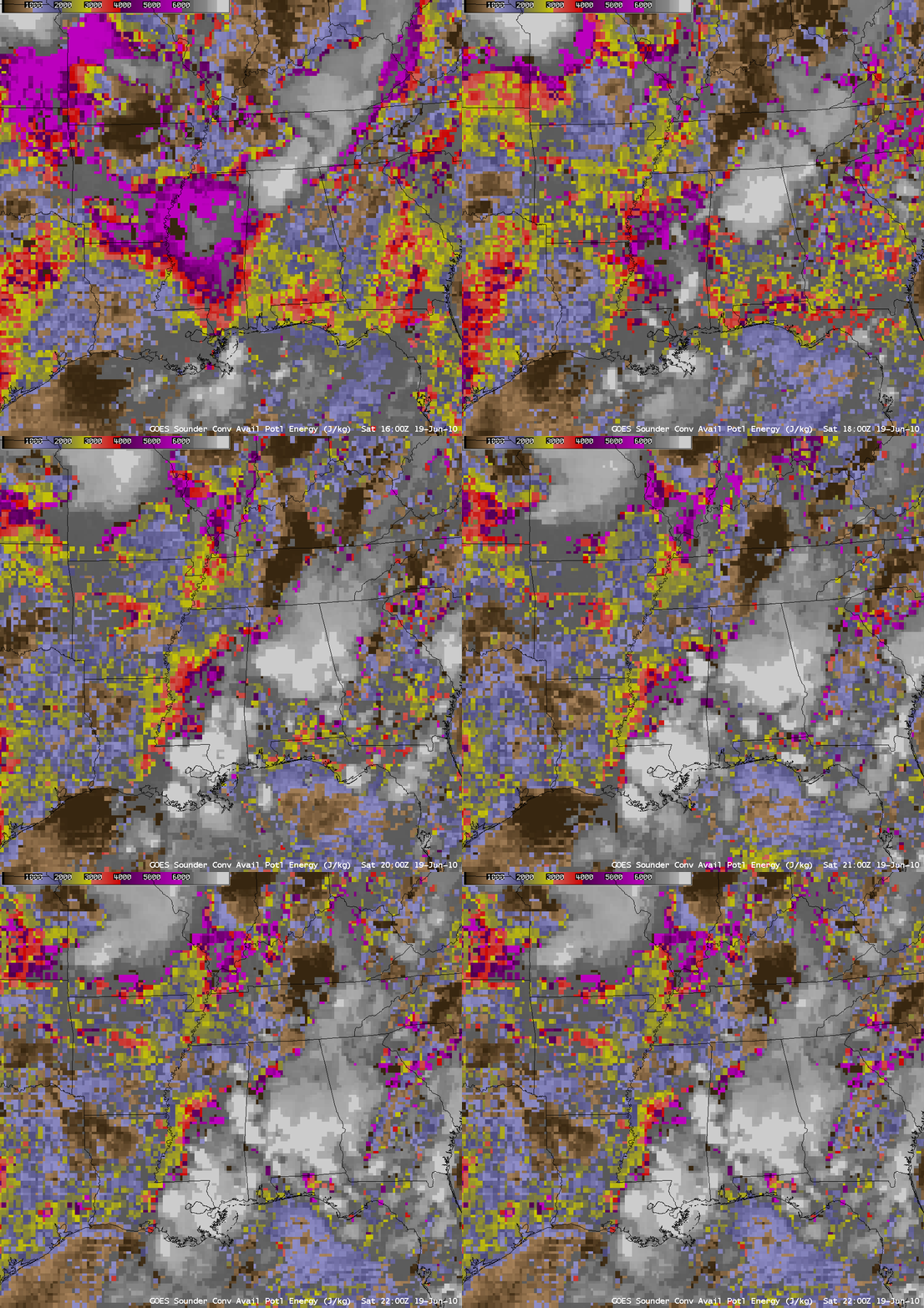
AWIPS images of GOES-13 sounder Convective Available Potential Energy or CAPE product (below) indicated that the region of convective development was quite unstable during this period, with widespread CAPE values of around 6000 Joules per kilogram (darker purple color enhancement).
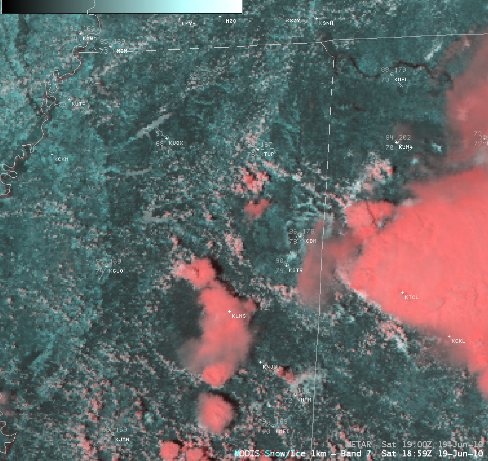
A MODIS false color RGB image using bands 01/07/07 (below) could be utilized to help discriminate areas of convection that were completely glaciated (darker red color enhancement) from those that were not (brighter white enhancement).


