Great Lakes advection fog features
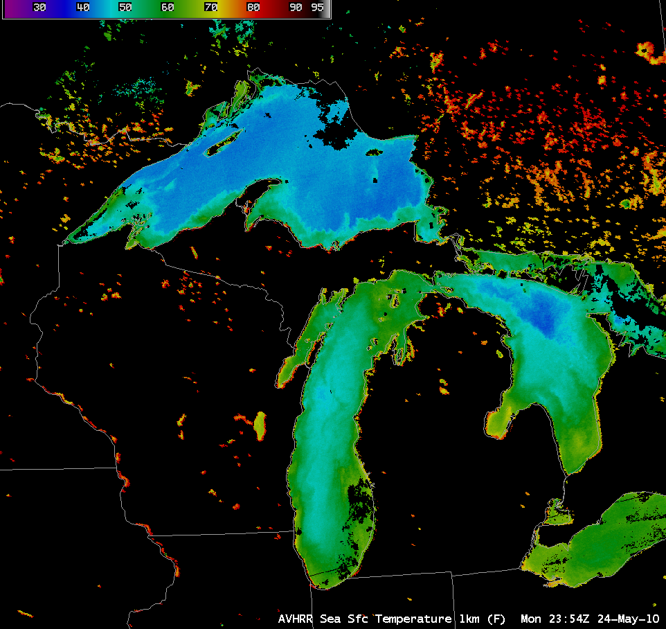
During 24 May – 25 May 2010, a northward flux of unseasonably warm (daily high temperatures in the 80s and 90s F) and humid (dew points in the middle 60s to low 70s F) air moved northward across the Great Lakes region. However, an AWIPS image of the POES AVHRR Sea Surface Temperature (SST) product (above) showed that SST values were still in the upper 30s to low 40s F over much of Lake Superior and the upper 40s to low 50s F over much of Lake Michigan.
The cold water temperatures caused the surface air to cool to saturation, with widespread advection fog developing over a great deal of Lake Superior and Lake Michigan. A 250-meter resolution MODIS Red/Green/Blue (RGB) image created using Bands 1/4/3 (below) revealed an interesting pattern of “shock waves” in the lake fog as the southeasterly flow was interacting with the coastline of parts of eastern Wisconsin.
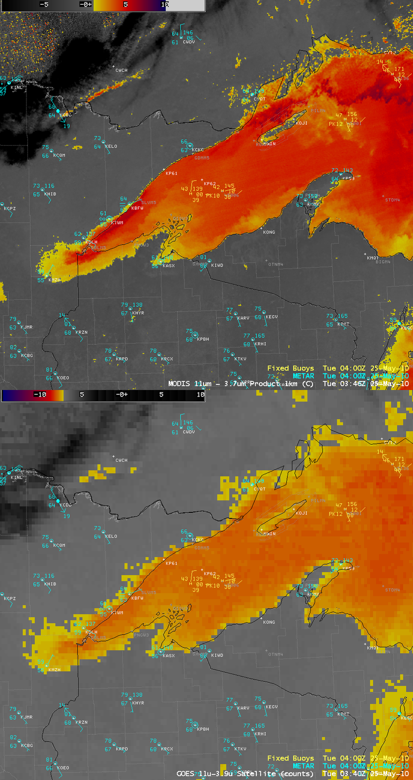
During the subsequent overnight hours, a comparison of the 4-km resolution GOES-13 fog/stratus product with the corresponding 1-km resolution MODIS fog/stratus product (below) demonstrated how the improvement in spatial resolution was an aid to more accurately locating the exact boundaries of the fog over western Lake Superior and the inland areas in the vicinity of Duluth, Minnesota (station identifier KDLH).
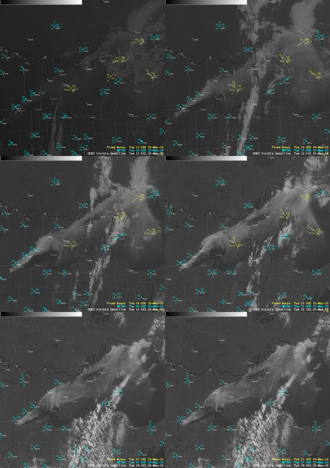
With arrival of daylight on the morning of 25 May, an animation of GOES-13 0.63 µm visible channel images (below) showed how the lake fog features were affecting various inland portions of northeastern Minnesota at different times.


