Cyclone Jasper makes landfall in Australia

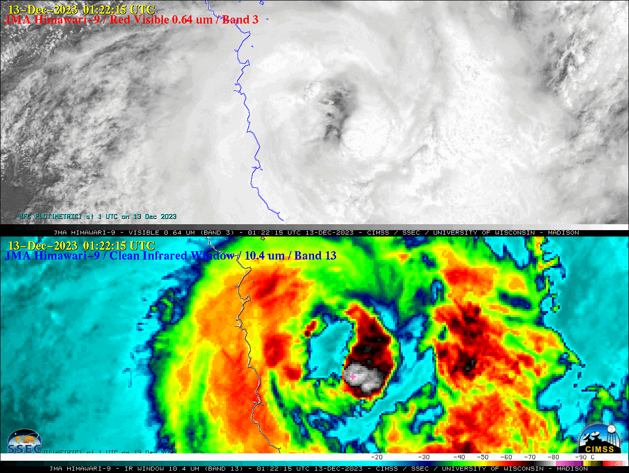
2.5-minute JMA Himawari-9 Red Visible (0.64 µm, top) and Clean Infrared Window (10.4 µm, bottom) images, from 2002 UTC on 12 December to 0822 UTC on 13 December [click to play animated GIF | MP4]
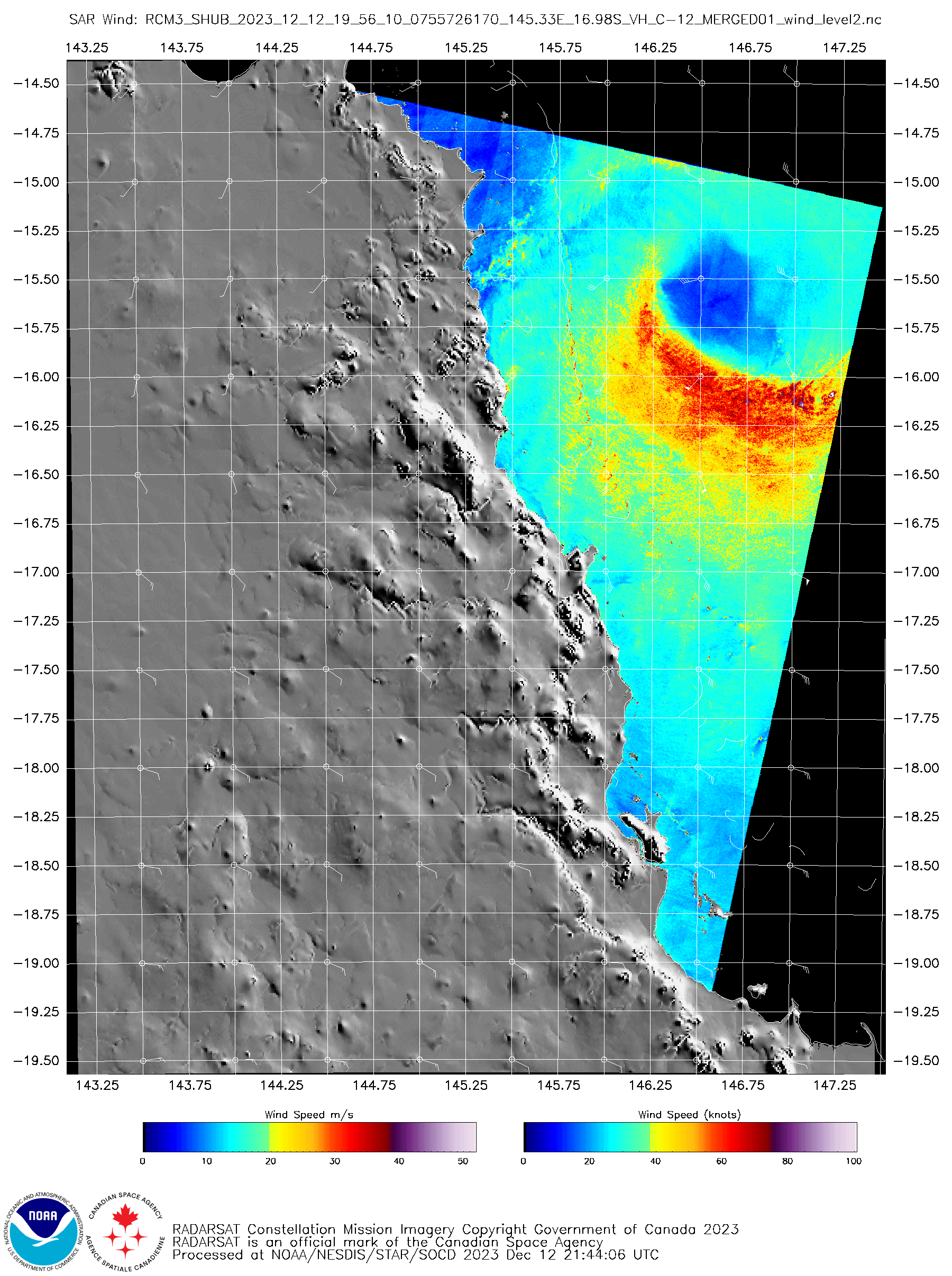
In Synthetic Aperture Radar (SAR) wind speed images from RCM-3 at 1956 UTC on 12 December and 0854 UTC on 13 December (source), a swath of higher speeds (having maxima of 65.78 knots and 49.62 knots, respectively) was seen within the southern semicircle of the eyewall (below).
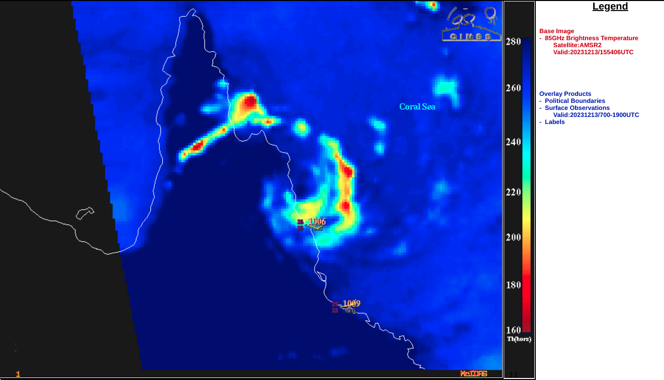
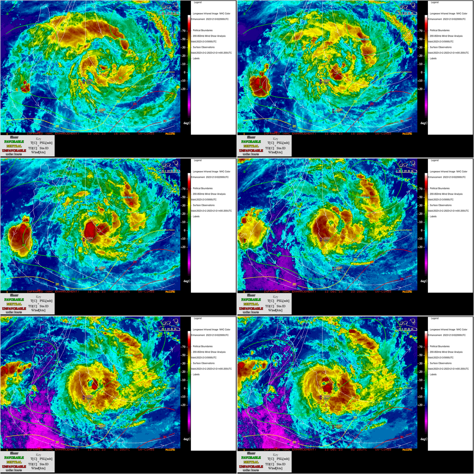
A GCOM-W1 AMSR2 Microwave (85 GHz) image at 1554 UTC on 13 December (below) also displayed higher reflectivity within the southern eyewall, moving inland near and just north of Cairn surface observation site. Himawari-9 Infrared Window (11.2 µm) images from the CIMSS Tropical Cyclones site (below) showed that Jasper was moving through an environment of low deep-layer wind shear — which, in addition to its motion across modestly-warm water (SST | OHC) favored some intensification. In fact, Jasper did intensify to 60 knots at 0600 UTC on 13 December (SATCON), about 6 hours prior to landfall,


