Cyclone Jasper in the Coral Sea

JMA Himawari-9 Clean Infrared Window (10.4 µm) images, from 0002 UTC on 07 December to 0602 UTC on 08 December [click to play animated GIF | MP4]
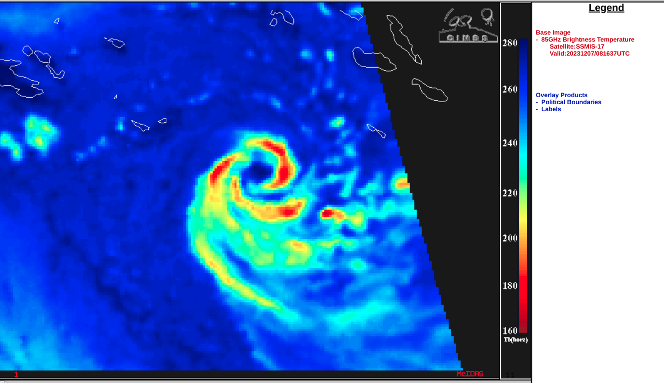
DMSP-17 SSMIS Microwave (85 GHz) image at 0816 UTC on 07 December [click to enlarge]
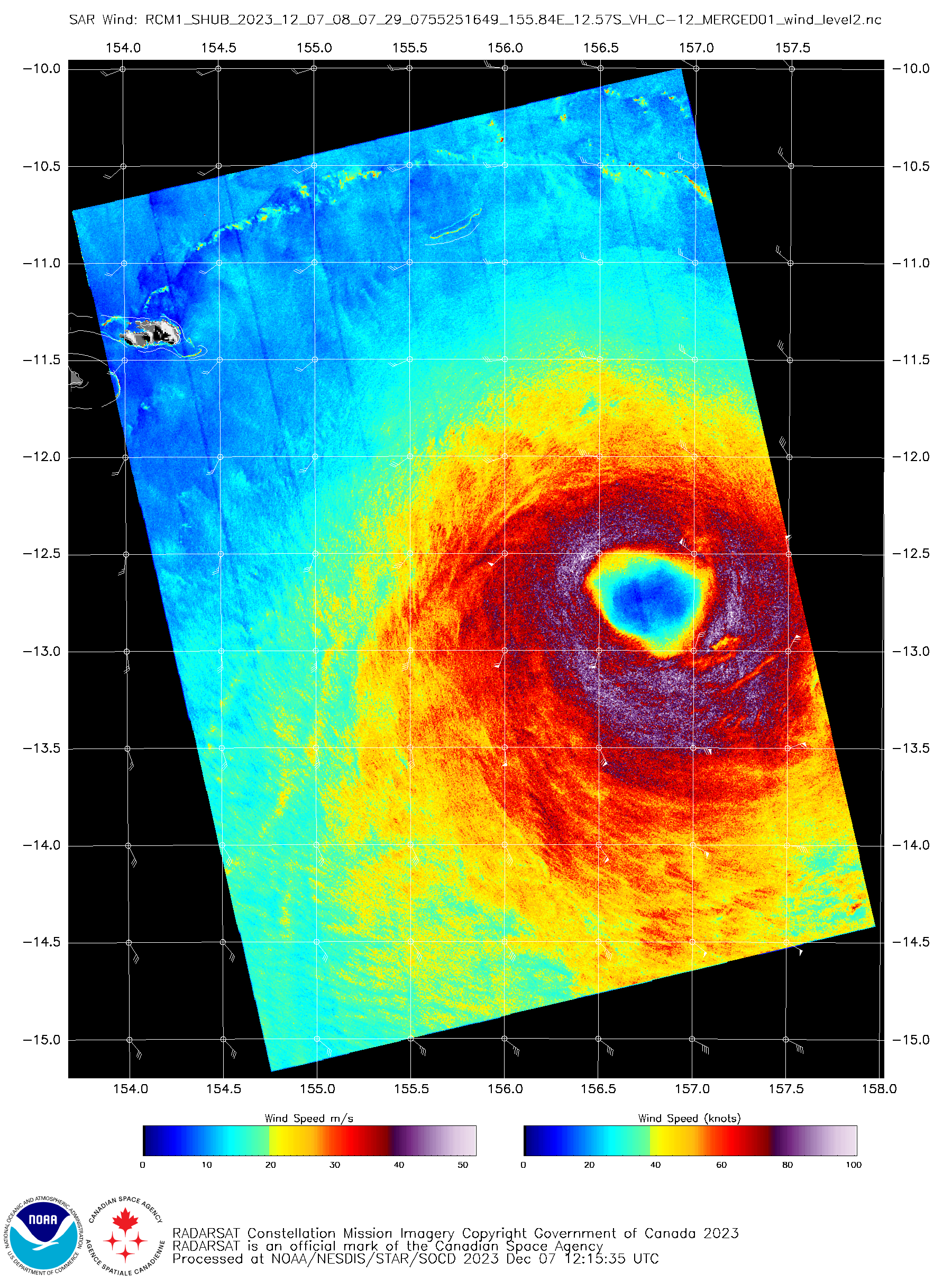
RCM-1 Synthetic Aperture Radar wind speed image at 0807 UTC on 07 December [click to enlarge]
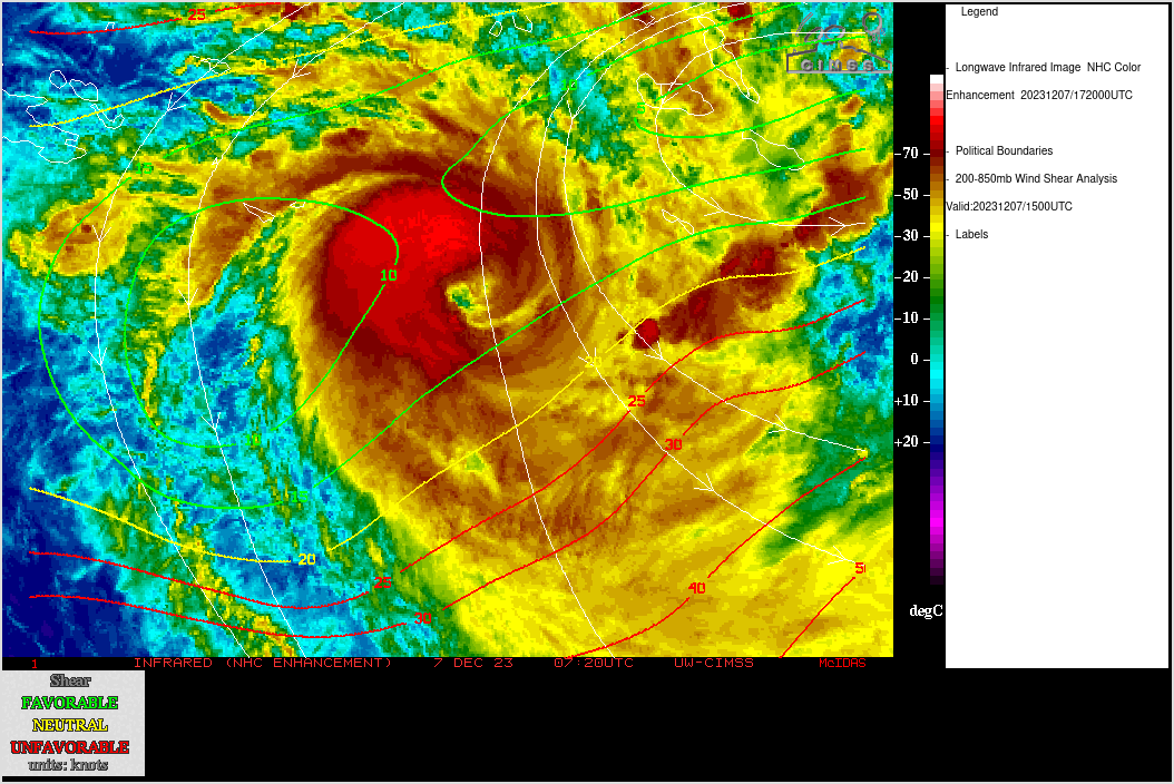
JMA Himawari-9 Infrared Window (11.2 µm) images, with contours and streamlines of deep-layer wind shear at 1500 UTC on 07 December [click to enlarge]
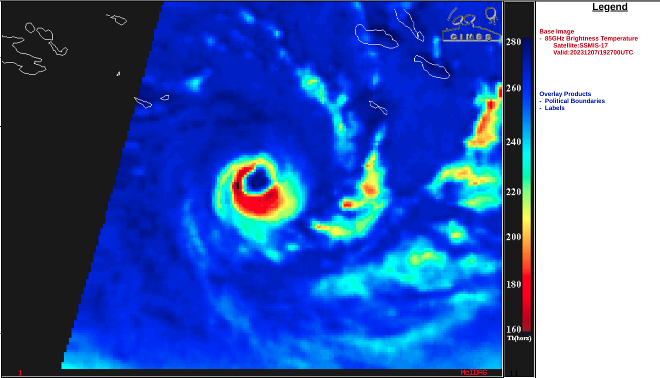
DMSP-17 SSMIS Microwave (85 GHz) image at 1927 UTC on 07 December [click to enlarge]
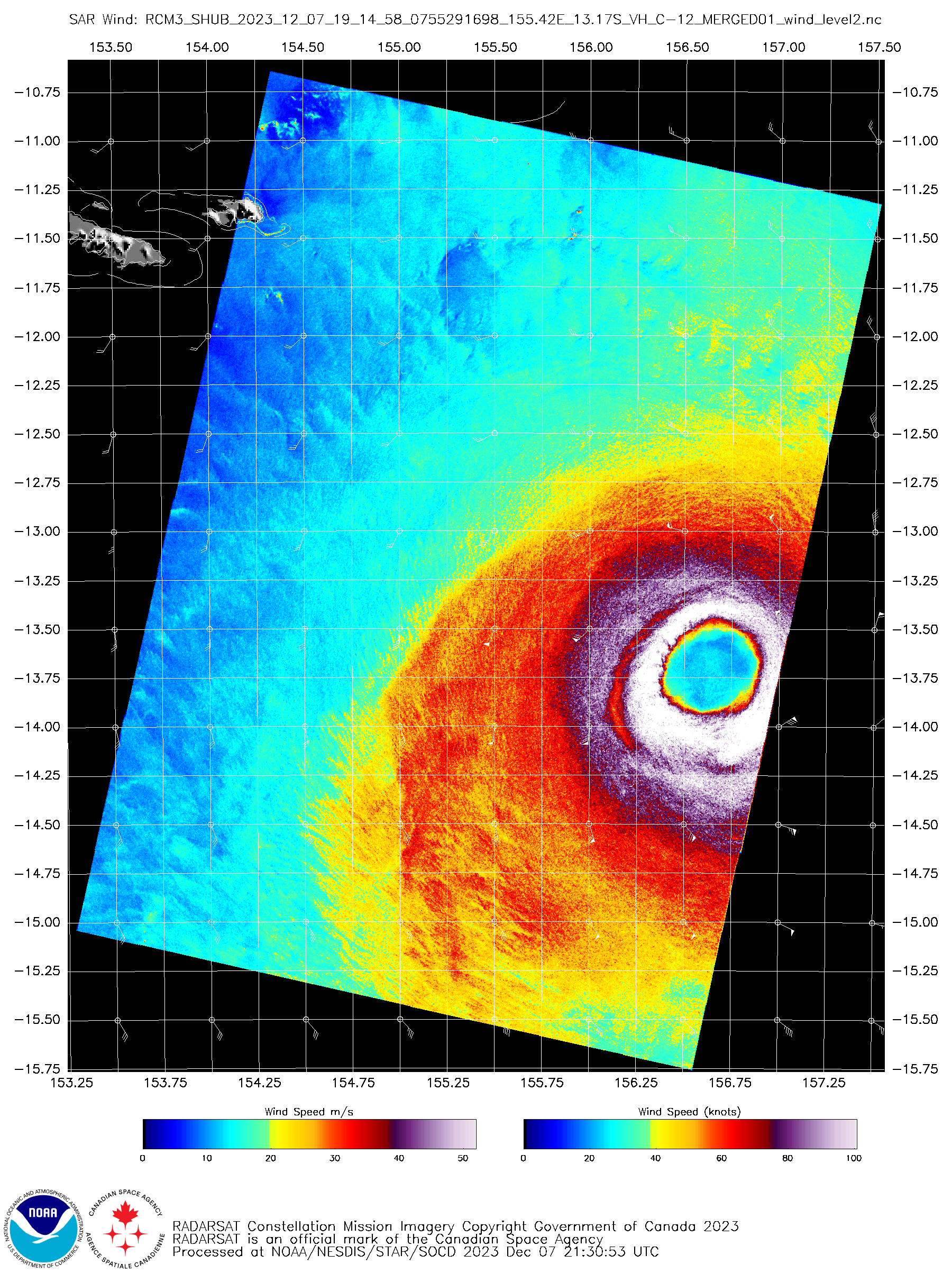
RCM-3 Synthetic Aperture Radar wind speed image at 1914 UTC on 07 December [click to enlarge]

JMA Himawari-9 Red Visible (0.64 µm, left) and Clean Infrared Window (10.4 µm, right) images, from 2232 UTC on 07 December to 0732 UTC on 08 December [click to play animated GIF | MP4]