Cold water eddies and ice floes in Hudson Bay
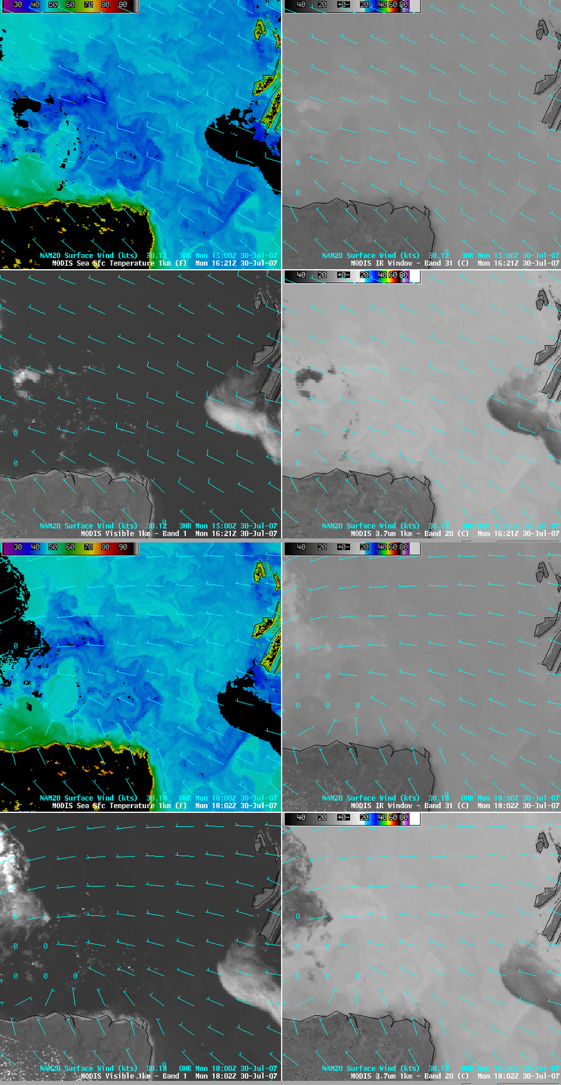
Our recent fascination with the MODIS Sea Surface Temperature (SST) product continues, with AWIPS imagery of the MODIS SST that revealed an intricate pattern of cold water eddies across the southern portion of Hudson Bay in Canada on 30 July 2007 (above; upper left panel). The 2 MODIS image sets are about 90 minutes apart, and the image animation indicates that these cold water eddies were moving rather rapidly westward during that short time interval — this water feature motion was in the opposite direction of the boundary layer winds, which were light westerly to northwesterly around the northern periphery of a surface anticyclone that was centered over northern Ontario.
There were patches of low-level cloudiness over the water in the eastern and western portions of the satellite scene — these clouds showed up as darker (warmer) features on the MODIS 3.7µm IR images (above; lower right panel) due to the solar radiation reflected off the tops of these water droplet clouds. If you look closely, you can also see several small white “specks” in the water near the middle of the MODIS visible images (above; lower left panel) which were also moving westward — these were small ice floes that were floating in the still-cold waters of Hudson Bay (the coldest SST values seen in that area on this day were around 37º F or +3º C, dark blue enhancement). The ice floes did not exhibit a darker signal on the MODIS 3.7µm IR image, since the component of solar radiation reflected off ice surfaces is minimal.
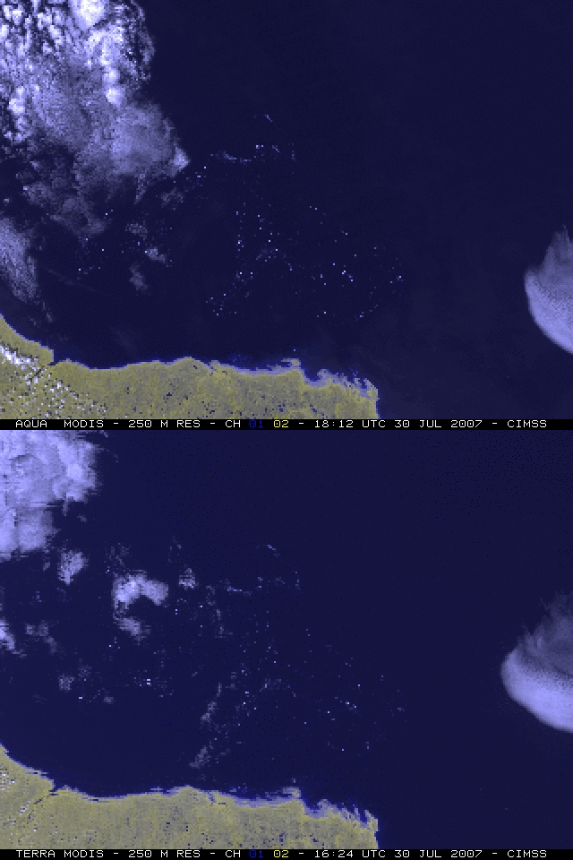
These small ice floes were more clearly depicted in false-color composite images using the 250-meter resolution visible channels 1 and 2 from the Terra abd Aqua MODIS instruments (above). Hudson Bay retained significant ice cover well into the month of June 2007 (MODIS true color image | MODIS false color image: ice features have a red enhancement), and a good deal of ice was still present as recently as early July 2007 (MODIS true color image | MODIS false color image: ice features have a red enhancement).
A comparison of GOES-13 and GOES-12 visible channel images (Java animation, below) better showed the motion of these ice floes during the 6-hour period from 14:02-20:15 UTC. Note the improved image navigation and registration (INR) evident with the GOES-13 satellite: the coastline and island features remain fairly steady from image to image, in contrast with the GOES-12 images which exhibit a notable amount of “wobble” in the animation. Using McIDAS, we tracked the speed of 2 different ice floe features on the GOES-13 imagery: one of the fastest-moving ice floes was seen to have a speed of about 1.8 kilometers per hour (1 knot), while most of the other ice floes seemed to be moving more slowly at a speed of around 0.5 kilometers per hour (0.3 knots). Using the AWIPS “Distance Speed” tool, the speed of displacement of the ice floes and cold water eddies between the 2 MODIS images was found to be about 3 kilometers per hour (2 knots).


