Terrain-induced cloud features off the coast of western North America
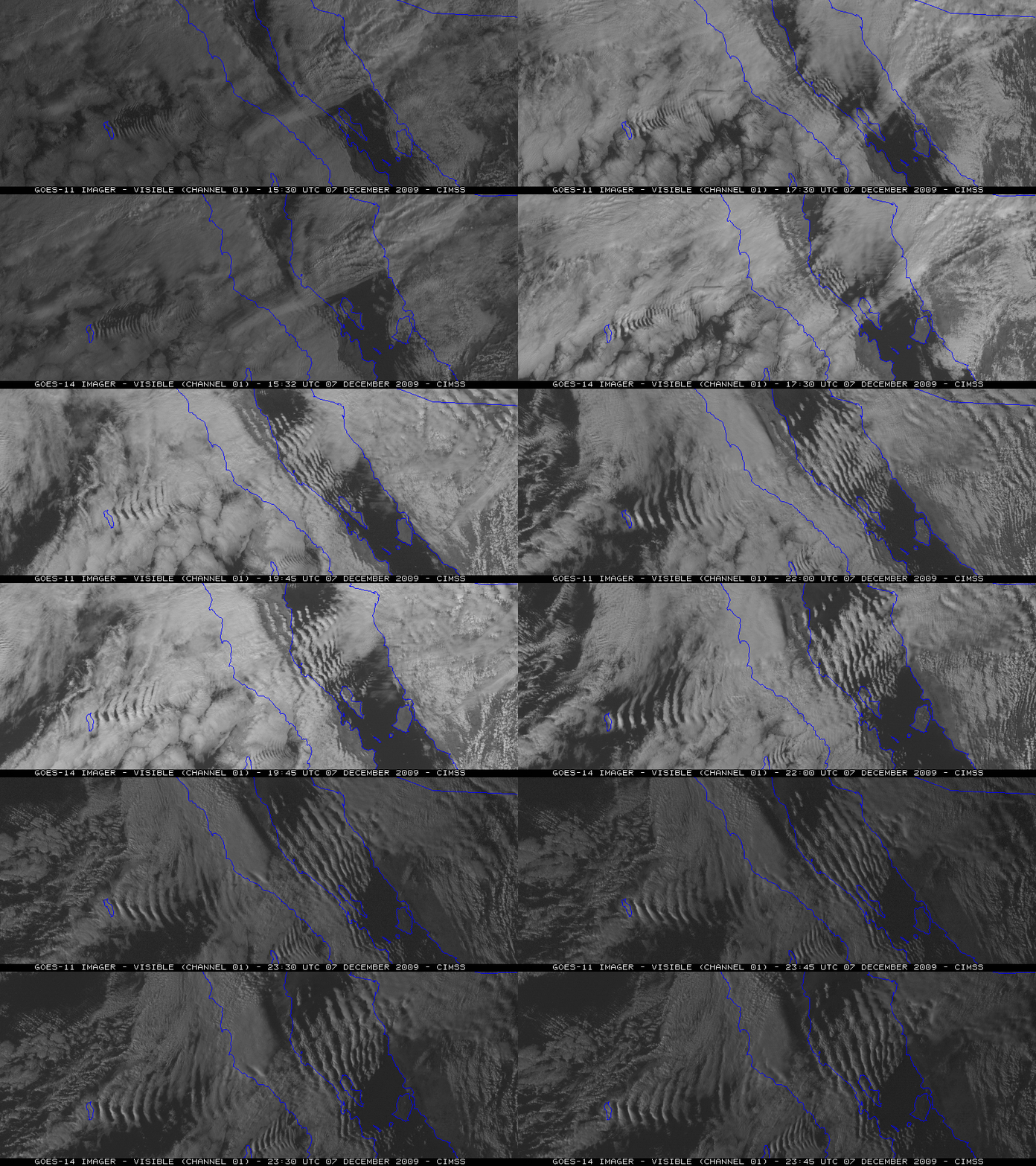
A comparison of GOES-11 and GOES-14 (which was undergoing its NOAA Science Test) visible channel images (above; also available as a QuickTime animation) showed a series of standing waves to the lee of Isla Guadalupe and also to the lee of Baja California on 07 December 2009. These terrain features were acting as an obstacle to strong westerly flow within the marine boundary layer, which initiated the formation of the lee waves.
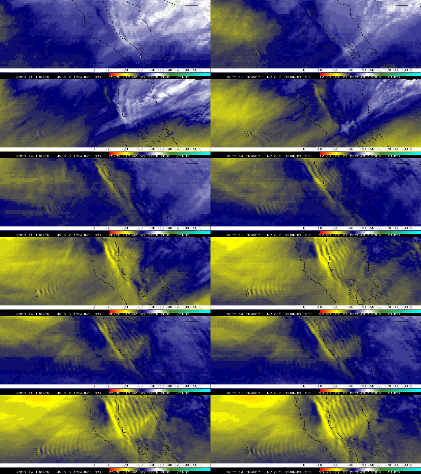
A signature of these lee waves was also evident on GOES-14 (and to a lesser extent, GOES-11) water vapor channel images (below; also available as a QuickTime animation). The spatial resolution of the 6.5 µm GOES-14 water vapor channel is 4 km, compared to the 8 km resolution of the 6.7 µm water vapor channel on GOES-11 — this allowed the wave structure to be observed with greater clarity using GOES-14.
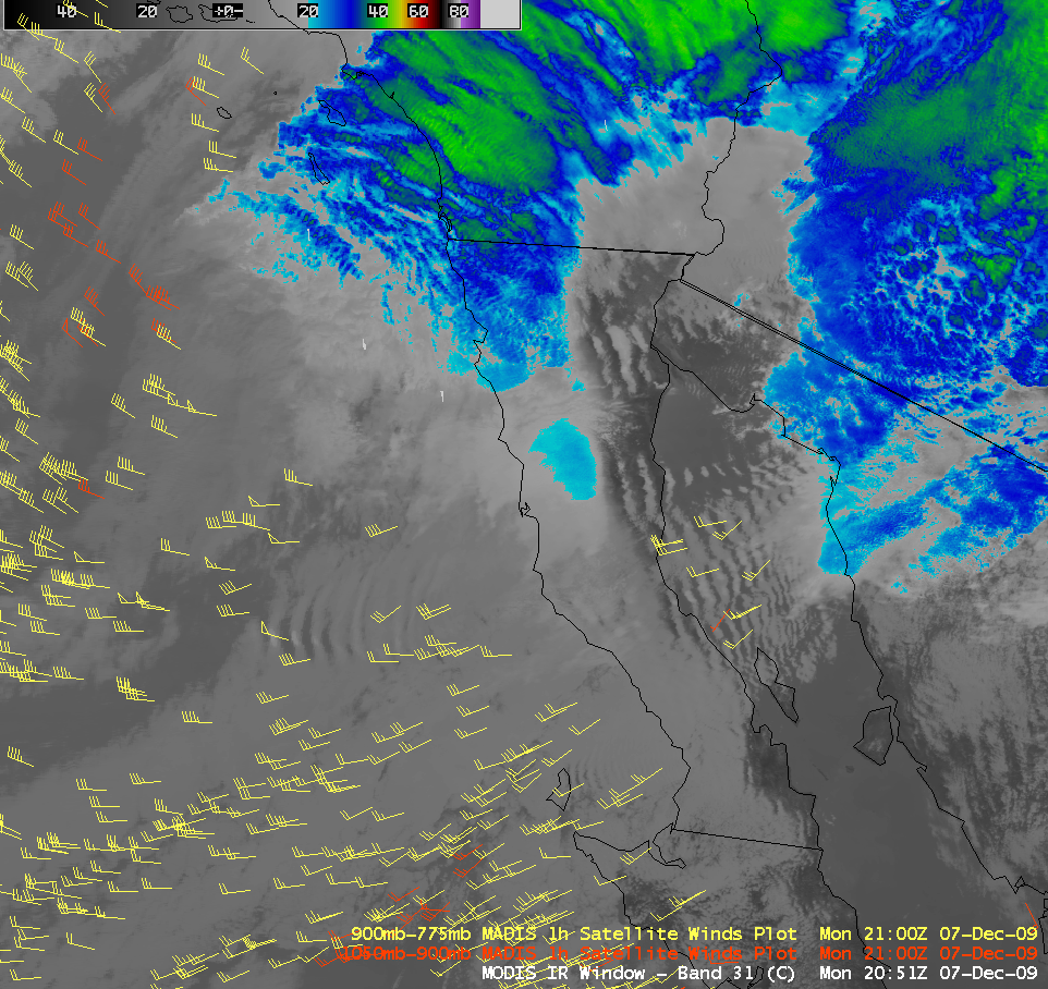
A MODIS 11.0 µm IR image with an overlay of 1-hour MADIS atmospheric motion vectors (below) showed that lower tropospheric wind speeds were as high as 50 knots over the region.
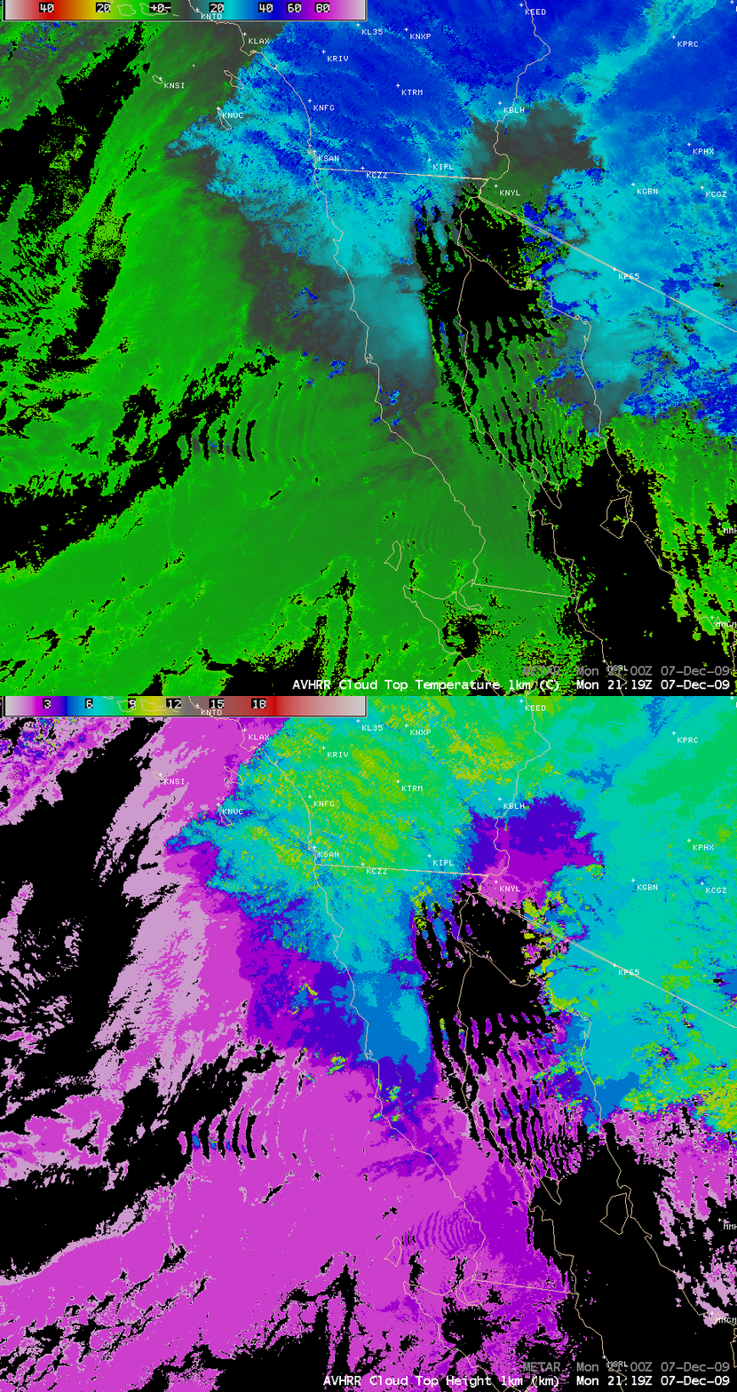
AVHRR Cloud Top Height (CTH) and Cloud Top Temperature (CTT) products (below) indicated the the crests of the waves immediately downwind of Isla Guadalupe exhibited CTH values as high as to 5 km and CTT values as cold as -30º C — the surrounding marine stratoculumus clouds had CTH values near 2 km and CTT values around +2º C.
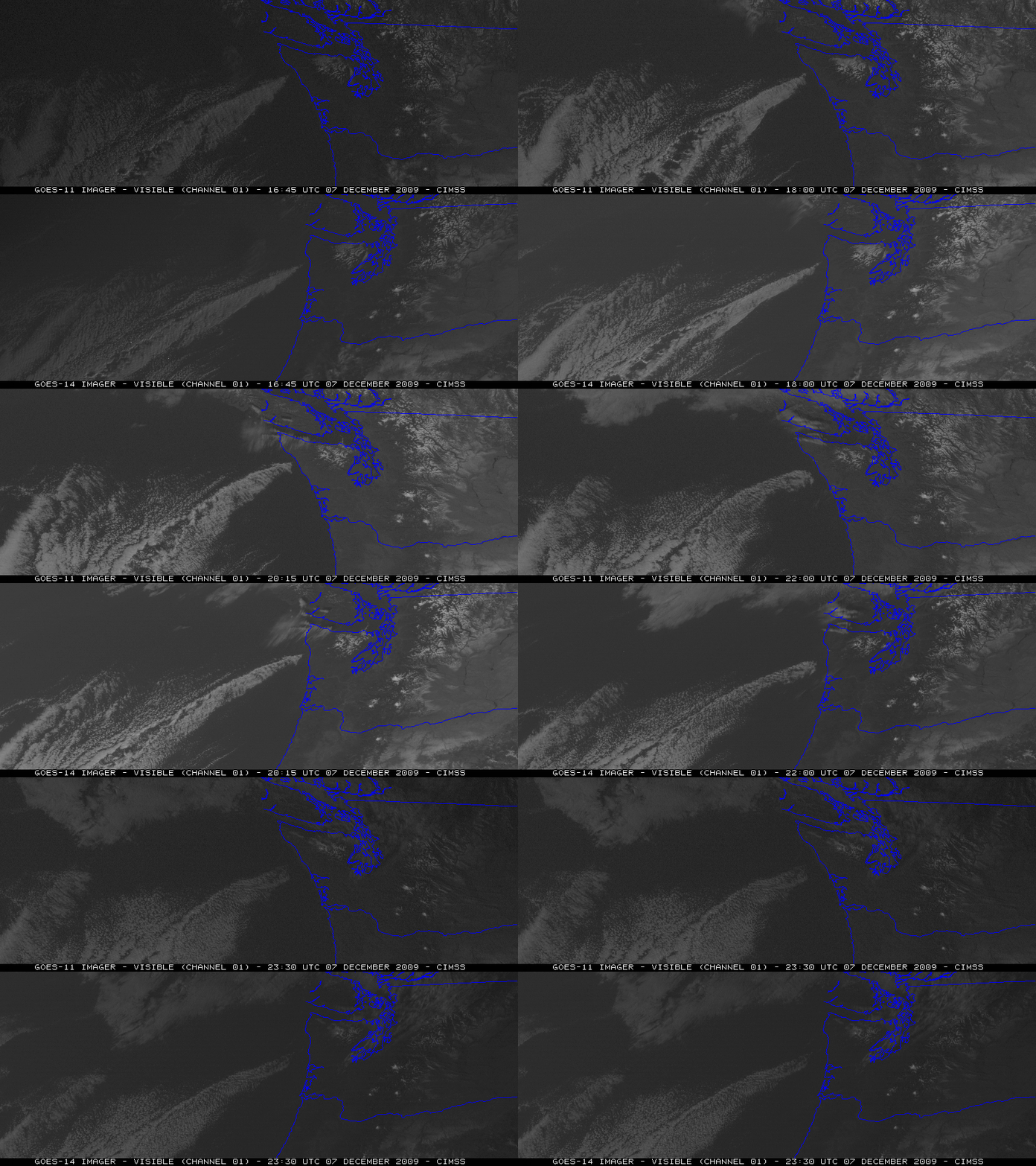
Farther to the north, GOES-11 and GOES-14 visible channel images (below; also available as a QuickTime animation) revealed a long cloud plume that had formed downwind of Mount Olympus in far northwestern Washington. Strong northeasterly flow had developed over the region in response to the formation of a broad trough of low pressure over the western US. Note the improvement in GOES-14 Image Navigation and Registration (INR), with much less image-to-image wobble compared to GOES-11.
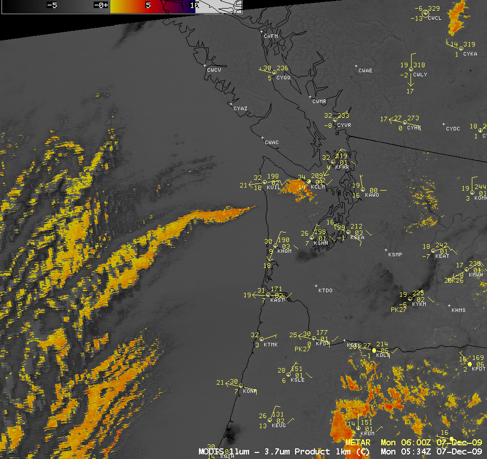
A MODIS fog/stratus product image (below) showed that this cloud plume was also apparent during the pre-dawn hours, before any visible channel imagery would have been available.
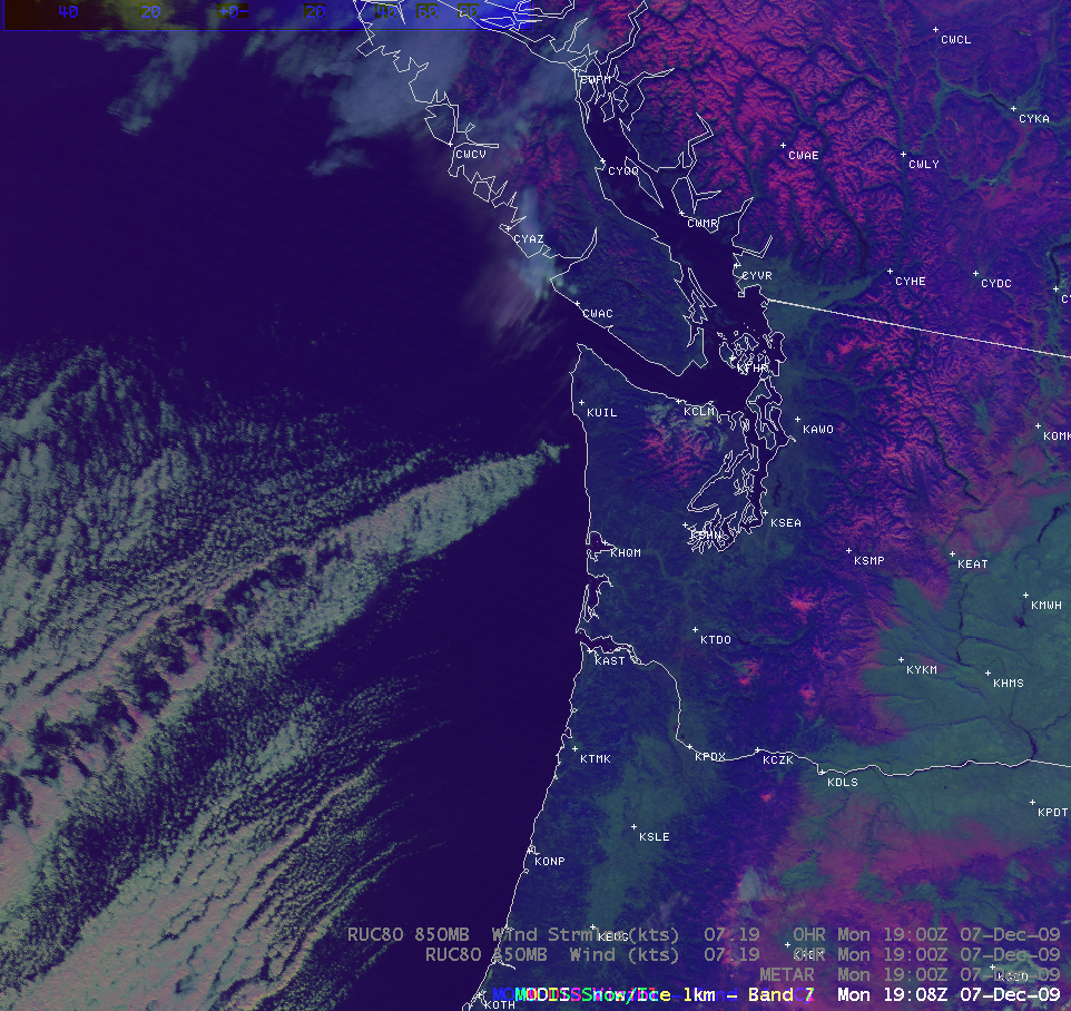
A MODIS 3-channel Red/Green/Blue (RGB) image (below) suggested that this cloud plume was comprised primarily of supercooled water droplets, which exhibit a brighter appearance on the RGB image — ice crystal clouds would have more of a pink-colored look on such an RGB image (like that seen with the deep snow cover over the interior mountains)
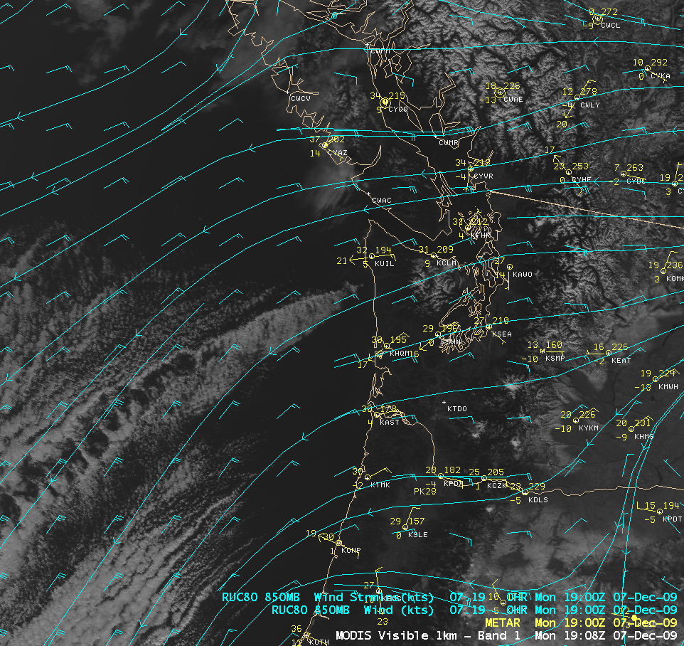
A MODIS visible channel image with an overlay of RUC80 850 hPa winds (below) confirmed the presence of northeasterly flow over the region. As the flow moved around the obstacle of Mount Olympus, lee-side convergence helped to aid in the formation of the cloud plume.


