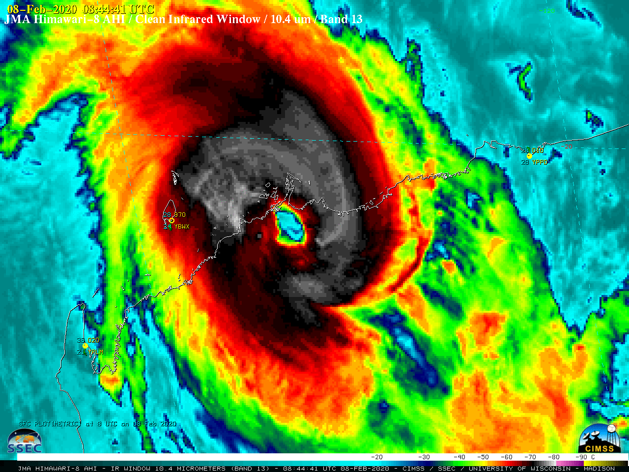
Cyclone Damien makes landfall in Western Australia

Himawari-8 “Clean” Infrared Window (10.4 µm) images [click to play animation | MP4]
GCOM-W1 AMSR2 Microwave (85 GHz) imagery from the CIMSS Tropical Cyclones site (below) showed the eye at 1710 UTC.
Just prior to landfall. cloud-top gravity waves were evident in VIIRS Infrared Window (11.45 µm) images from NOAA-20 and Suomi NPP, as viewed using RealEarth (below).Wind speed, wind gusts and atmospheric pressure as Severe #CycloneDamien crossed the coast over our #Karratha Airport weather station.
This highlights the dramatic changes as the eye moves over an area.Need more weather graphs? https://t.co/bOnuYRnTOV pic.twitter.com/rA4ITFAqQ5
— Bureau of Meteorology, Western Australia (@BOM_WA) February 9, 2020
Tropical Storm Damien was also seen in the first-light image from Russia’s Elecro-L3 satellite, a few hours before Damien reached Category 1 hurricane intensity.
??????????? ????????? #???????? ? 3 ? ?????? ?????? ????????? ???? ???????? ? ???????? ?????? ?????? ????? ? ??????? ? ??-?????????? — https://t.co/RBHtlQaTU9
?? ??? ??? ????????? ??????? ????????????? ??????! pic.twitter.com/raXeYbLQe5
— ????????? (@roscosmos) February 7, 2020


![GCOM-W2 AMSR2 Microwave (85 GHz) image [click to enlarge]](https://cimss.ssec.wisc.edu/satellite-blog/images/2020/02/200208_1710utc_amsr2_microwave_Damien.png)
![VIIRS Infrared Window (11.45 µm) images from NOAA-20 and Suomi NPP [click to enlarge]](https://cimss.ssec.wisc.edu/satellite-blog/images/2020/02/200208_05utc_noaa20_06utc_suomiNPP_viirs_infrared_Damien_anim.gif)