Hurricane Harvey makes landfall
* GOES-16 data posted on this page are preliminary, non-operational and are undergoing testing *
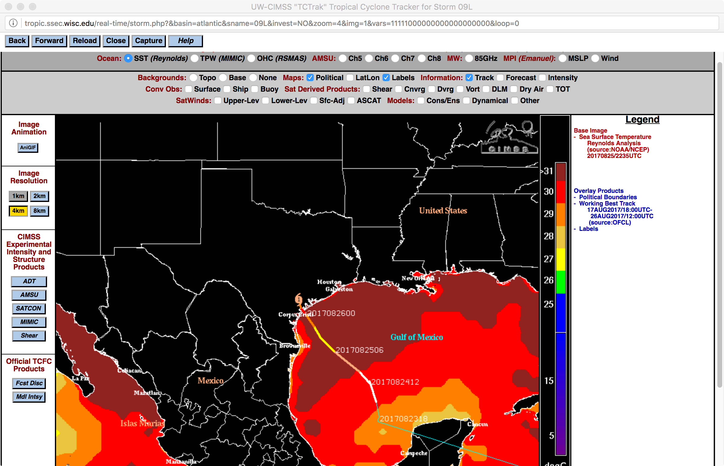
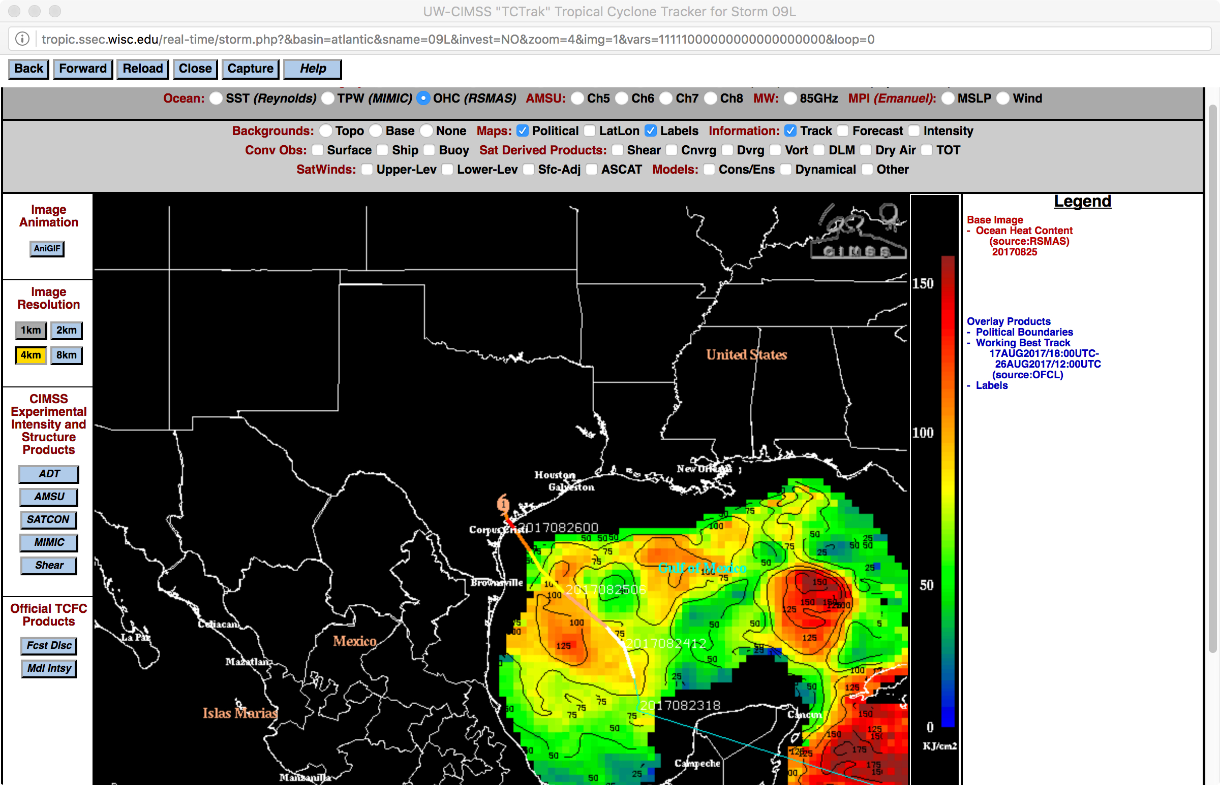
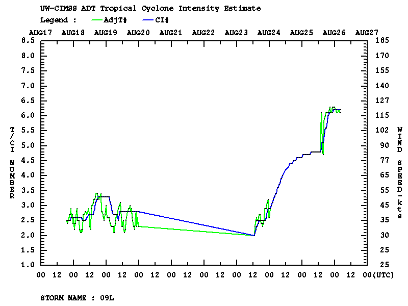
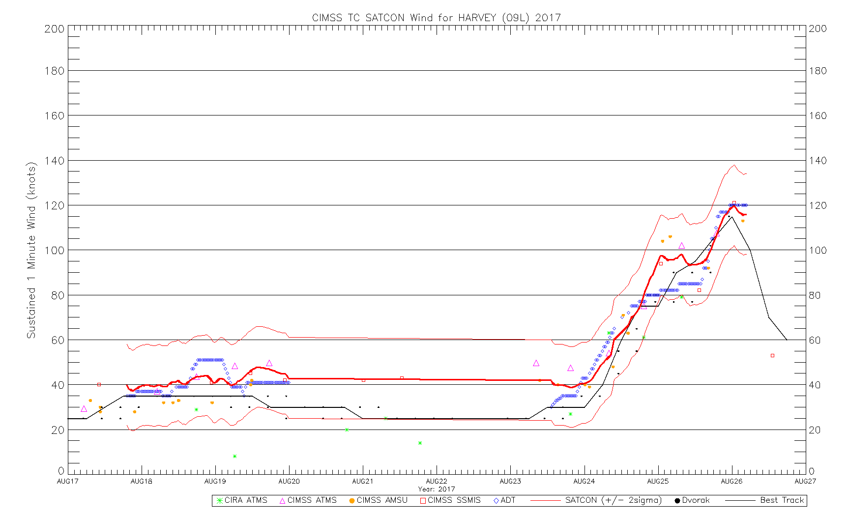
As Harvey moved across warm waters in the northwestern Gulf of Mexico (SST | OHC), it continued to intensify (ADT | SATCON) to a Category 4 hurricane just before making landfall along the Texas coast around 03 UTC on 26 August 2017 (10 pm local time on 25 August). Overlapping 1-minute GOES-16 Mesoscale Sectors had been positioned over Harvey, providing images at 30-second intervals — “Red” Visible (0.64 µm) images prior to sunset (below) showed the approach of the eye. A comparison of GOES-16 vs GOES-13 (GOES-East) Visible images is available here.
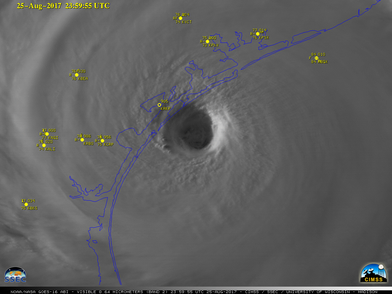
GOES-16 “Red” Visible (0.64 µm) images, with hourly surface ports plotted in yellow [click to play MP4 animation]
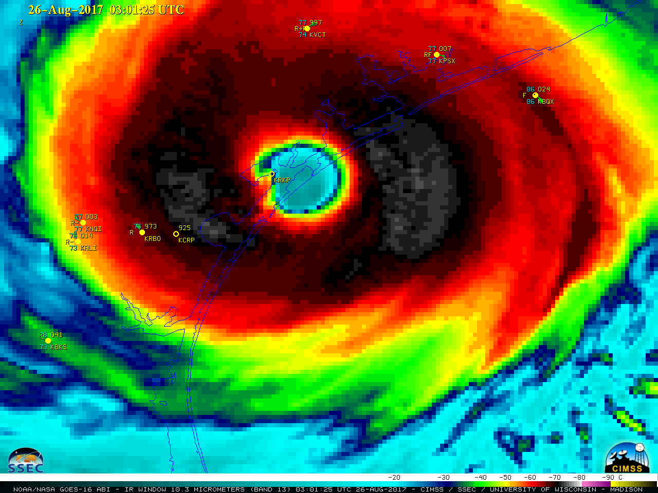
GOES-16 “Clean” Infrared Window (10.3 µm) images, with hourly surface reports plotted in yellow [click to play MP4 animation]
![Terra/Aqua MODIS (11.0 µm) and Suomi NPP VIIRS (11.45 µm) Infrared Window images [click to enlarge]](https://cimss.ssec.wisc.edu/satellite-blog/wp-content/uploads/sites/5/2017/08/170826_modis_viirs_infrared_Harvey_anim.gif)
Terra/Aqua MODIS (11.0 µm) and Suomi NPP VIIRS (11.45 µm) Infrared Window images [click to enlarge]