Lake Michigan lake-effect snow band, and Lake Superior ice
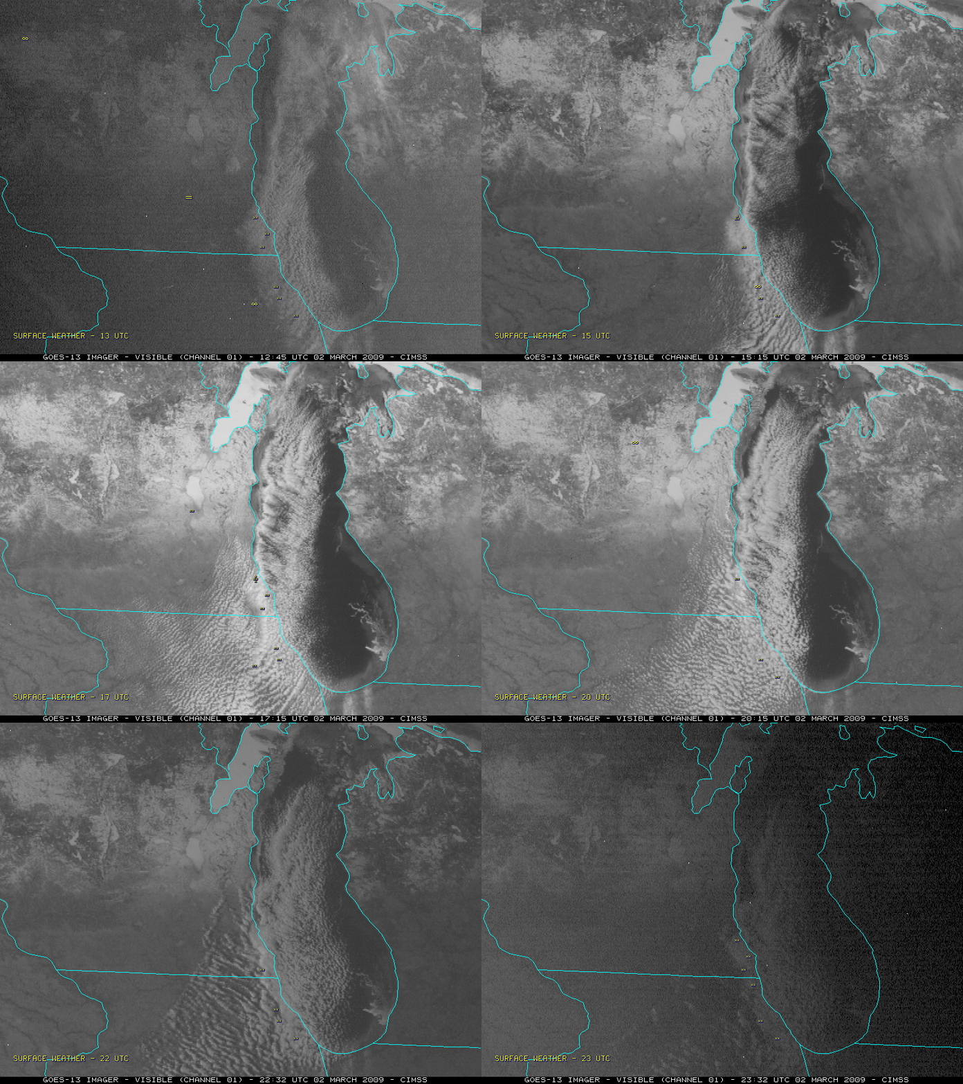
A single-band lake-effect snow event dropped as much as 14.4 inches of snow in parts of Milwaukee, Wisconsin on 02 March 2009. GOES-13 visible images (above) showed the narrow but intense band as it meandered across the far western portion of Lake Michigan.
GOES-12 sounder visible images with an overlay of GOES-12 imager-derived CIMSS Mesoscale Winds (below) indicated that there was some low-level convergence helping to establish and maintain the band.
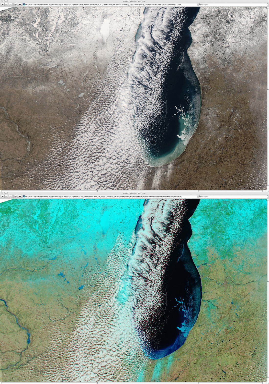
A comparison of 250-meter resolution MODIS “true color” and “false color” images (below) showed a number of interesting features that were not as apparent on the GOES imagery above: (1) there were several narrow bands of snow cover (snow on the ground shows up as cyan-colored features on the false color image) along the southern part of Lake Michigan (from a lake-effect snow band event on the previous day); (2) intricate structure to the ice floes in the southeastern part of Lake Michigan; (3) some of the lakes in southern Wisconsin were showing more of a darker blue signature, indicating that the ice had lost it’s top layer of snow cover.
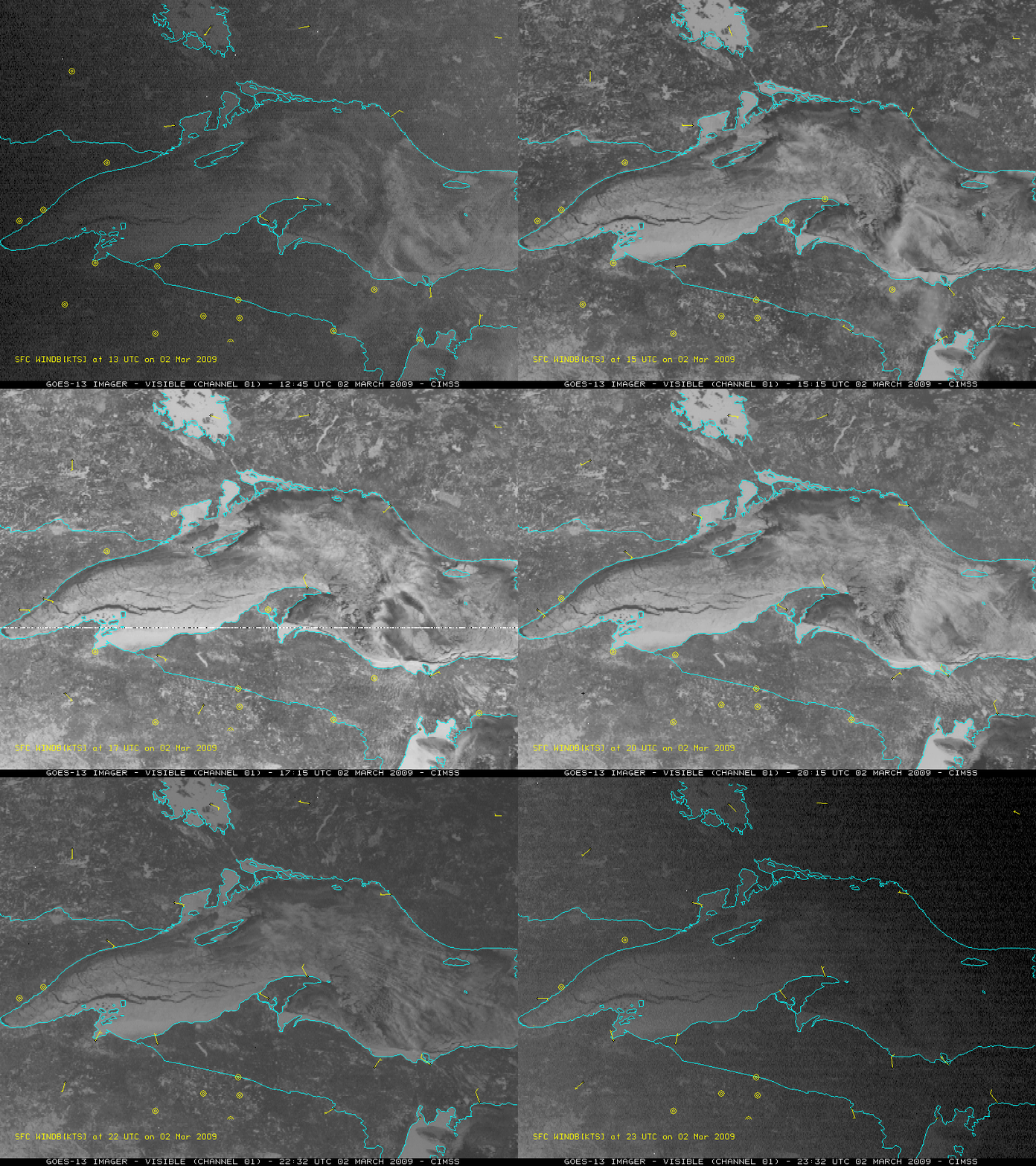
Farther to the north, several days of cold temperatures (overnight lows in the -20s to -30s F, with -31º F or -35º C at both Spincich Lake in Upper Michigan and Land O’ Lakes in northern Wisconsin on the morning of 02 March) led to a significant increase in ice coverage over Lake Superior. GOES-13 visible images (below) showed the extent of the ice, which was not moving a great deal during the day due to fairly light winds. It was interesting to note that 2 separate lake vortices tried to form over Lake Superior, but the light winds and the thick ice conspired to prevent them from becoming well organized.


