Severe thunderstorm over West Texas, as viewed from 3 GOES satellites
![GOES-15 (left), GOES-14 (center), and GOES-13 (right) 0.62 µm visible channel images [click to play animation]](https://cimss.ssec.wisc.edu/satellite-blog/wp-content/uploads/sites/5/2015/05/150519_goes15_goes14_goes13_visible_Texas_severe_thunderstorms_anim.gif)
GOES-15 (left), GOES-14 (center), and GOES-13 (right) 0.62 µm visible channel images [click to play animation]
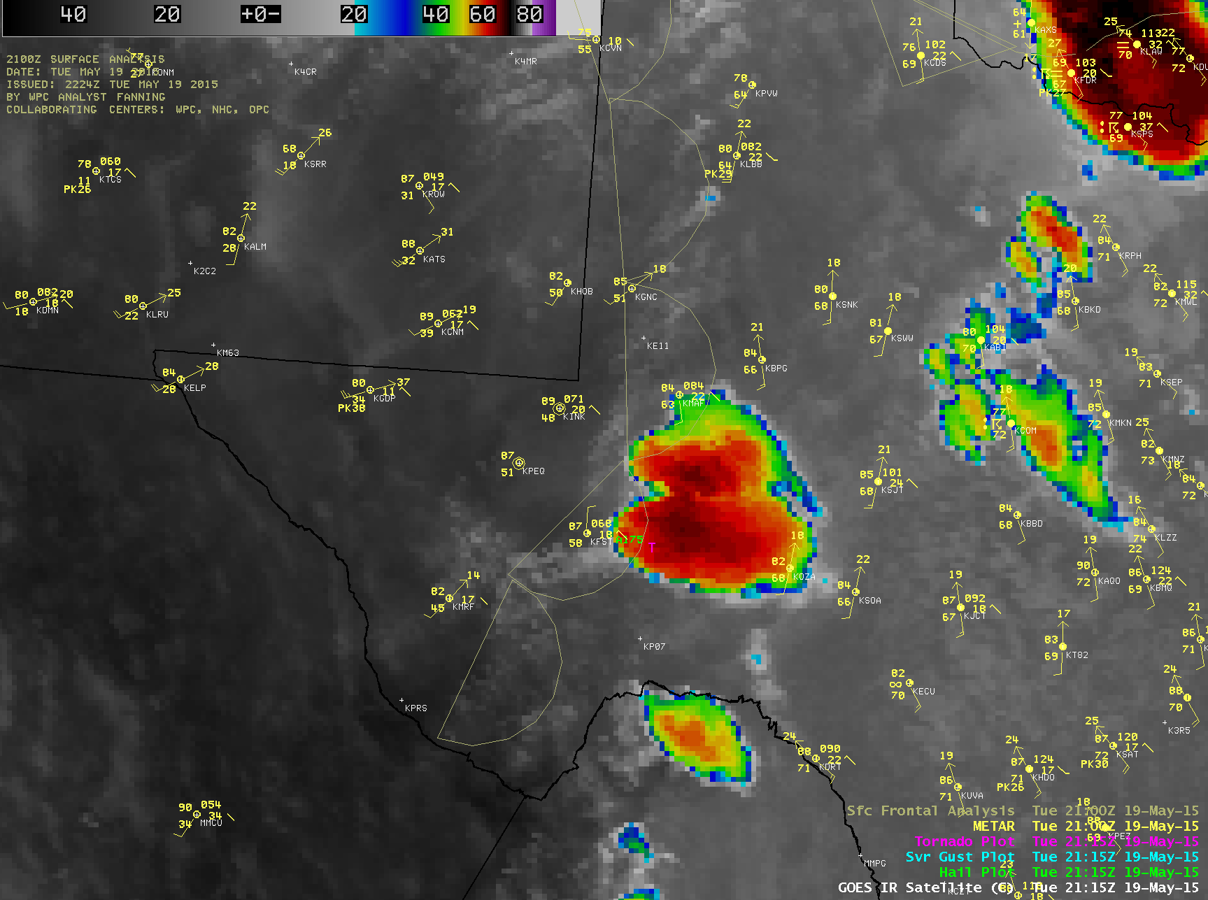
One interesting feature seen on the visible channel images above was the apparent merger of the large dominant dryline storm and a smaller northward-moving storm that had formed in Mexico (radar animation). In GOES-13 10.7 µm IR imagery with an overlay of SPC storm reports (below; click image to play animation), one report of 2.0-inch diameter hail was seen around or shortly after the time of the storm merger.
GOES-13 10.7 µm IR channel images (click to play animation)
With higher spatial resolution IR imagery from MODIS (1-km), VIIRS (375-meter), and AVHRR (1-km), much colder cloud-top IR brightness temperatures were seen (below) compared to the corresponding 4-km resolution GOES IR imagery at those times — especially during the early formative stages of the thunderstorms captured with MODIS and VIIRS. The coldest cloud-top IR brightness temperature on the 2128 UTC AVHHRR image was -80º C, compared to -67º C on the 2130 UTC GOES image.
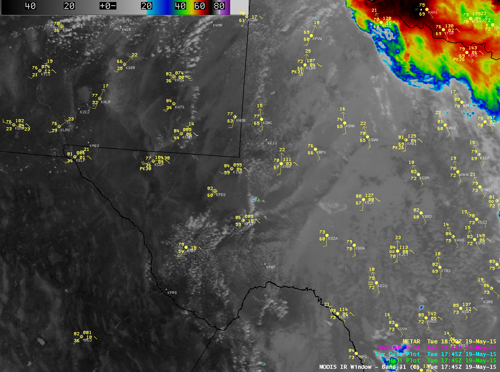
Terra and Aqua MODIS 11.0 µm, Suomi NPP VIIRS 11.45 µm, and POES AVHRR 12.0 µm IR channel images
A more detailed discussion of this event can be found on the RAMMB GOES-R Proving Ground Blog.