Calbuco volcanic eruption in Chile

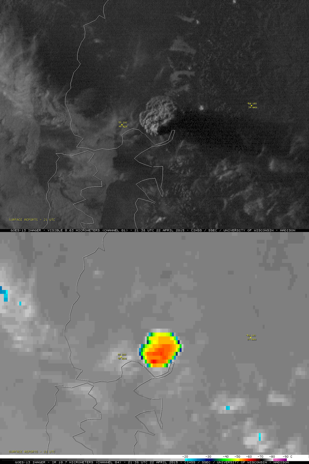
GOES-13 (GOES-East) 0.63 µm visible and 10.7 µm IR channel images at 2138 UTC (with surface reports)
The Calbuco volcano in southern Chile erupted around 2103 UTC or 6:03 pm local time on 22 April 2015. The first good satellite view of the volcanic cloud was provided by the 2138 UTC or 6:38 pm local time GOES-13 (GOES-East) 0.63 µm visible channel and 10.7 µm IR channel images (above). The coldest cloud-top IR brightness temperature at that time was -65º C, which was very close to the tropopause temperature as indicated on the nearby Puerto Montt rawinsonde reports from 1200 UTC on 22 April and 23 April — the height of the tropopause was between 12.3 and 15.6 km on each day (there were 2 tropopause levels TRO1 and TRO2 coded in both of the upper air reports).
However, before the volcanic cloud was seen, a well-defined thermal anomaly or “hot spot” was evident on the previous GOES-13 3.9 µm shortwave IR image at 2045 UTC or 5:45 pm local time (below). The hottest 3.9 µm IR brightness temperature at that time was 340.8 K (red pixel), which is very close to the saturation temperature of the GOES-13 3.9 µm detectors.
An oblique view of the early stage of the volcanic cloud was captured on a 2100 UTC GOES-15 (GOES-West) 0.63 µm visible image (below; closer view).
A sequence of GOES-13 (GOES-East) 10.7 µm IR channel images (below; click image to play animation; also available as an MP4 movie file) revealed that there was a second explosive eruption that began sometime before the 0508 UTC or 2:08 am local time image on 23 April. The coldest cloud-top IR brightness temperature with this second eruption was -68º C at 0808 UTC. Also, at 0508 UTC mesospheric airglow waves were seen with Suomi NPP VIIRS Day/Night Band imagery.
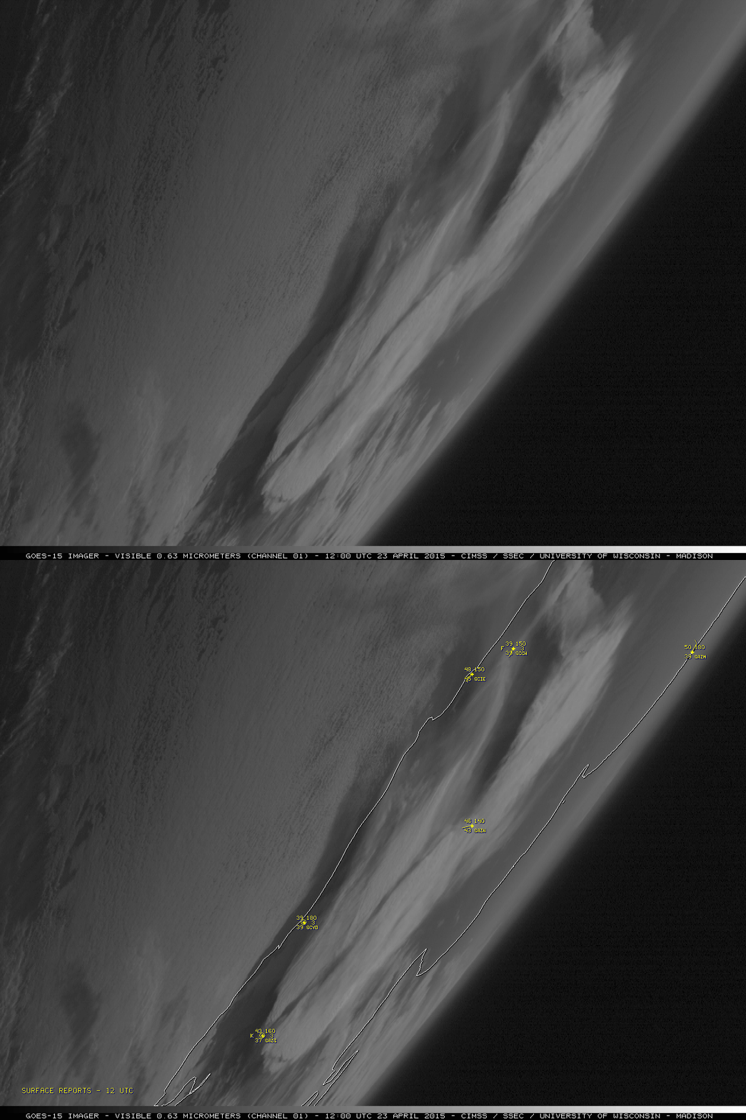
On the morning of 23 April, a 1200 UTC GOES-15 (GOES-West) 0.63 µm visible image (below) provided a good view of the large areal coverage of volcanic cloud material resulting from the 2 eruptions.
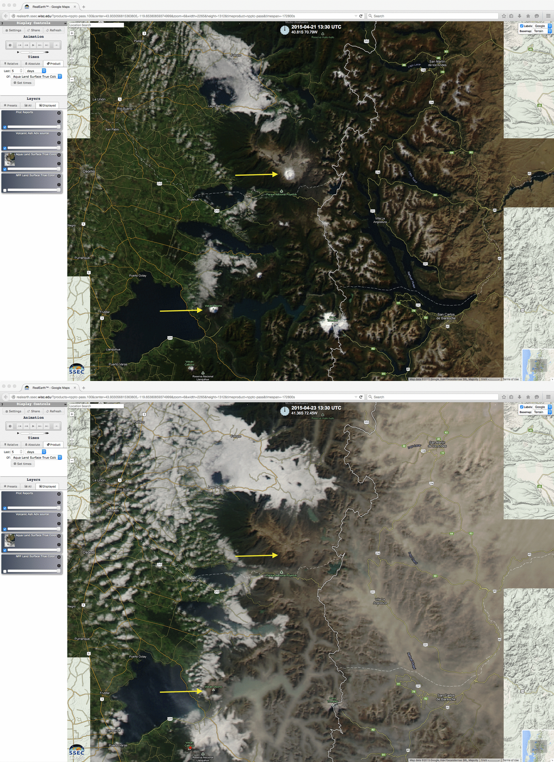
Finally, a before-eruption (21 April) and post-eruption (23 April) comparison of Aqua MODIS true-color Red/Green/Blue (RGB) images as visualized using the SSEC RealEarth web map server (below) showed the effect of ashfall on some of the higher terrain downwind of Calbuco, which was particularly evident on the snow-capped summits of the Osorno and Puyehue volcanoes (yellow arrows).
—– 24 April Update —–
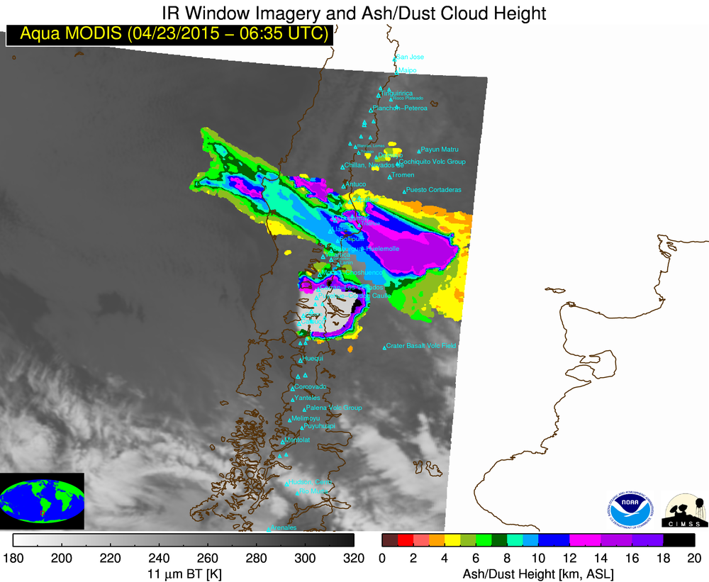
A series of GOES-13 and Terra/Aqua MODIS volcanic ash height retrieval images from the SSEC Volcano Monitoring site (below; click image to play animation) showed that the ash from each of the two explosive eruptions reached heights of 18-20 km (black color enhancement), which was well into the stratosphere.


