Lake Michigan: lake-effect snow band, and lake ice
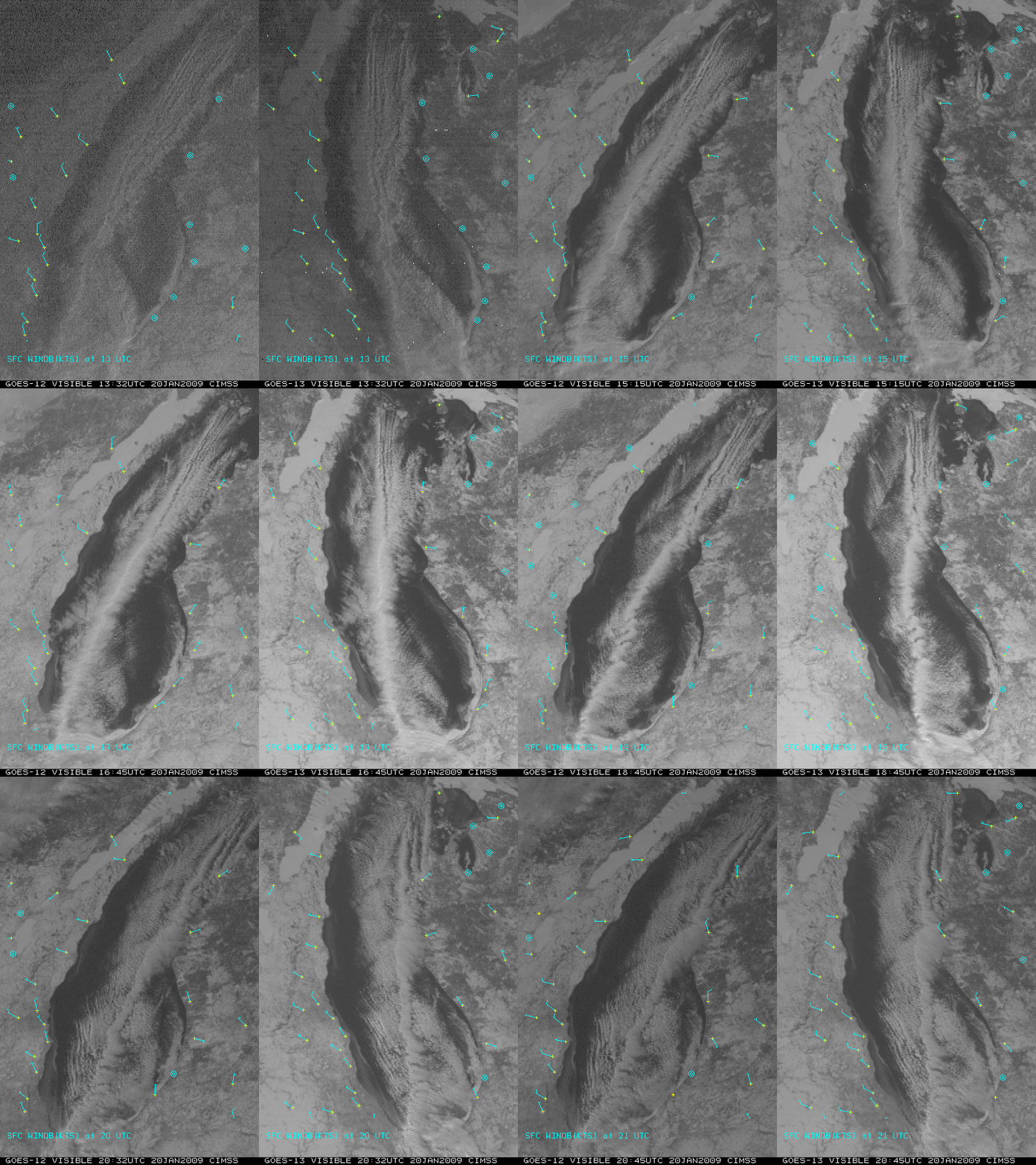
A comparison of GOES-12 and GOES-13 visible images (above) showed a long lake-effect cloud band that was oriented generally north-to-south across Lake Michigan on 20 January 2009. Convergence of surface winds was helping to sustain the cloud band over the lake, which was producing localized areas of heavy snowfall where it moved onshore in Illinois (5.0 inches reported in Chicago and Burnham) and Indiana (8.0 inches reported at Whiting). One thing that becomes immediately obvious in the above image comparison is the improved navigation on the new GOES-13 satellite: there is much less image-to-image wobble compared to GOES-12. As a result of this improved navigation, one is able to get a better sense of the actual drift of the ice that is floating in parts of the lake — ice along the eastern portion of the lake was drifting slowly westward away from the Michigan shore, while ice in the northwestern part of the lake was drifting slowly southward.
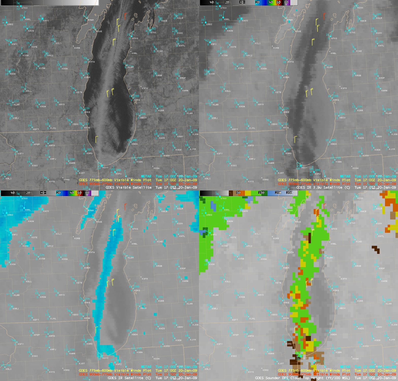
AWIPS images of the GOES-12 visible, 3.9 µm shortwave IR, 10.7 µm IR window, and Sounder Cloud Top Height product (below) suggested that the lake-effect cloud band was likely composed primarily of supercooled water droplets at 17:00 UTC — there was a strong signal of solar reflection on the shortwave IR image (darker gray enhancement), and IR window cloud top brightness temperature values were only as cold as -17 to -20º C (cyan color enhancement). The GOES-12 sounder Cloud Top Height values were generally in the 10,000-12,000 foot range (green color enhancement). Note that there were only a few GOES-12 satellite-derived wind vectors associated with the cloud band; the number and accuracy of these atmospheric motion vectors would no doubt be improved using the better navigation of the GOES-13 visible imagery.
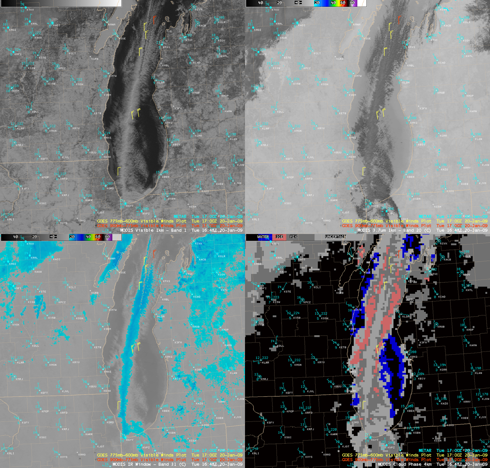
AWIPS images of the MODIS visible, 3.7 µm shortwave IR, 11.0 µm IR window, and Cloud Phase product (below) were similar to the GOES-12 images shown above — a strong “solar reflection signal” on the shortwave IR image (darker gray enhancement), with IR window cloud top brightness temperature values in the -17 to -20º C range (cyan color enhancement) — and the MODIS Cloud Phase product indicated that most of the cloud band was of the “Mixed Phase” or “Uncertain” category (gray colors).
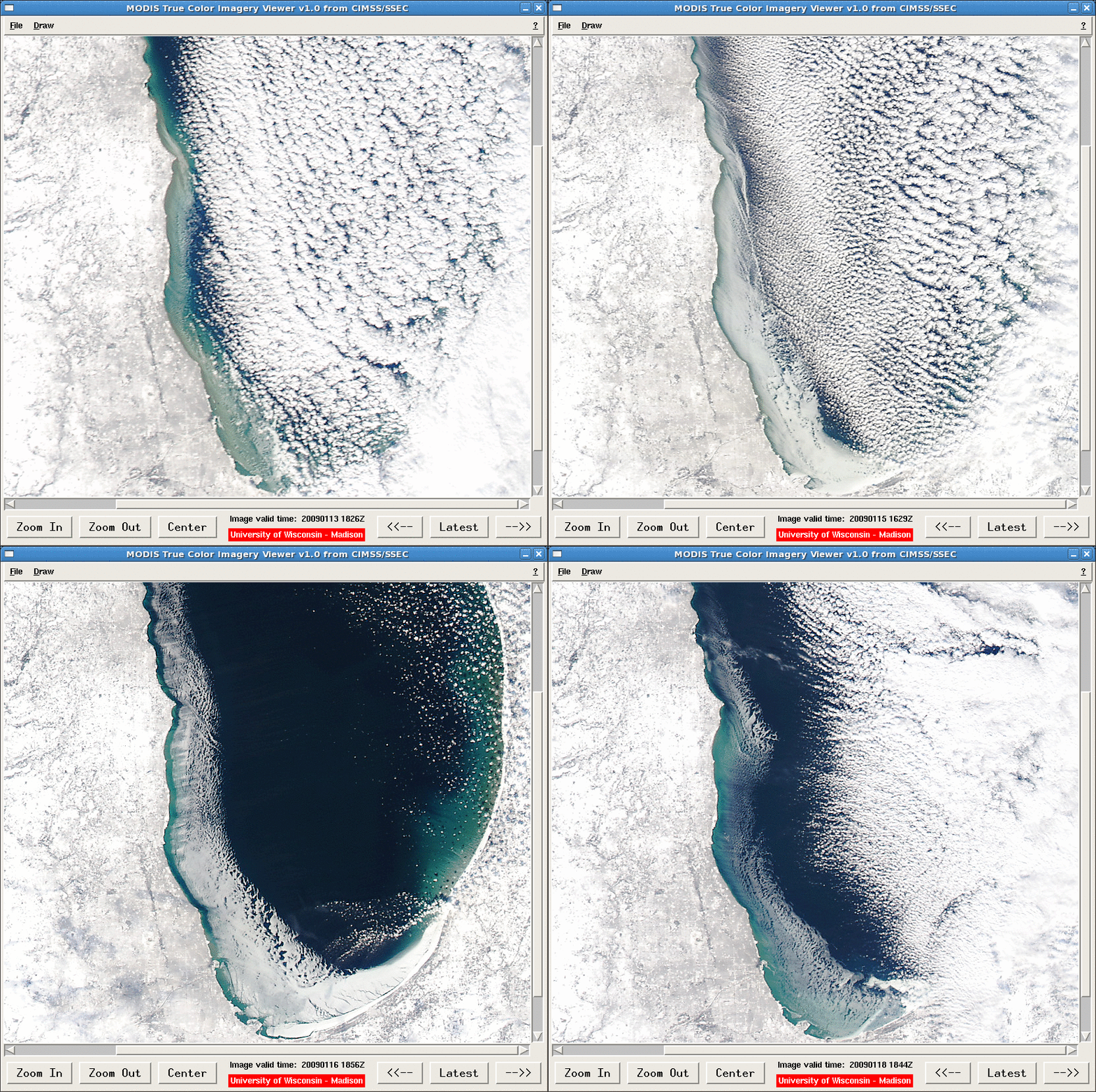
It is interesting to view a series of 250-meter resolution MODIS true color images (below), using the CIMSS MODIS True Color Imagery Viewer on AWIPS (available to NWS forecast offices in Wisconsin that have installed the CIMSS MODIS imagery scripts) — the ice increased in areal coverage on 15-16 January (when inland surface temperatures were as cold as -35º F or -37º C over southern Wisconsin), but then decreased somewhat on 18 January as temperatures slowly moderated.


