Hurricane Arthur
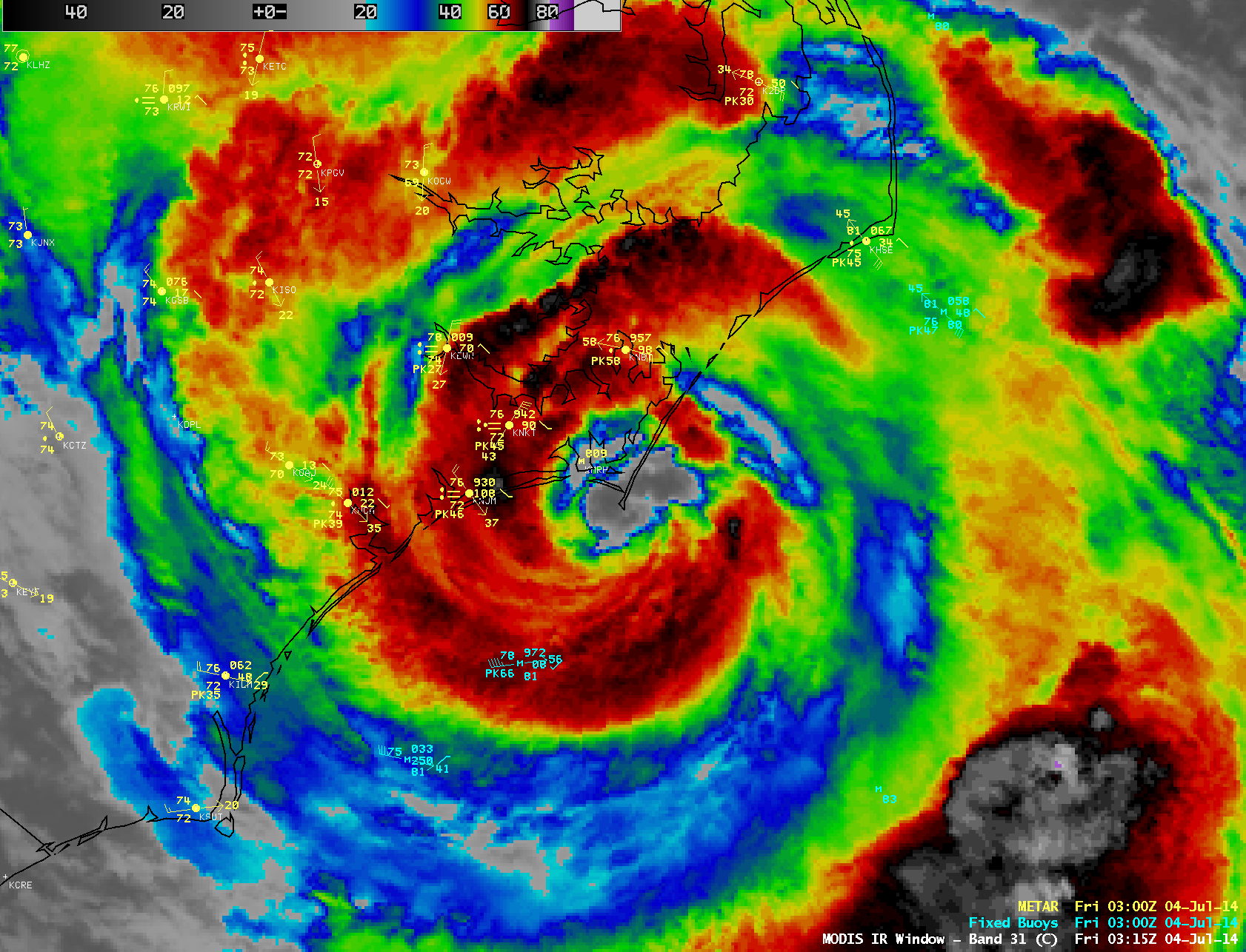
04 July Update: a 1-km resolution Terra MODIS 11.0 µm IR image (above) showed the eye of Category 2 Hurricane Arthur making landfall along the coast of North Carolina around 03:13 UTC or 11:15 pm Eastern Time. Arthur was the earliest hurricane to make landfall in North Carolina since records began in 1851 (the previous record was 11 July, 1901).
[5:45 PM EDT 3 July 2014 Update: The animation of GOES-13 visible images above, ending at 21:45 UTC or 5:45 PM Eastern Daylight Time, shows Hurricane Arthur very close to the North Carolina coast. Convection continues redeveloping in the circulation close to the eye.]
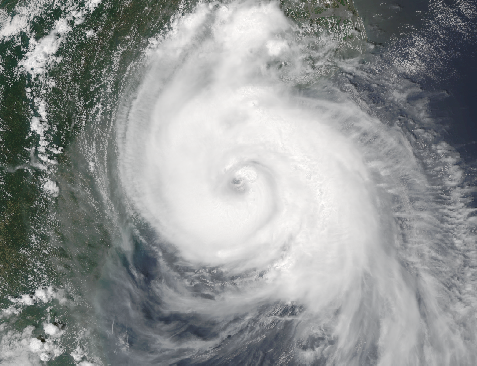
The original VIIRS image, above (courtesy of Russ Dengel), was clipped from this link. An animation of VIIRS True-Color imagery of Arthur (courtesy of Kathy Strabala), taken from the Webmap server at SSEC is shown below.
Tropical Storm Arthur has strengthened overnight to become the first hurricane of the Atlantic Tropical Season. The storm-centered animation above, from GOES-East, (click here for an animation without the map) shows evidence of the relaxation in wind shear that has allowed intensification. At the beginning of the animation, most convection is to the east and south of the system. By 3 July, convection is much closer to the center of the strengthening storm and an outflow channel to the southeast has developed; a distinct eye is present by 2045 UTC on 3 July. Note that in the color enhancement that the coldest cloud tops — purple — are cooler than -80° C. This image (from this website) shows Arthur, at 1500 UTC on 3 July 2014, under a minimum in wind shear. (Zoomed-in version of wind shear).
The tropical cyclone has been moving due north over the past 24 hours, but the National Hurricane Center notes that a recurvature to the northeast is occurring now. Interests along the South and North Carolina coasts should pay special attention to forecasts for today and tomorrow.
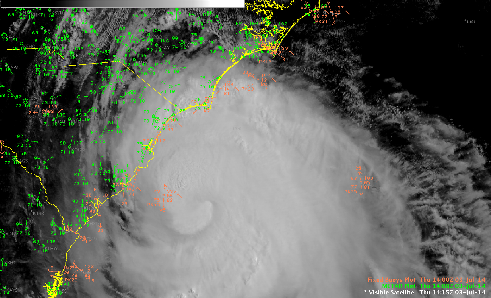
GOES-13 0.63 µm visible channel image with surface observations, 1400 UTC 3 July 2014 (click to enlarge)
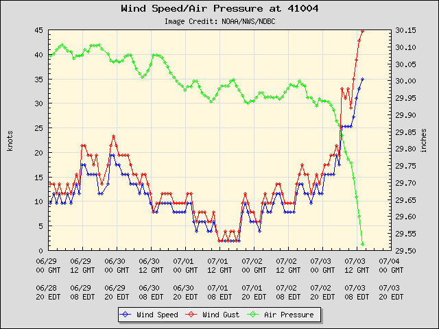
Visible imagery from 1400 UTC, above, does not yet show an eye, and strongest winds at that time remained offshore. Moored Buoy 41004 (41 miles southeast of Charleston, SC, at 32°30’2″ N 79°5’58” W) shows tropical-storm force-winds; a plot of the pressure and winds at the station, below, suggests an approaching storm.
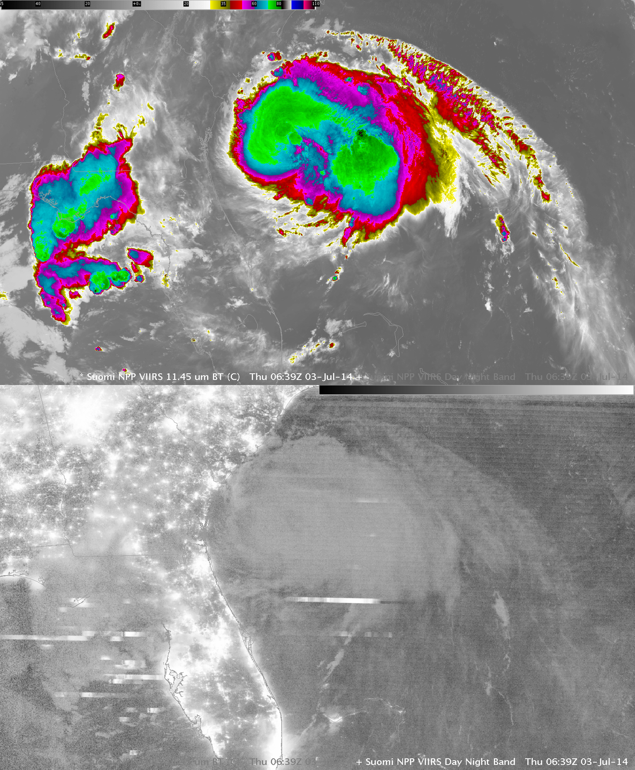
Toggle between Suomi NPP VIIRS 11.45µm Infrared Imagery and Day/Night Band at 0639 UTC 3 July (click to enlarge)
Suomi NPP overflew Arthur in the early morning of July 3rd, affording a high-resolution view of the convective clouds. The coldest overshooting tops, around -85°C are far to the east of the surface circulation, but a large cirrus shield with temperatures near -75°C is over the storm center. The Day/Night band shows little contrast because the Quarter Moon set at 0400 UTC and therefore no lunar illumination is available. A few lightning streaks in the convection around Arthur are present. Lightning is far more common in the convection over the northeast Gulf of Mexico.
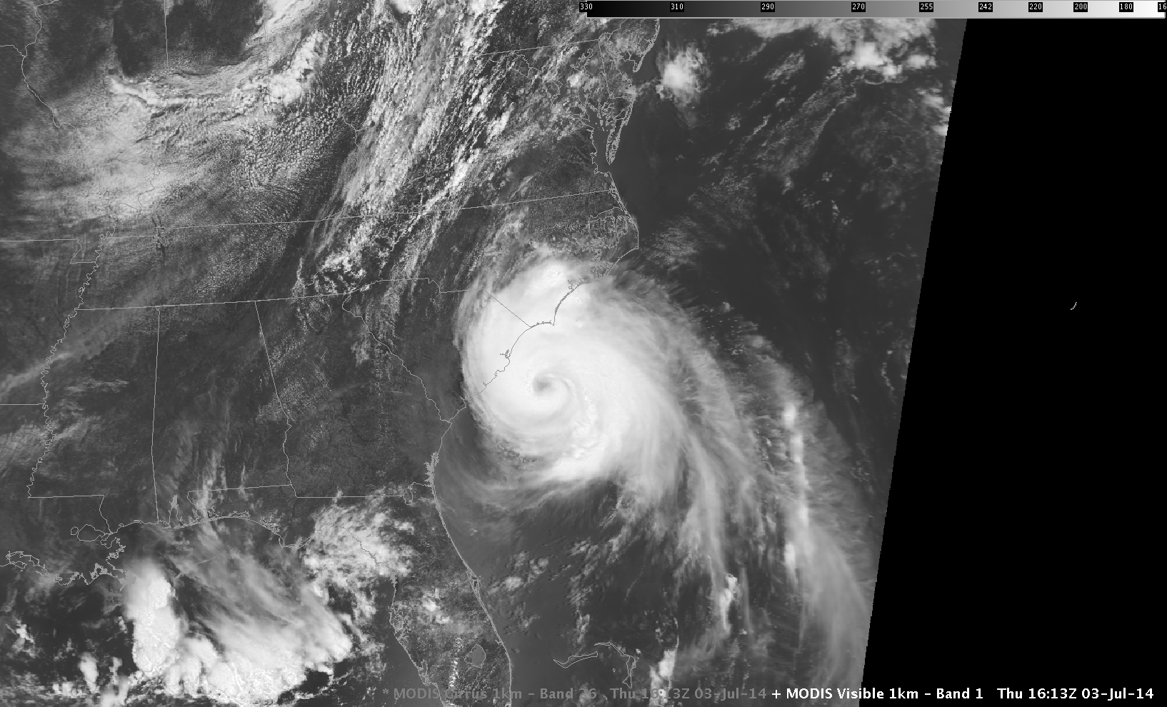
MODIS imagery over Arthur was available from Terra at 1613 UTC today. A variety of channels are shown above — Visible imagery (0.64 µm), the Snow/Ice Channel (a wavelength of 1.6 µm, at which snow/ice strongly absorb radiation and therefore appear dark), the Cirrus channel (a wavelength of 1.38 µm, at which cirrus clouds are strongly reflective and are therefore highlighted), the Water Vapor channel (6.7 µm, showing the height of the top of the moist layer) and the Infrared channel near 11 µm.
Previous Tropical Storm Arthurs passed near the North Carolina coast in 1996 (a swirl in mid-level clouds with little deep convection) and in 2002 (a mass of convection that obscured any circulation).


