Tropical Storm Arthur forms east of Florida
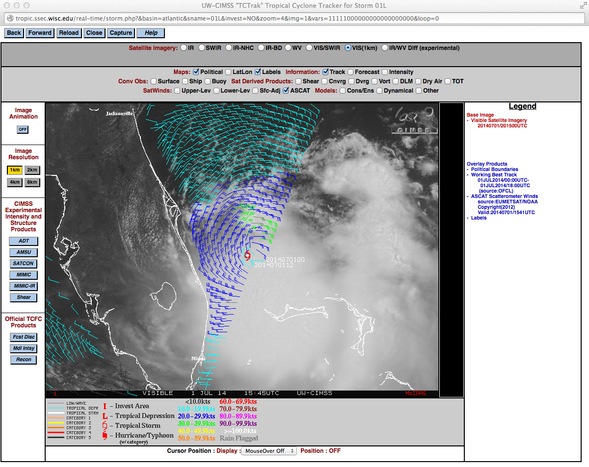
The first tropical depression (update: Arthur was named as a tropical storm at 1500 UTC 1 July) of the season in the tropical Atlantic has formed just to the east of Florida. The visible imagery animation, above, shows persistent strong thunderstorms with overshooting tops in the area of disturbed weather over the Gulf Stream and the Bahamas. Refer to the National Hurricane Center and the CIMSS Tropical Cyclones sites for particulars on the future track of this system. Note that current forecasts have the system strengthening to a hurricane in the next few days, and close to the North Carolina coast on July 4th.
Metop ASCAT surface scatterometer winds at 1541 UTC, below, indicated that the strongest winds (green barbs, 30-39 knots) were found within the northeastern quadrant of the tropical storm.
——————————————————————————————
The tropical Atlantic has lately been besieged by Saharan Air Layer (SAL) dust (see, for example, this post from last week, or this image from today); that dry air suppresses tropical cyclone formation. The animation of GOES-13 10.7 µm imagery, above, shows that this Tropical Depression formed out of an impulse that sank southward from the Carolinas over the past 6 days, so its gradual development has not been impeded by the SAL.
The VIIRS instrument on board the Suomi NPP satellite provided high-resolution imagery over this tropical system shortly after midnight on the 1st (see below). A large cirrus shield with brightness temperatures cooler than -70º C (Green in the enhancement) with a few overshooting tops that are colder than -85º C are present. An analysis of some NUCAPS Soundings from this overpass is here.
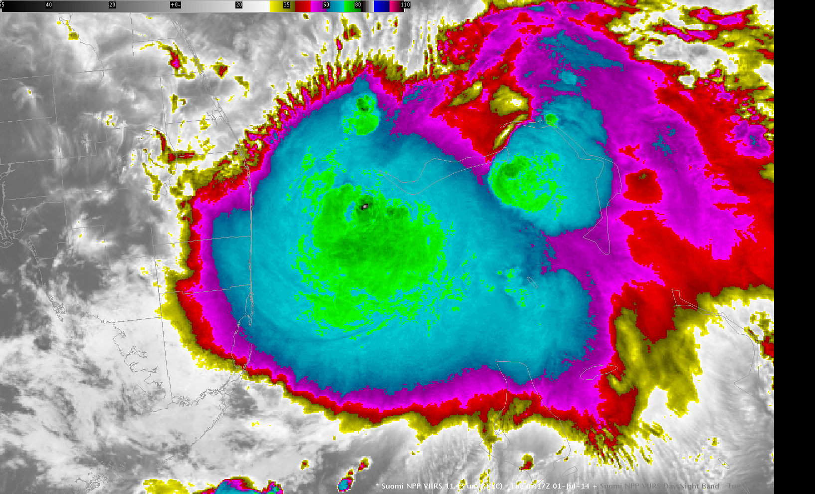
Suomi NPP VIIRS 11.35 µm infrared imagery, Day/Night Band imagery (0.70 µm) and lightning data at ~0715 UTC on 1 July 2014 (click to toggle through images)
Arthur’s projected track moves the storm up the East Coast over very warm waters associated with the Gulf Stream. Both MODIS and VIIRS analyses of SSTs show widespread temperatures in excess of 80º F.
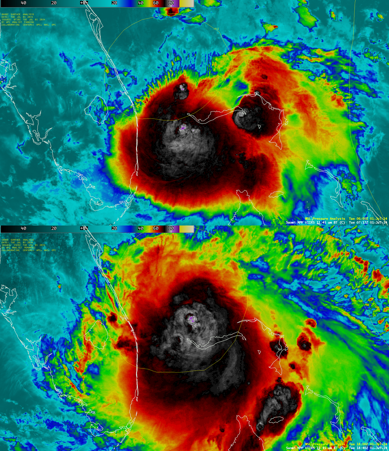
A comparison of Suomi NPP VIIRS 11.45 µm IR channel images at 0717 UTC and 1840 UTC, below, showed that the areal coverage of cold cloud tops was increasing during the day on 01 July, but the deep convection remained well to the southeast of Arthur’s low-level center of circulation.
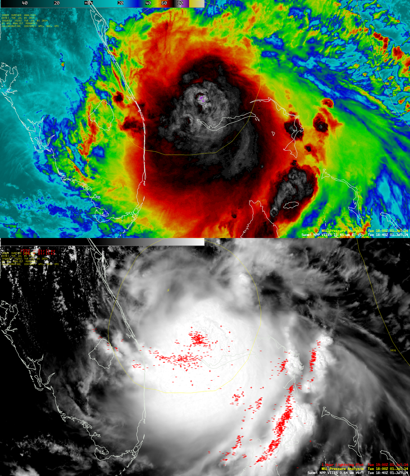
At 1840 UTC, a comparison of the Suomi NPP VIIRS 11.45 µm IR channel image with the corresponding 0.64 µm visible channel image with an overlay lightning data, below, revealed a large number of cloud-to-ground strikes within the 1-hour period ending at 1900 UTC.
===== 02 July Update =====
Arthur continued to slowly intensify on 02 July, and began to show hints of an organized eye structure on GOES-13 0.63 µm visible channel images (above; also available as an MP4 movie file).
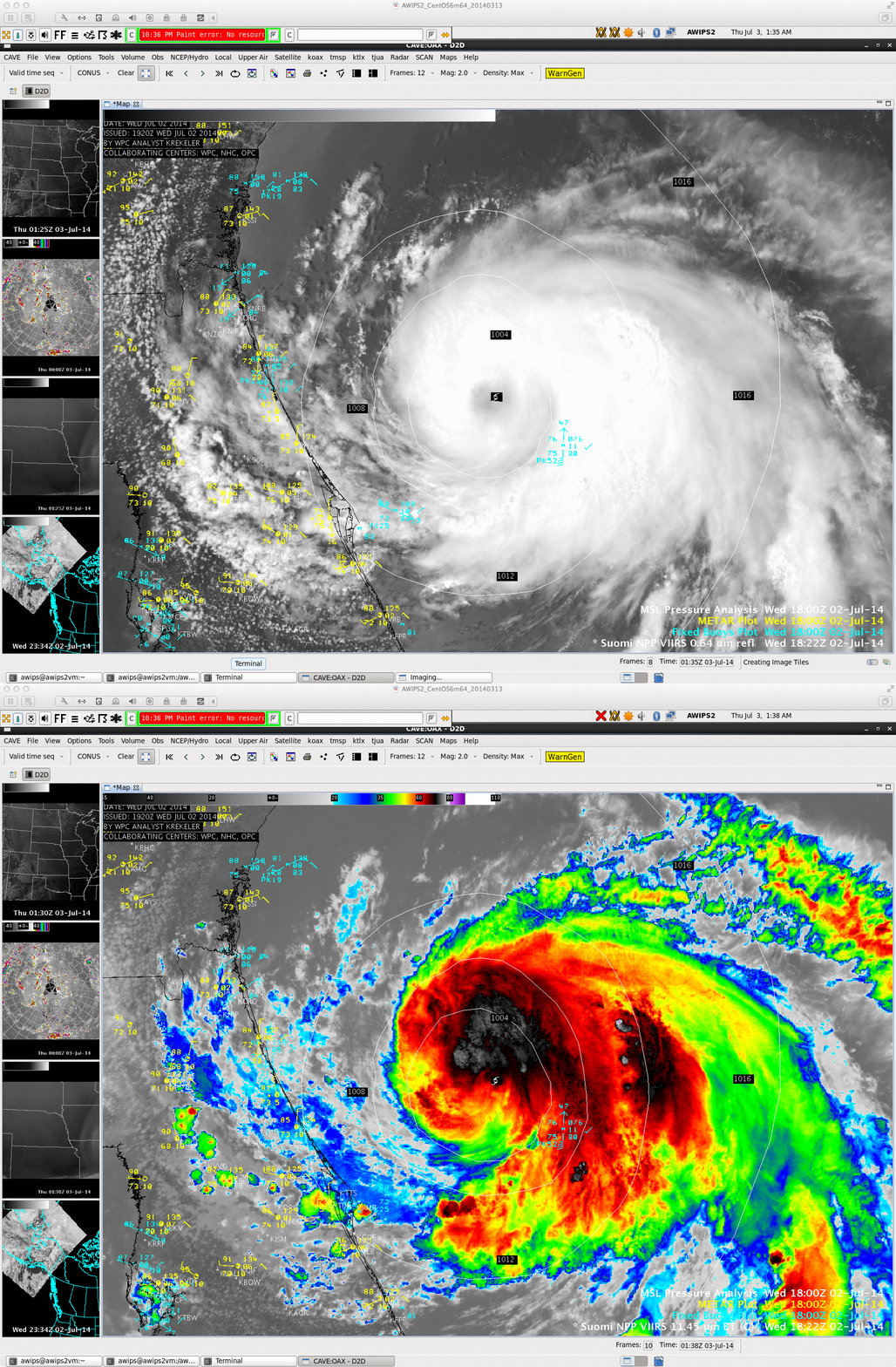
A comparison of AWIPS-2 images of Suomi NPP VIIRS 0.64 µm visible channel and 11.45 µm IR channel images (below) showed that the coldest cloud tops were north of the center of Arthur at 1822 UTC. A buoy just southwest of the center reported winds gusting to 52 knots (60 mph).
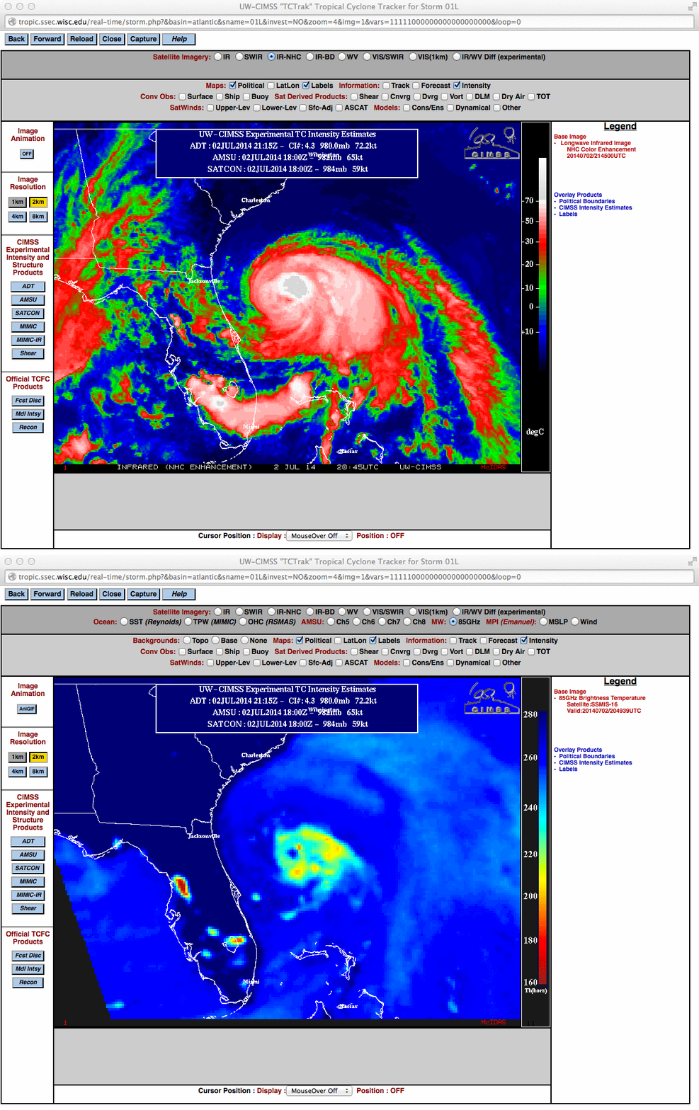
Even though an eye was not evident on GOES-13 10.7 µm IR channel imagery around 2045 UTC, a DMSP SSMIS 85 GHz microwave image at 2049 UTC did display a well-organized eye signature (below).


