Saharan Air Layer dust over the Gulf of Mexico
McIDAS images of GOES-13 0.63 µm visible channel data on 20 June 2014 (above; click image to play animation; also available as an MP4 movie file) and on 21 June 2014 (below; click image to play animation; also available as an MP4 animation file) revealed the hazy signature of a veil of Saharan Air Layer (SAL) dust aloft over much of the southern and western portions of the Gulf of Mexico.
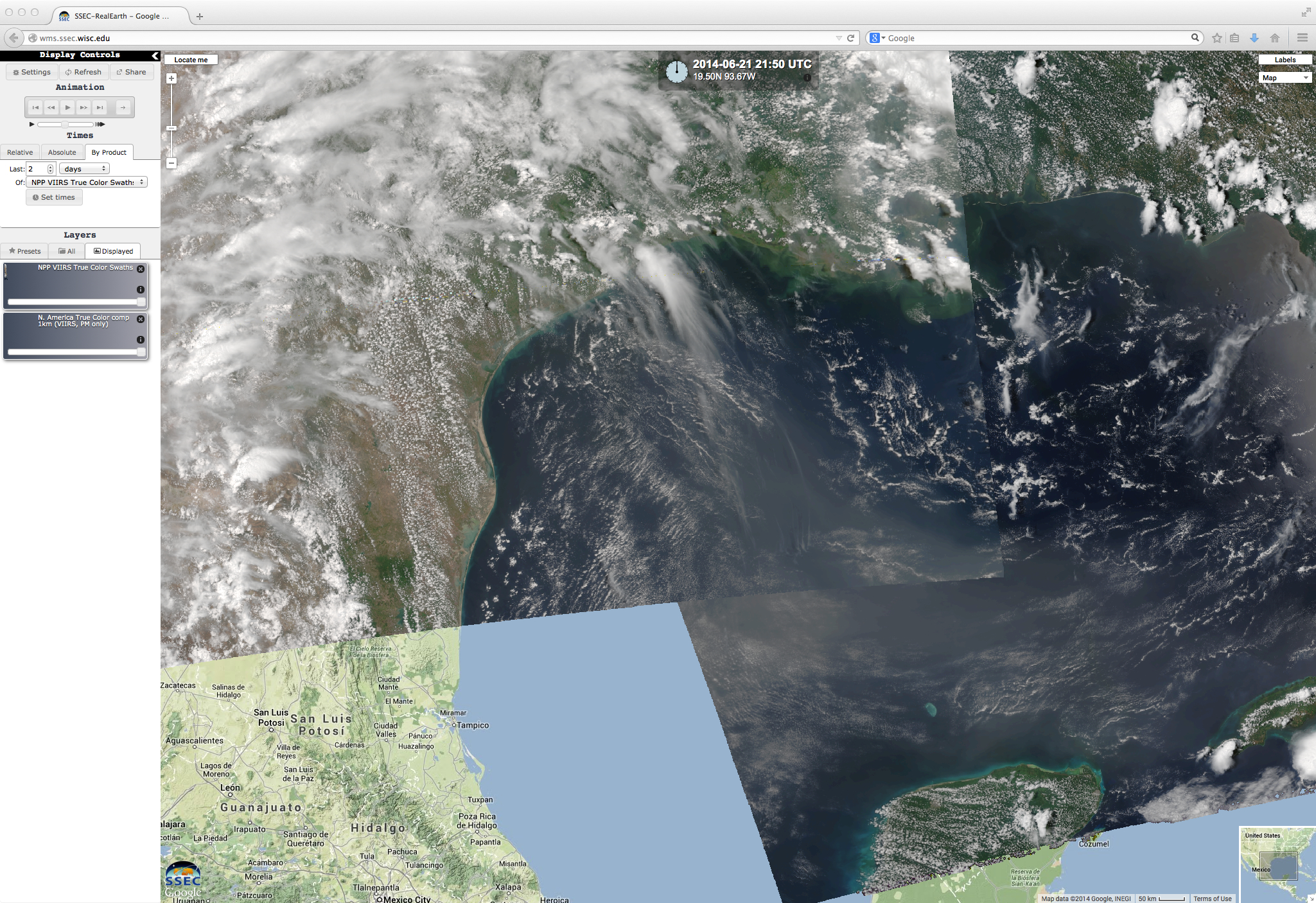
The hazy dust signature also showed up well in Suomi NPP VIIRS true-color Red/Green/Blue (RGB) images, as visualized using the SSEC RealEarth web map server (below).
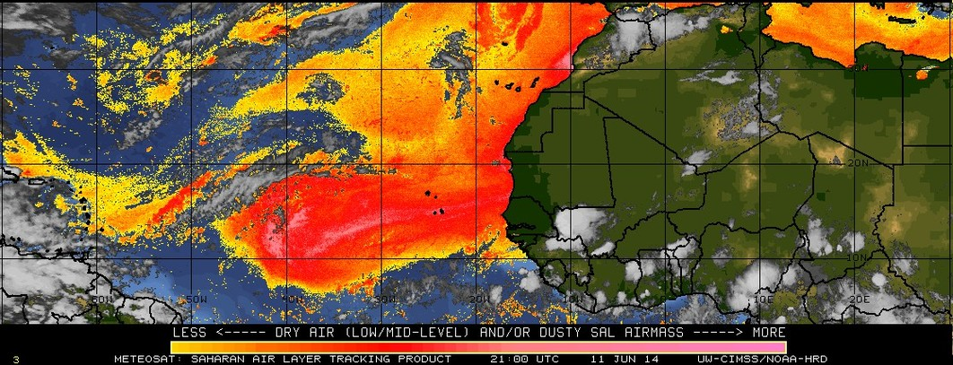
The SAL tracking product showed the strong pulse of SAL dust emerging from the African continent on 10 June, then moving rapidly westward across the Atlantic Ocean and over the Caribbean Sea by 17 June (below; click image to play animation).


