Mountain wave hydraulic jump over Colorado
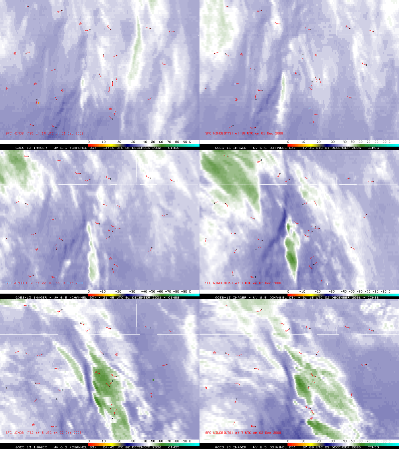
A minor “high wind event” was noted in Boulder, Colorado on 01 December – 02 December 2008, when winds gusted as high as 48 mph during the night-time hours. GOES-13 6.5 µm water vapor channel images (above) showed the formation of mountain waves clouds over the Foothills region of Colorado, as the westerly winds began to increase at Boulder (located in the center of the images). Curiously, Boulder was the only location what experienced the strong winds — and their winds were light southerly until around 18:00 UTC on 01 December (below).
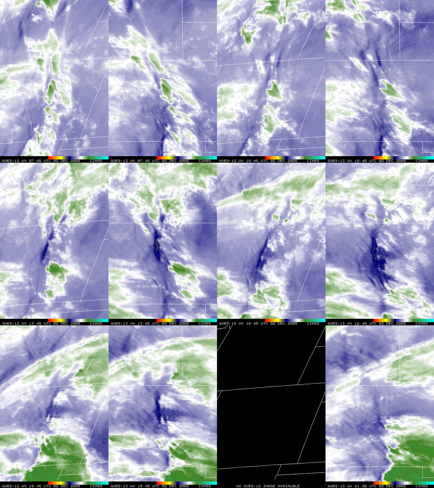
A comparison of GOES-12 and GOES-13 6.5 micrometer water vapor images (below) showed that a distinct warm/dry “hydraulic jump” signature formed immediately downwind of the highest terrain. Even though both GOES-12 and GOES-13 have a 4-km resolution water vapor channel, the better viewing angle afforded by the position of GOES-13 at 105º West longitude allowed a clearer depiction of the hydraulic jump (there was an outage of GOES-12 images during the 17:00-21:30 UTC period, due to a GOES-12 North-South station-keeping maneuver).
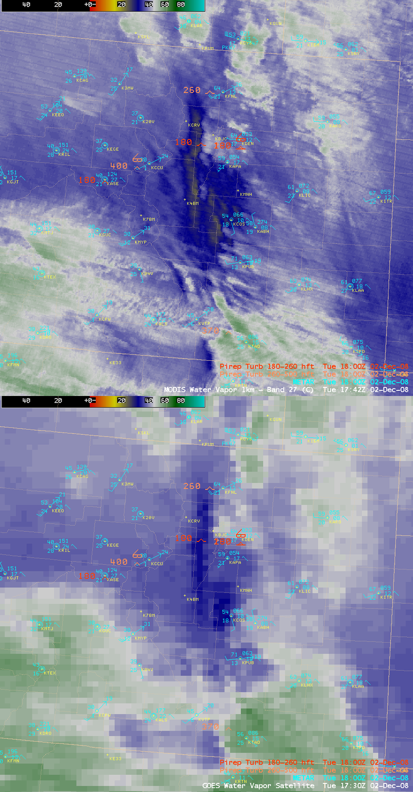
AWIPS images of the 1-km resolution MODIS and the 4-km resolution GOES-12 water vapor images (below) showed that the hydraulic jump was well-defined at that time, with one pilot report of moderate to severe turbulence at a flight level of 18,000 feet seen over the area of the warm/dry hydraulic jump signature on water vapor imagery.
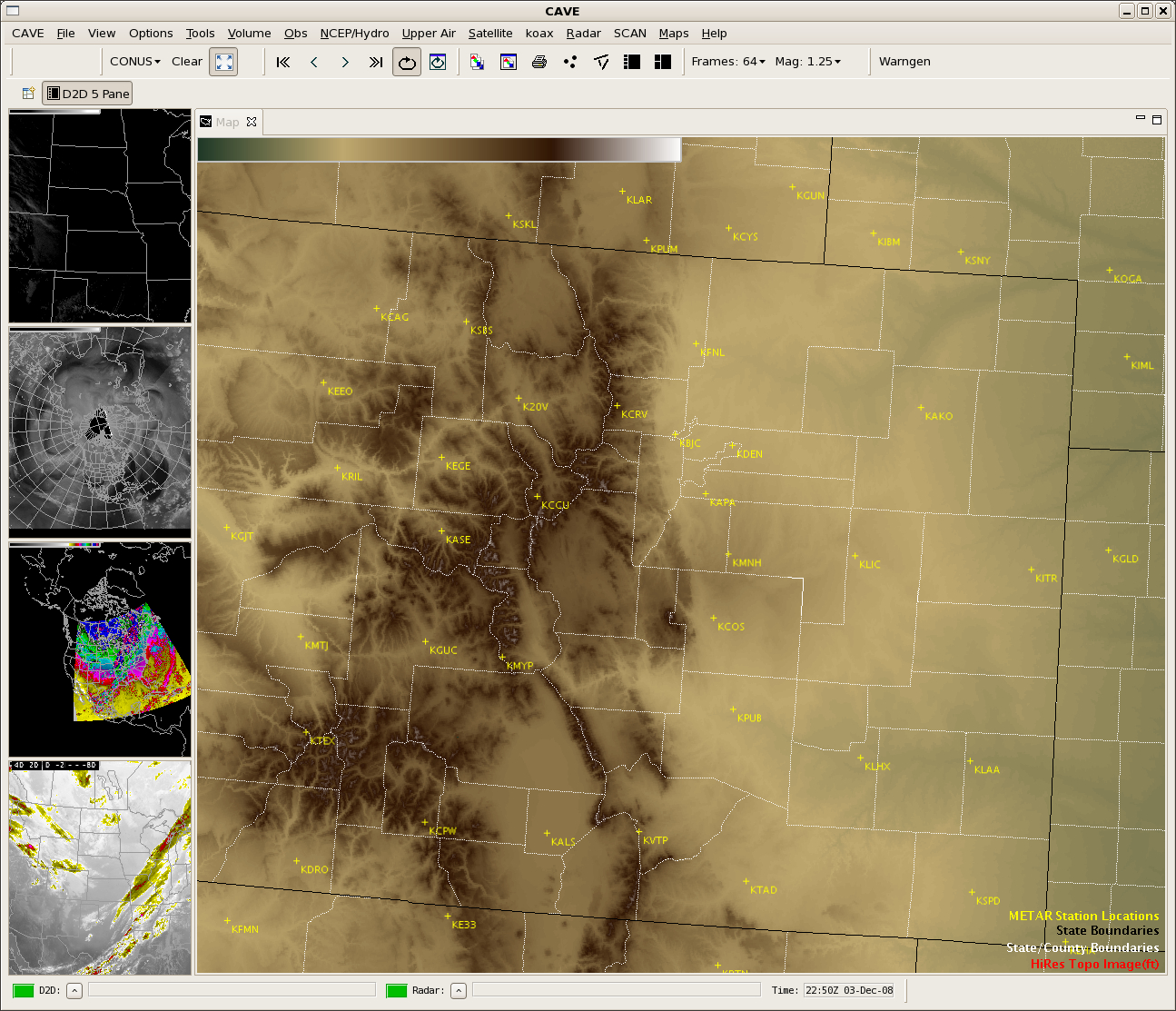
Note that the position of the warm/dry hydraulic jump signature was slightly farther to the west on the MODIS water vapor image — this placed the hydraulic jump closer to the spine of the highest terrain as seen on an AWIPS-2 image of the topography (below). The large viewing angle of the GOES satellite does not allow as accurate of a placement of such mesoscale features (compared to the more direct viewing angle of an overpassing polar orbiter satellite).


